Map of Columbus, Ohio
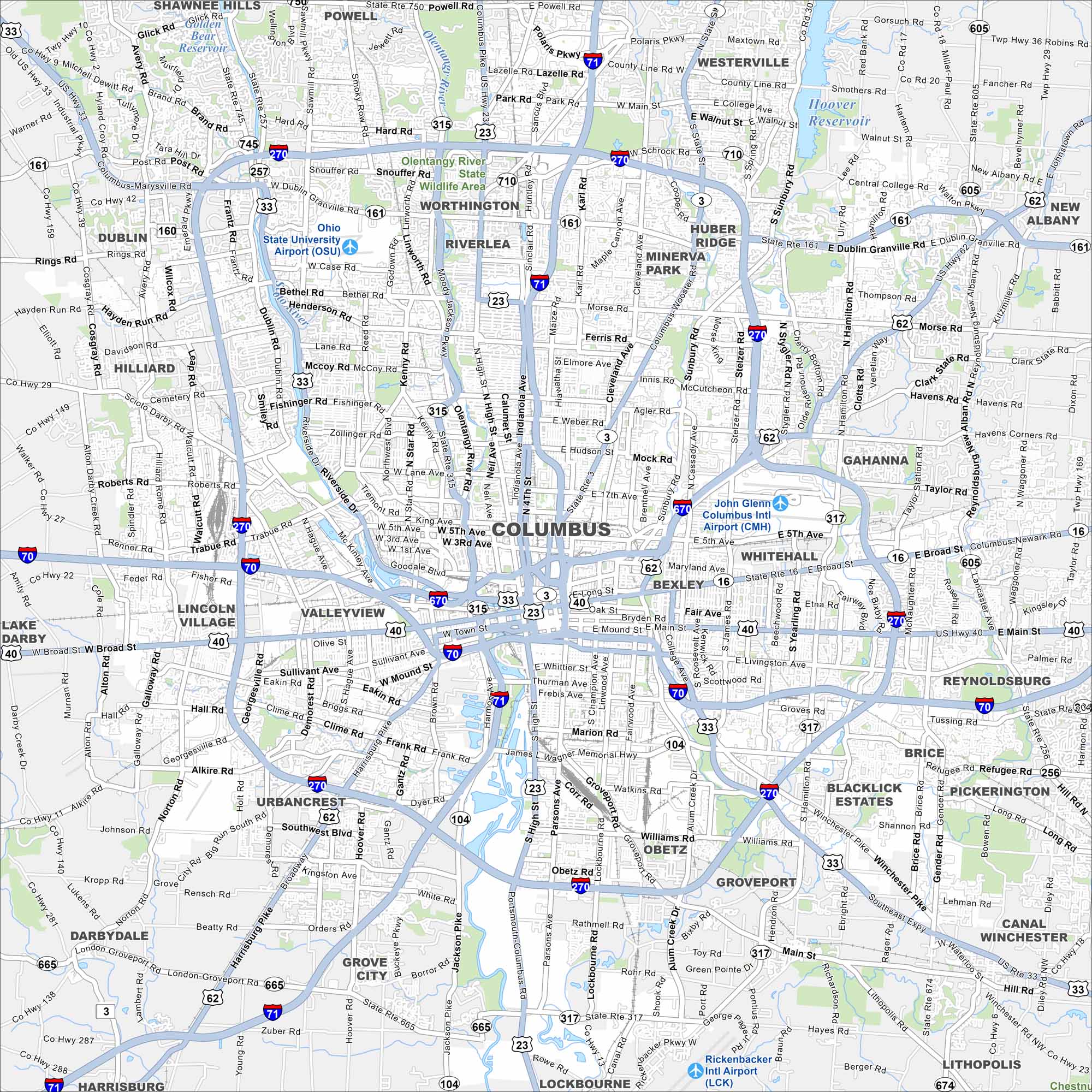
See Columbus on our map with its highways, roadways, and river crossings. The city, Ohio’s capital, spreads across the Scioto River. Its central location has made it a hub for the whole state.
Map Information
On the Map
Interstates/Highways: I-70, I-71, I-270, I-670, US Hwy 23, US Hwy 33, US Hwy 40, US Hwy 62, State Rte 315, State Rte 161, State Rte 3, State Rte 16, State Rte 104, State Rte 317, State Rte 605 Major Roads: High St, Broad St, Main St, Morse Rd, Hamilton Rd, Cleveland Ave, Westerville Rd, Dublin Granville Rd, Bethel Rd, Henderson Rd, Olentangy River Rd, Riverside Dr, Sawmill Rd, Kenny Rd, Indianola Ave, Livingston Ave, Whittier St, Hudson St, 5th Ave, 11th Ave Airports: John Glenn Columbus Intl Airport (CMH), Rickenbacker Intl Airport (LCK), Ohio State University Airport (OSU) Lakes and Reservoirs: Hoover Reservoir, Alum Creek Lake, Griggs Reservoir, O’Shaughnessy Reservoir Major Rivers: Olentangy River, Scioto River Nearby Communities: Dublin, Worthington, Westerville, Gahanna, Reynoldsburg, Pickerington, Canal Winchester, Groveport, Obetz, Grove City, Urbancrest, Lincoln Village, Valleyview, Hilliard, Whitehall, Bexley, Grandview Heights, Upper Arlington, Riverlea Neighborhoods: Downtown ColumbusOhio State Maps
Check out our maps covering farmland or any of Ohio’s major cities.


City Maps of Ohio
Here are maps of Columbus and Ohio’s major cities


