Home » State Maps » Pennsylvania Lakes and Rivers Map

Pennsylvania Lakes and Rivers Map

Pennsylvania Lakes and Rivers Map

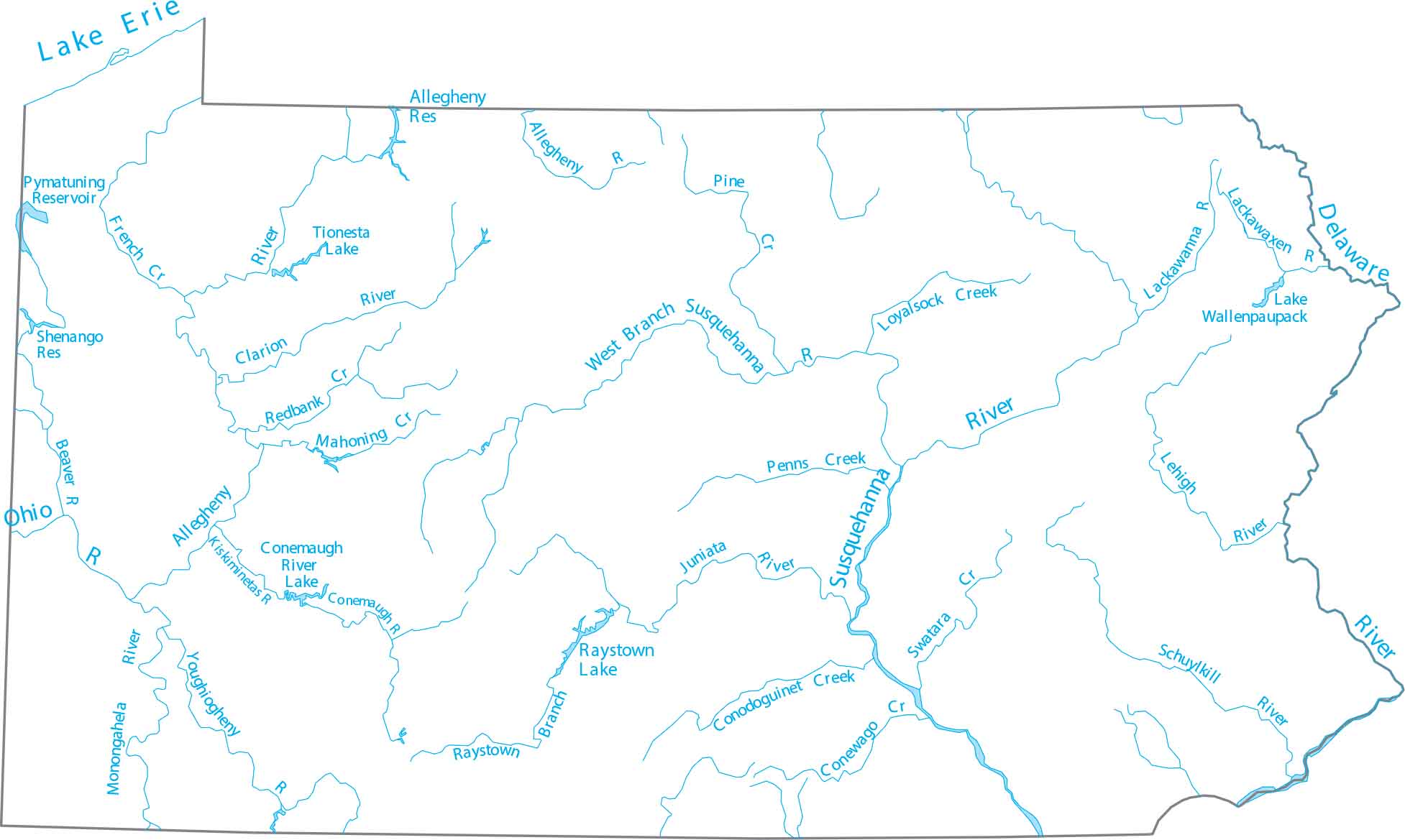
Pennsylvania is located in the Mid-Atlantic and Great Lakes regions. You’ll notice that the Delaware River forms the eastern border. The Susquehanna flows through the center and the Ohio River begins in Pittsburgh.

Map Information

  • Lakes and Rivers Map of Pennsylvania
  • Original map provided by National Map. Map updated by our team.
  • Free for personal and commercial purpose. Attribution is required. How to attribute?

On the Map

Pennsylvania Location Map
Lakes/Reservoirs: Allegheny Reservoir, Lake Erie, Lake Wallenpaupack, Pymatuning Reservoir, Raystown Lake, Shenango Reservoir, Tionesta Lake Rivers and Creeks: Allegheny River, Beaver River, Clarion River, Conemaugh River, Conewago Creek, Conodoguinet Creek, Delaware River, French Creek, Juniata River, Kiskiminetas River, Lackawanna River, Lackawaxen River, Lehigh River, Loyalsock Creek, Mahoning Creek, Monongahela River, Ohio River, Penns Creek, Pine Creek, Redbank Creek, Schuylkill River, Susquehanna River, Swatara Creek, Youghiogheny River Bays: Chesapeake Bay, Delaware Bay

Leave a Reply

Your email address will not be published. Required fields are marked *