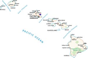
Hawaii Lakes and Rivers Map
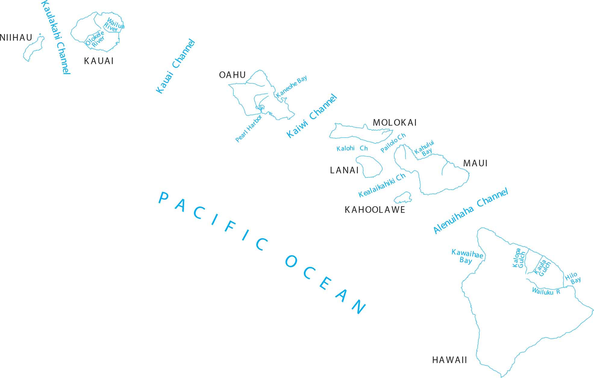
Here’s our map of Hawaii’s channels, bays and gulches across the islands. Located in the Pacific Ocean, we’ve mapped out each island and the channels that flow between each one.
Map Information
On the Map
Lakes and Rivers State Maps
Select any state map below to view its lakes and rivers map.


Hawaii State Maps
All the essential Hawaii maps you need are below