Map of Westlake, Ohio
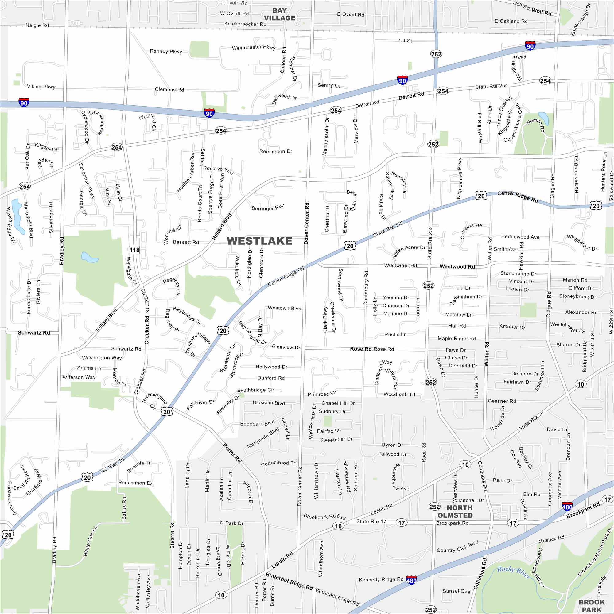
Get around Westlake, a western suburb of Cleveland. The city offers parks, shopping centers, and quick access to Lake Erie. Use our street map to find directions this city in Ohio.
Map Information
On the Map
Interstates/Highways: I-90, I-480, US Hwy 20, State Rte 254, State Rte 252, State Rte 113, State Rte 10, State Rte 17 Major Roads: Detroit Rd, Center Ridge Rd, Hilliard Blvd, Bradley Rd, Clague Rd, Crocker Rd, Dover Center Rd, Columbia Rd, Lorain Rd, Bassett Rd, Westwood Rd, Canterbury Rd, Porter Rd, Stearns Rd, Schwartz Rd, Bradley Rd, Brookpark Rd, Butternut Ridge Rd, Cahoon Rd, Walter Rd Major Rivers: Rocky River Nearby Communities: Bay Village, North Olmsted, Brook ParkOhio State Maps
Check out our maps covering farmland or any of Ohio’s major cities.


City Maps of Ohio
Here are maps of Columbus and Ohio’s major cities


