Map of Westerville, Ohio
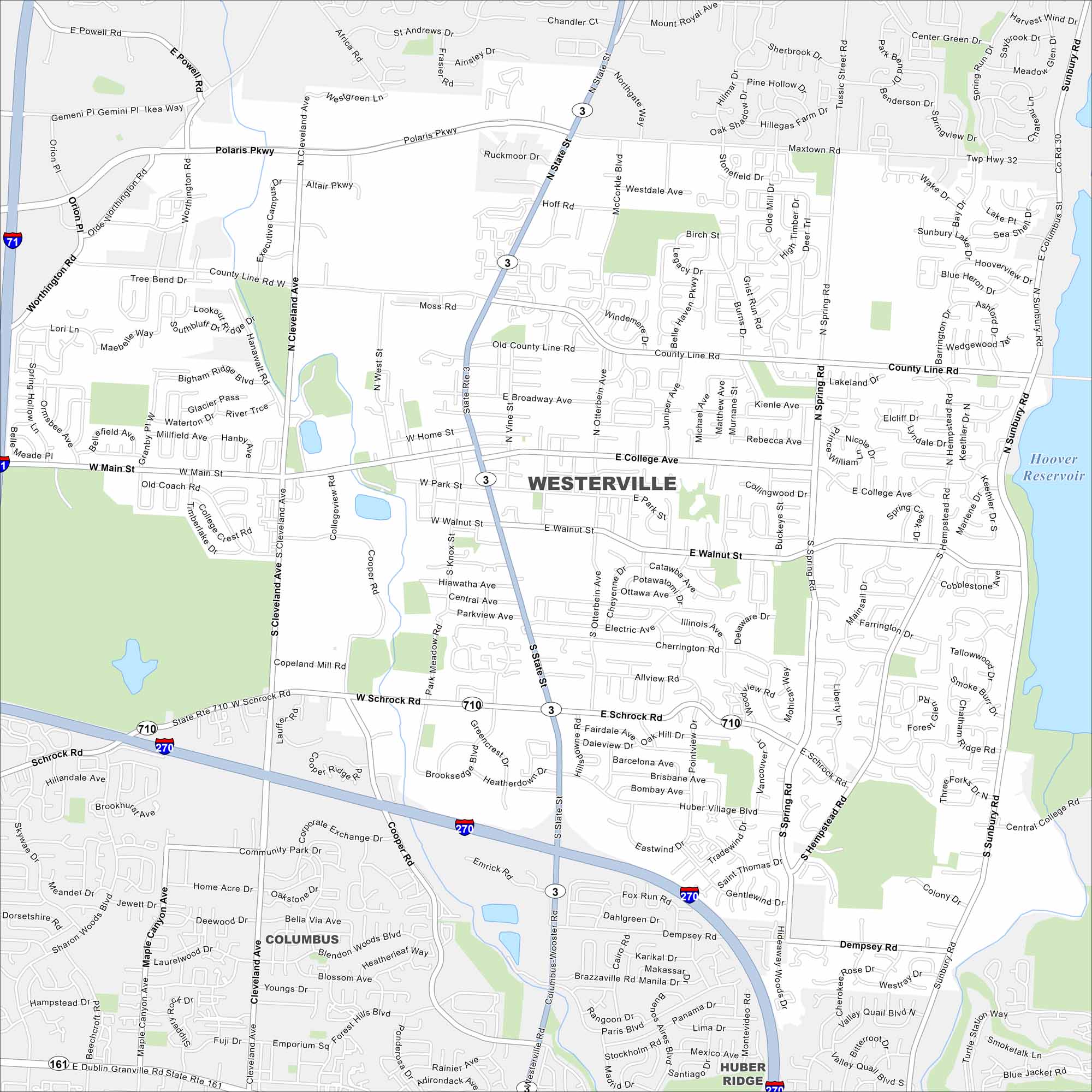
Our Westerville map shows this suburban city just north of Columbus. It’s home to Otterbein University and has a lot of historic neighborhoods.
Map Information
On the Map
Interstates/Highways: I-270, I-71, State Rte 3, State Rte 710, State Rte 161 Major Roads: Polaris Pkwy, Westerville Rd, Schrock Rd, Main St, State St, Cleveland Ave, County Line Rd, College Ave, Sunbury Rd, Walnut St, Spring Rd, Cooper Rd, Hempstead Rd, Executive Campus Dr, Worthington Rd, Africa Rd, Maxtown Rd, Tussic Street Rd, Hanby Ave, Park Meadow Rd Lakes and Reservoirs: Hoover Reservoir Nearby Communities: Columbus, Huber RidgeOhio State Maps
Check out our maps covering farmland or any of Ohio’s major cities.


City Maps of Ohio
Here are maps of Columbus and Ohio’s major cities


