US Election 1848 Map
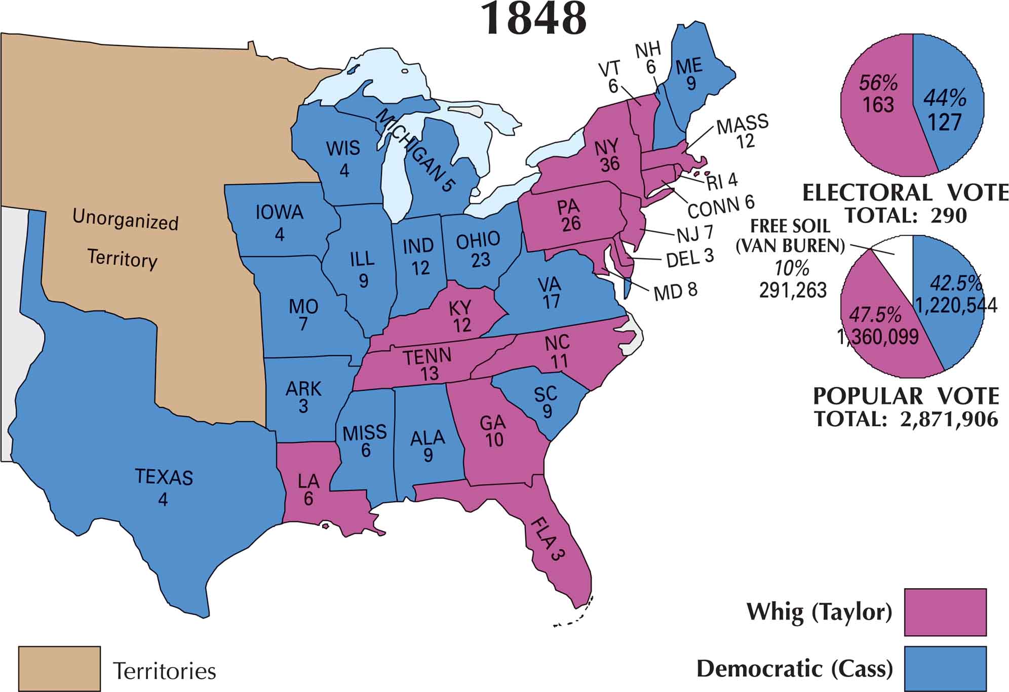
This map of the US 1848 election shows a country divided. Zachary Taylor’s Whig support spreads across the South and much of the West. Lewis Cass’s Democratic strength is mostly in the Northeast and parts of the Midwest. But Taylor’s popularity as a military hero helped him win key states.
Map Information
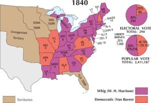
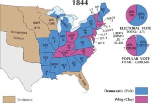
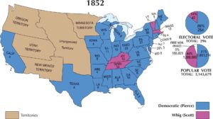
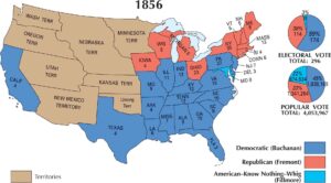
US Election Maps
Click on a map below to check out the US election map and results.

Country Maps
Explore the geography that defines this nation.


