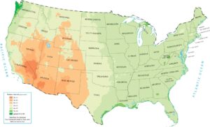
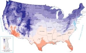
United States Precipitation Map
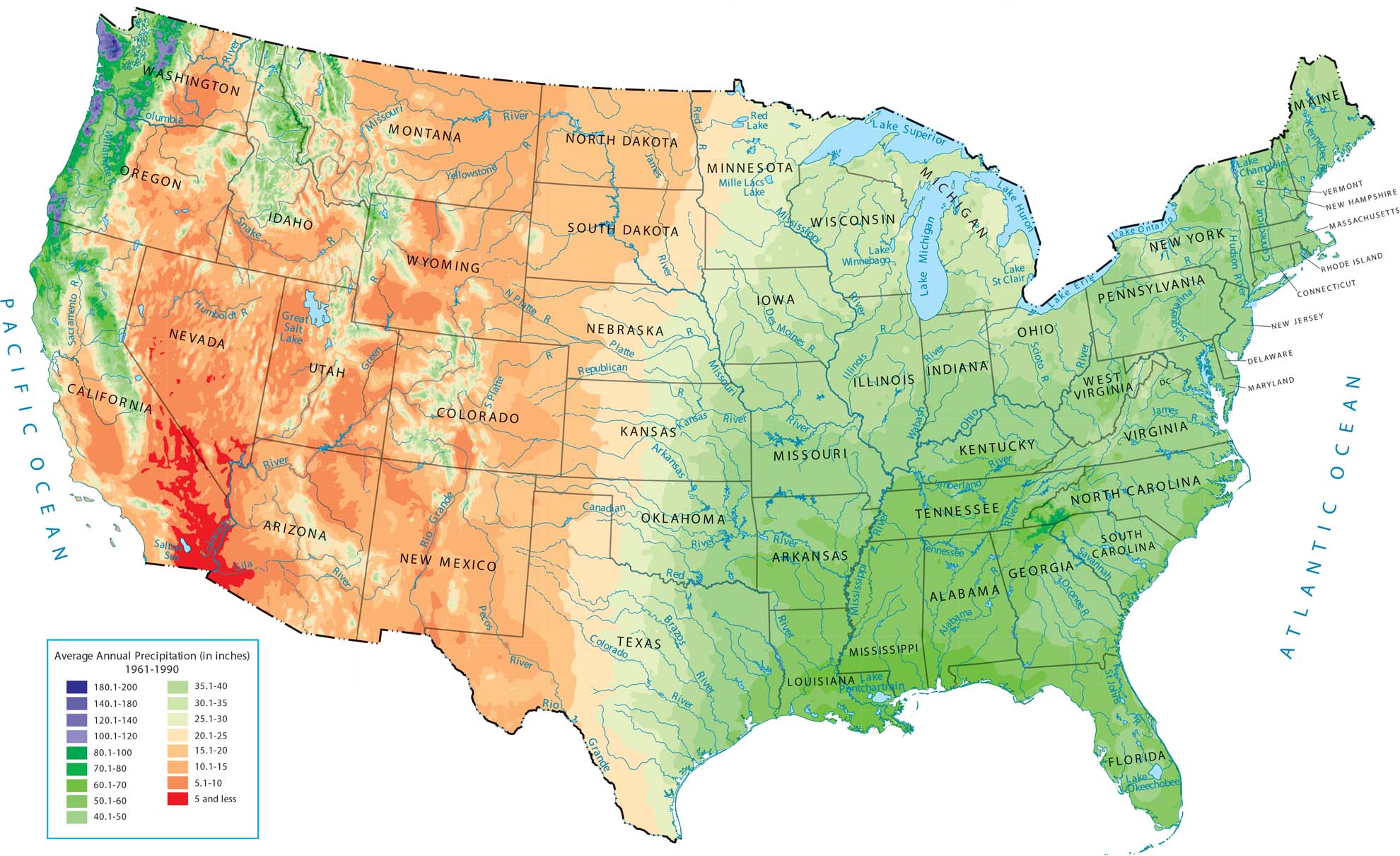
The United States has a wild variety of weather because the landscape is so different from one coast to the other. Our precipitation map of the entire country shows a huge split. The eastern half and the Northwest are super green, while the west interior is mostly a giant dry zone.
Map Information
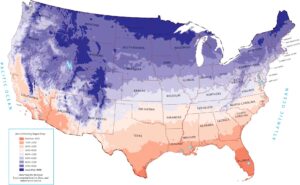
State Precipitation Maps
Select any state map below to view its precipitation map.


US Climate Maps
Feel the pulse of the nation’s nature.