Map of Toledo, Ohio
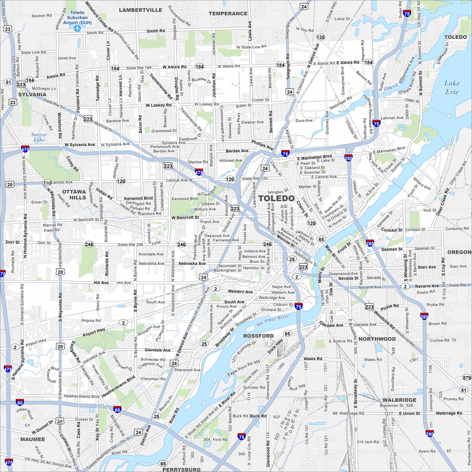
Here’s a simple map of Toledo along Lake Erie. Known for its Glass City heritage, it’s shaped by the Maumee River and a strong industrial past. It’s also situated in very close proximity to Lake Erie.
Map Information
On the Map
Interstates/Highways: I-75, I-280, I-475, I-80, US Hwy 24, US Hwy 23, US Hwy 20, State Rte 246, State Rte 120, State Rte 184, State Rte 51, State Rte 25, State Rte 2, State Rte 65 Major Roads: Central Ave, Alexis Rd, Monroe St, Sylvania Ave, Cherry St, Front St, Miami St, Anthony Wayne Trl, Airport Hwy, Dorr St, Bancroft St, Laskey Rd, Jackman Rd, Secor Rd, Talmadge Rd, Douglas Rd, Detroit Ave, Collingwood Blvd, Summit St, Broadway St Airports: Toledo Suburban Airport (DUH) Lakes and Reservoirs: Lake Erie Major Rivers: Maumee River, Ottawa River Nearby Communities: Ottawa Hills, Maumee, Perrysburg, Rossford, Northwood, Oregon, Walbridge, Lambertville, TemperanceOhio State Maps
Check out our maps covering farmland or any of Ohio’s major cities.


City Maps of Ohio
Here are maps of Columbus and Ohio’s major cities


