Louisiana Physical Map
Louisiana is what the Mississippi River built. Our physical map of Louisiana shows delta, swamp, and marshland spreading into the Gulf Coast.
Louisiana is what the Mississippi River built. Our physical map of Louisiana shows delta, swamp, and marshland spreading into the Gulf Coast.
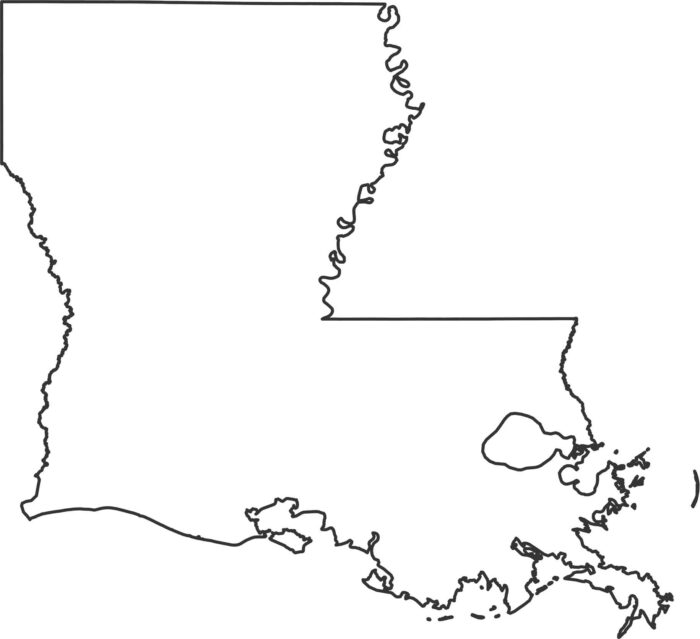
Our outline map of Louisiana shows the Mississippi River along the entire eastern border. The Gulf Coast shapes the southern coastline.
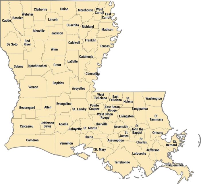
Louisiana calls them parishes instead of counties. Rivers, bayous, and the Gulf Coast shape most of the 64 parishes in Louisiana.
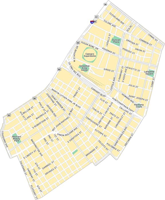
Downtown New Orleans sits between the Mississippi River and the French Quarter. Our map shows its main streets, plazas, and parks.
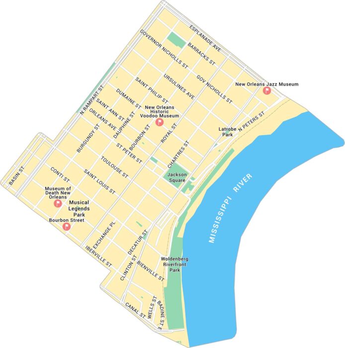
Our map of the French Quarter shows this neighborhood’s streets between the Mississippi River and Rampart Street.
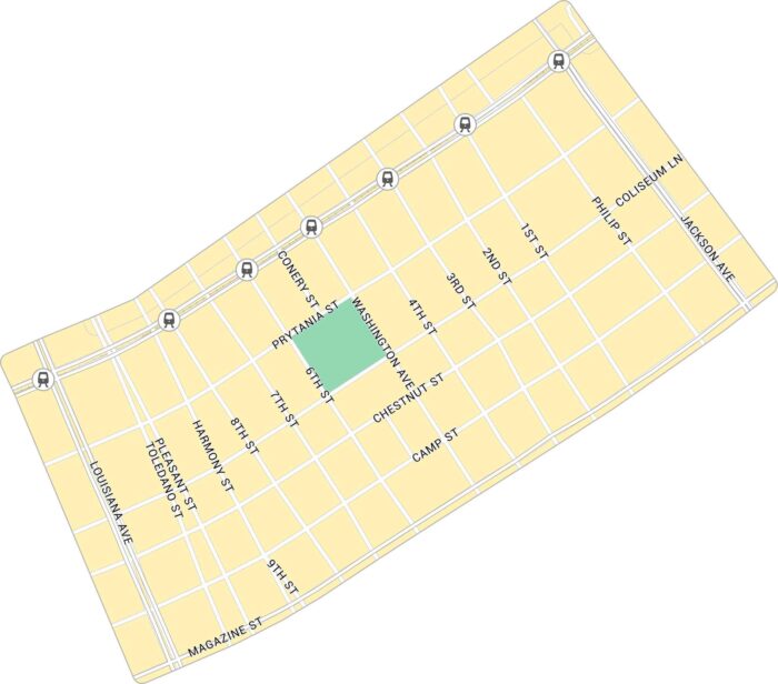
Our map of the Garden District shows the uptown New Orleans neighborhood. You’ll get to see St. Charles Avenue and its quiet blocks.
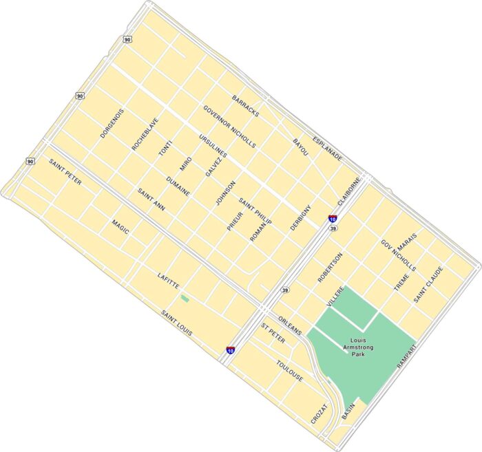
Our Treme map displays its narrow streets, from Louis Armstrong Park to Claiborne Avenue. It’s historic, proud, and beats to its own rhythm.
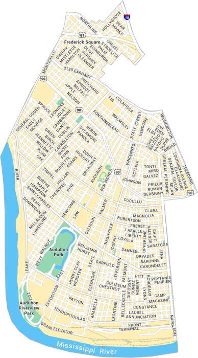
Our map of Uptown, New Orleans shows Magazine Street, Audubon Park, and every turn leading toward the Mississippi River.
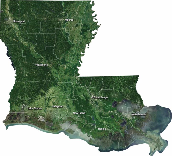
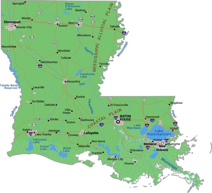
Our satellite map of Louisiana captures its bayous, rivers, and the Mississippi Delta. You can spot New Orleans, Baton Rouge and Shreveport.
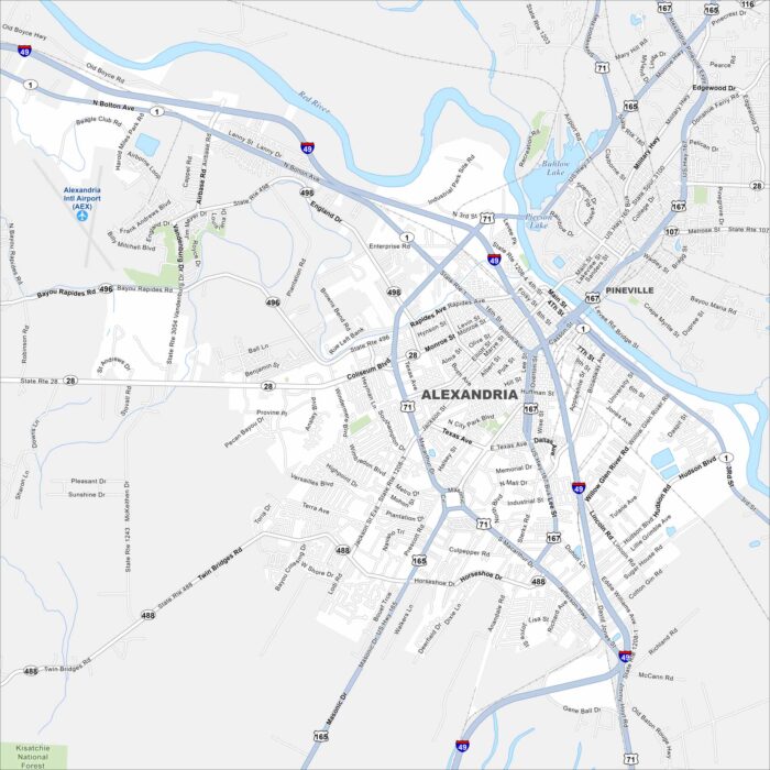
Alexandria sits along the Red River, with roads and bridges tying the city together. Our map shows how it truly is a crossroads of Louisiana.
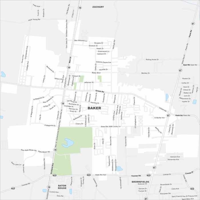
Baker is mapped with its highways, streets, and nearby park spaces. You can see how it connects to Baton Rouge.
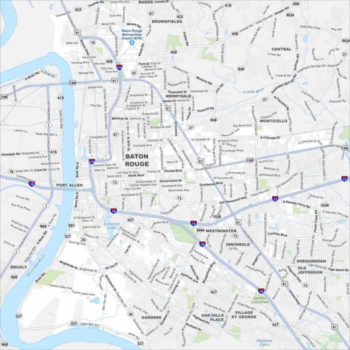
Here’s our map of Baton Rouge, sitting proudly on the Mississippi River. Explore the capital’s downtown and riverfront views.
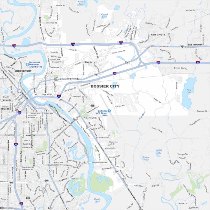
Our map of Bossier City highlights its location along the Red River. Casinos and retail line the waterfront, but neighborhoods fill inland.
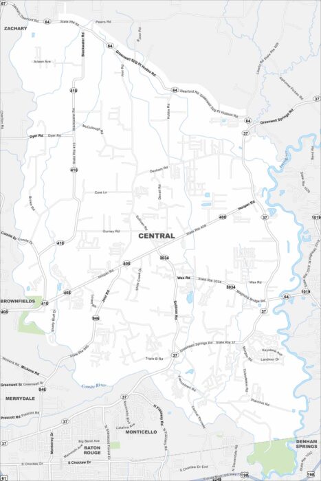
Our map of Central shows its neighborhoods with bayous cutting through. The city is tied to Baton Rouge but holds onto its own identity.
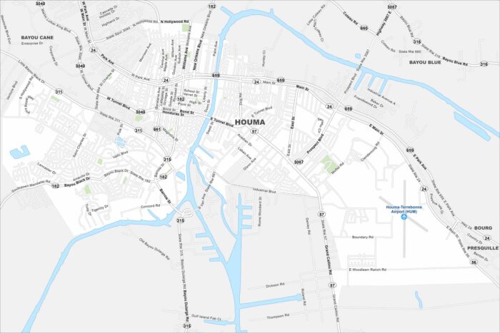
Check out our map of Houma deep in bayou country. Waterways and canals flow through the map. The Gulf lies just a short drive south.