Map of Miami Springs, Florida
Learn about Miami Springs with our road map. The city’s circular street plan stands out immediately with the airport to the south.
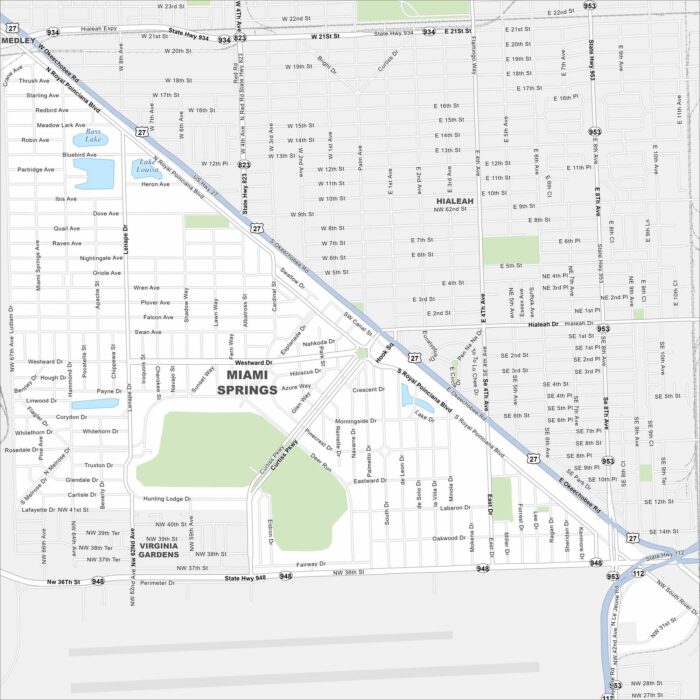
Learn about Miami Springs with our road map. The city’s circular street plan stands out immediately with the airport to the south.
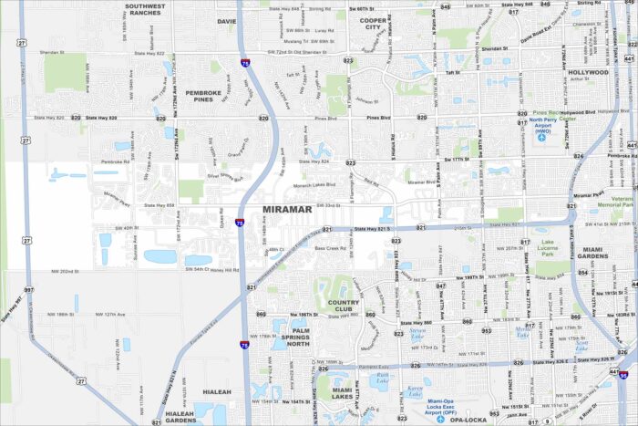
Miramar sits between Miami and Fort Lauderdale. Our map shows wide residential neighborhoods, lakes, and major highways.
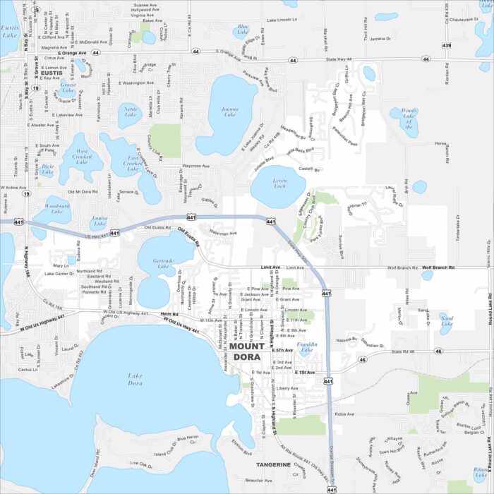
Check out Mount Dora on our map of central Florida. Lake Dora borders the city, with historic downtown streets nearby.
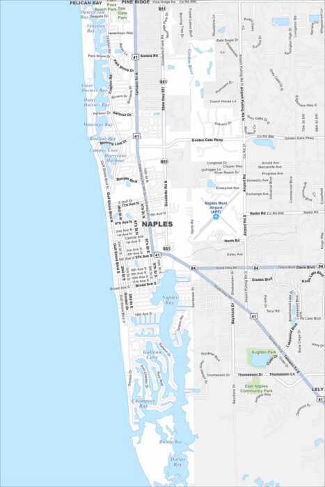
Get to know Naples by viewing our map of the Gulf Coast. The city features a grid of beachside neighborhoods, golf courses, and wetlands.
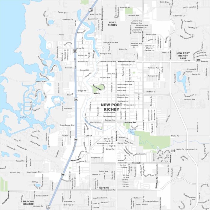
New Port Richey lies north of Tampa along the Pithlachascotee River. This map shows highways/roads, parks and Gulf access nearby.
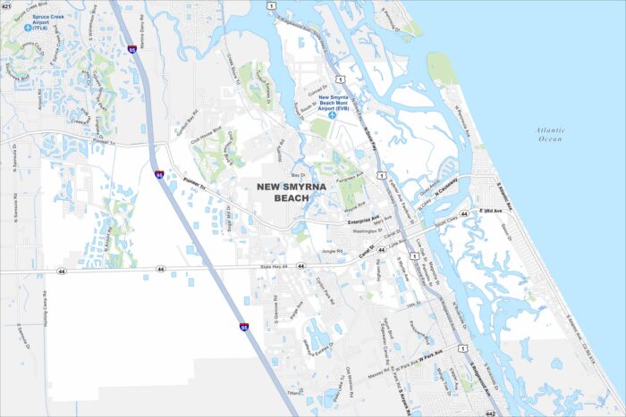
New Smyrna Beach lines the Atlantic coast south of Daytona. Check out our to see its roads highways, bridges, and riverfront.
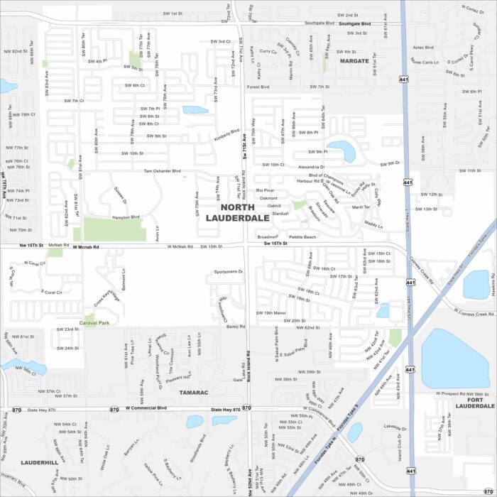
Take a look at North Lauderdale in Broward County. Our map shows its residential streets with canals running through.
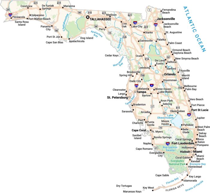
Our Florida map shows the Sunshine State. Cities line up along the coasts, and highways travel along the edge of the Everglades.
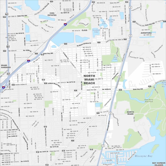
North Miami Beach lies inland from the coast but close to Biscayne Bay. This map shows a suburban layout of lakes, highways and streets.
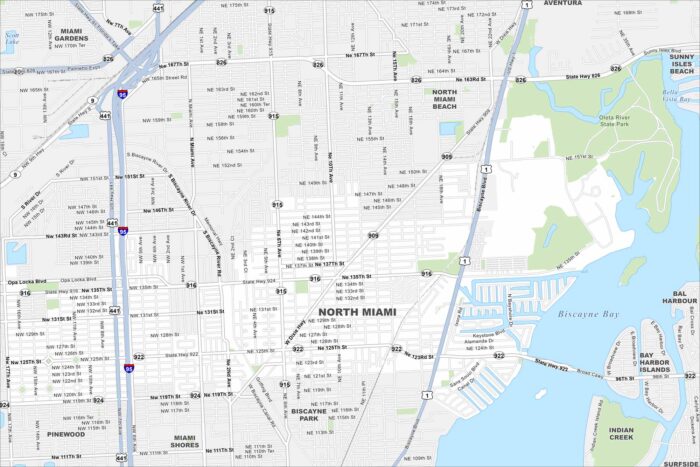
Our map of North Miami highlights this city along Biscayne Bay. It’s mostly waterways and dense neighborhoods that shape the area here.
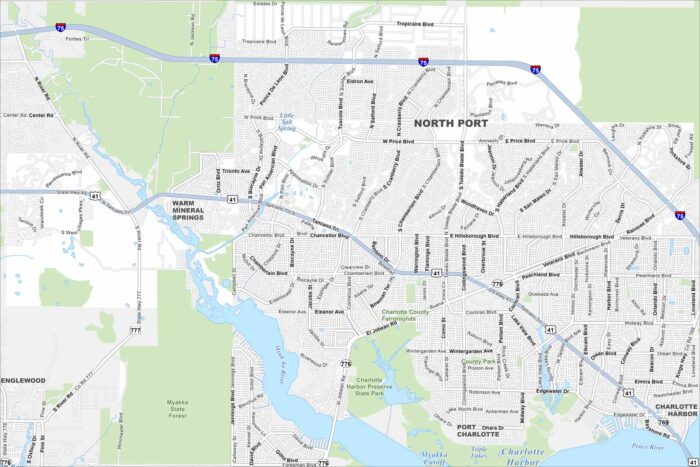
North Port lies between Sarasota and Port Charlotte. Check out this map to see its residential streets spread across the city.
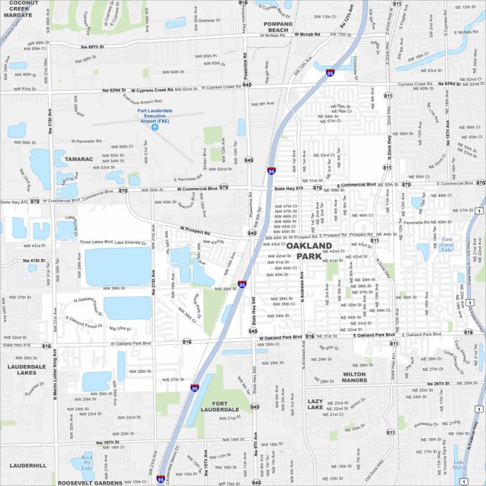
Oakland Park lies just north of Fort Lauderdale. Check out our map to see a compact urban grid with canals cutting through.
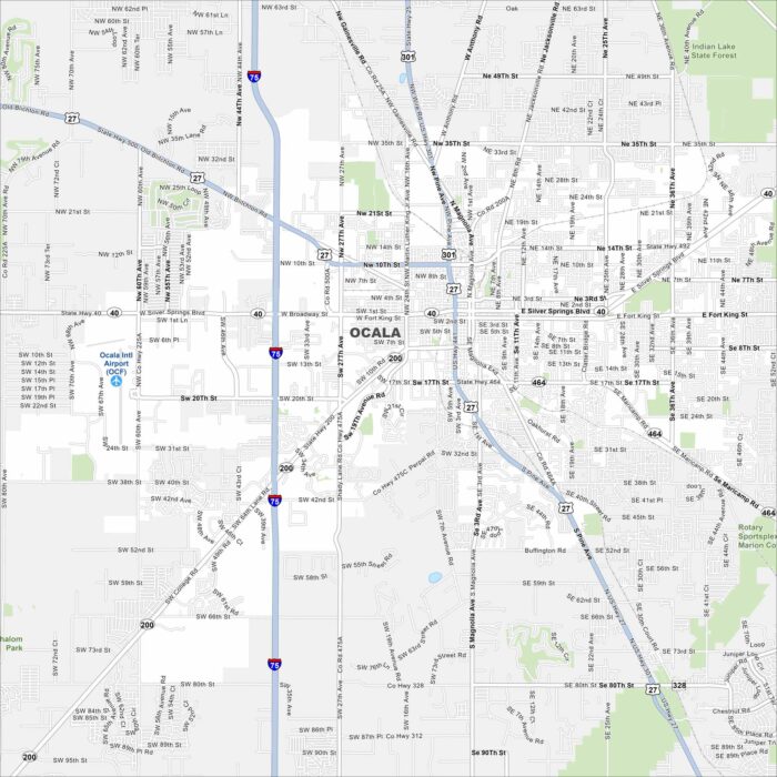
Take a look at our map of Ocala in north-central Florida. This map shows a spread of neighborhoods and a historic downtown square.
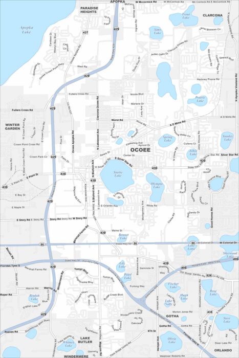
Ocoee lies west of Orlando with neighborhoods clustered around lakes. This map shows suburban developments linked by major highways.
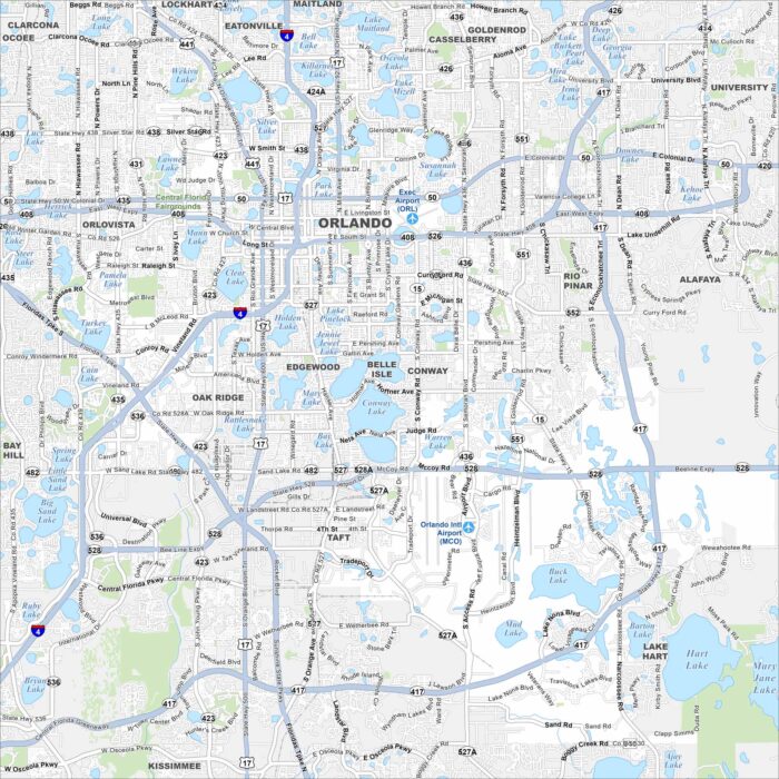
Orlando spreads across central Florida with lakes scattered everywhere. Our map highlights the downtown grid and road network.