Map of Gainesville, Florida
Gainesville is in north-central Florida. This map shows lakes, creeks, and state parks. Highways link it across flat, green land.

Gainesville is in north-central Florida. This map shows lakes, creeks, and state parks. Highways link it across flat, green land.
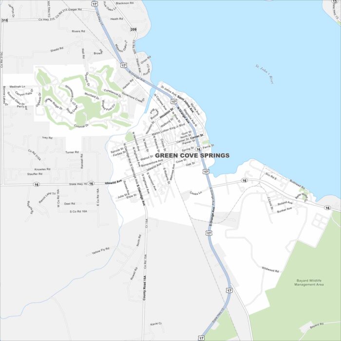
Green Cove Springs is along the St. Johns River in northeast Florida. On the map, you’ll see the river shaping the city’s edge.
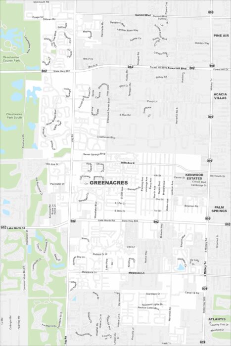
Our map of Greenacres places it inland in Palm Beach County. Neighborhoods fill the inner city grid. Larger roads connect it to the Atlantic.
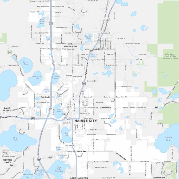
Take a look at our map of Haines City in central Florida. Lakes are scattered throughout the area. Highways link it to Orlando and Lakeland.
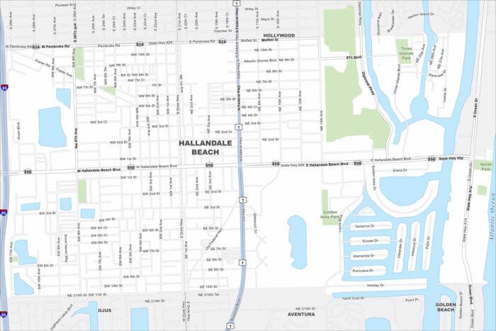
Our map of Hallandale Beach shows its strip along the Atlantic coast. Canals and waterways flow through the city.
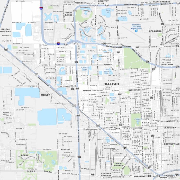
Hialeah sits in South Florida, just northwest of Miami. Our map shows a dense grid of streets. Major highways cut across the city.
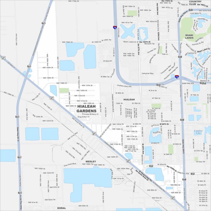
Our map of Hialeah Gardens highlights its position along the Palmetto Expressway (State Road 826). It borders Hialeah to the east. Canals and residential blocks are spread throughout. Map Information On the Map Interstates/Highways: I-75, US Hwy 27, State Rte 821, State Rte 826, State Rte 924, State Rte 932, Palmetto Expy Major Roads: Okeechobee…
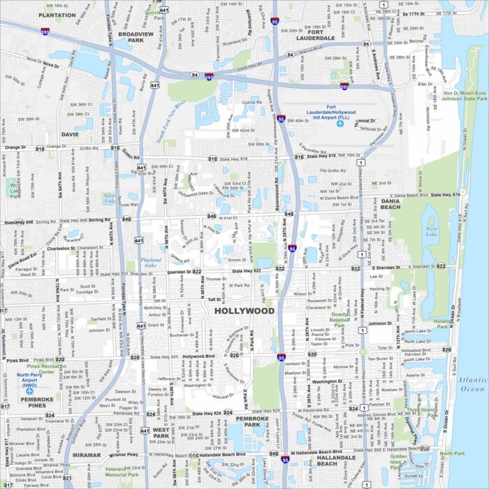
Hollywood, Florida is set between Miami and Fort Lauderdale. Our map highlights its roads, lakes and beachfront boardwalk.
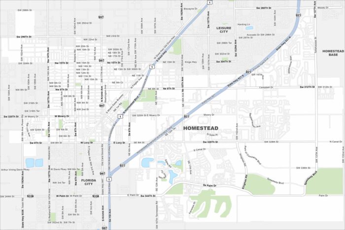
Check out our map of Homestead at the gateway to the Keys. Farmland surrounds much of the city. Everglades National Park lies to the west.
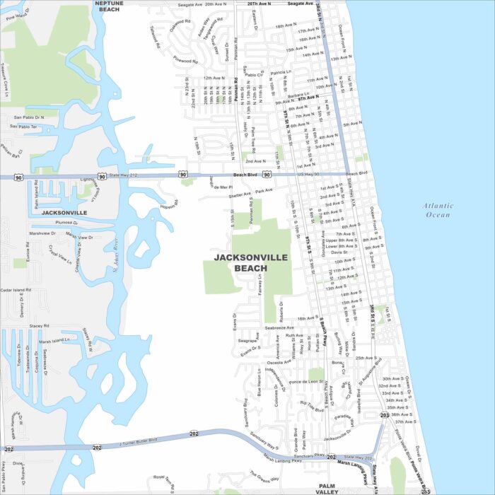
Our map of Jacksonville Beach highlights the Atlantic shoreline. A long stretch of beach runs the length of the city.
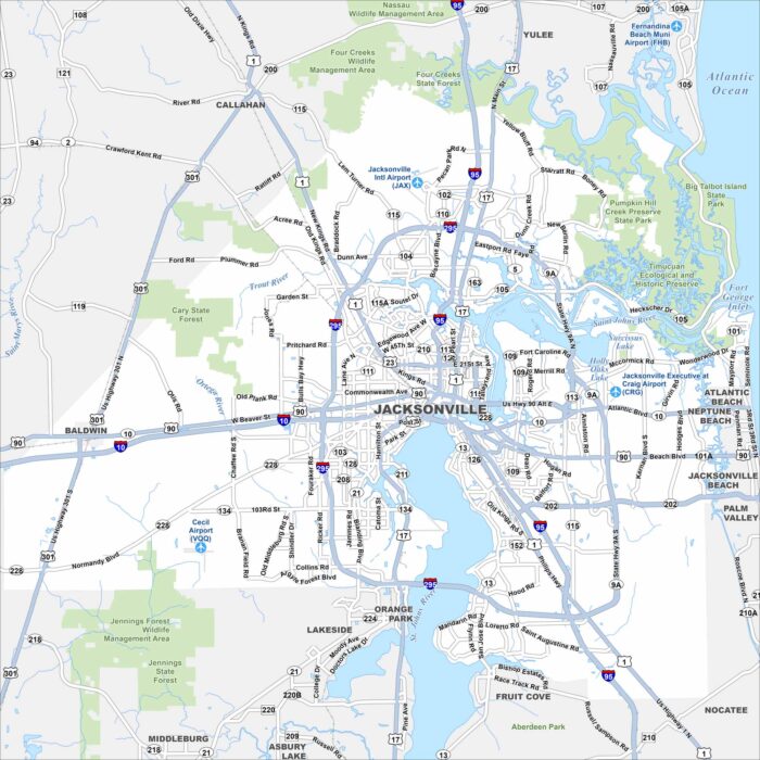
Jacksonville spreads along the St. Johns River. Find the state parks and highways looping the city. Beaches and suburbs extend to the east.
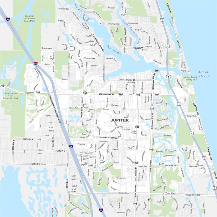
Jupiter sits on Florida’s Atlantic coast. Our map shows the Loxahatchee River meeting the ocean. Beaches, inlets, and waterways are here.
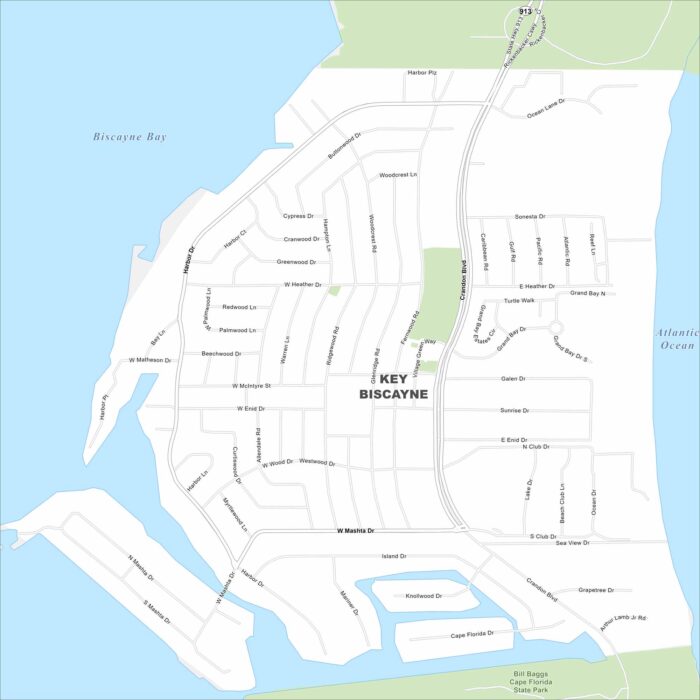
Key Biscayne is a barrier island south of Miami. This map shows it linked by the Rickenbacker Causeway. Beaches run along both shores.
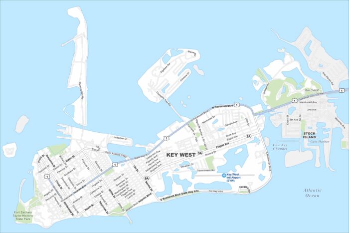
Key West sits at the end of the island chain. Our map highlights the Overseas Highway leading in. The Gulf and Atlantic meet near here.
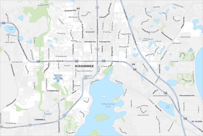
Kissimmee lies just south of Orlando. Our map shows lakes across the landscape and roads leading toward Disney parks.