Map of Ormond Beach, Florida
Ormond Beach hugs the Atlantic shoreline just north of Daytona Beach. Check out this map to see coastal neighborhoods, bridges, and parks.
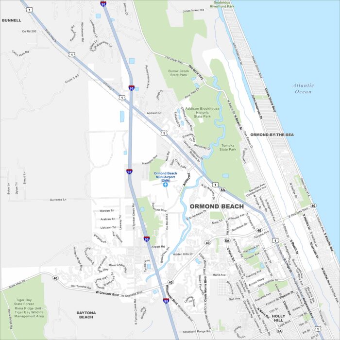
Ormond Beach hugs the Atlantic shoreline just north of Daytona Beach. Check out this map to see coastal neighborhoods, bridges, and parks.
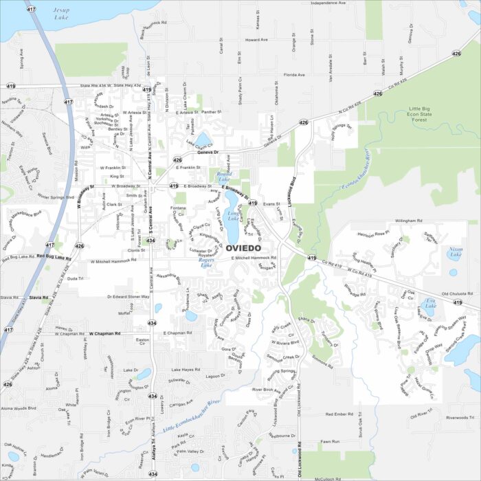
Oviedo lies northeast of Orlando with suburban neighborhoods and lakes scattered throughout. Take a look at this map to see its growth.
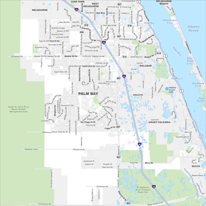
Palm Bay stretches along the Indian River Lagoon. Check out our map to see its wide suburban layout and nearby nature preserves.
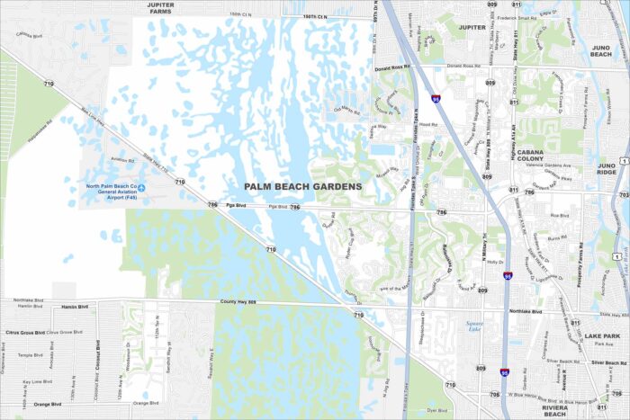
Our map of Palm Beach Gardens highlights its lakes and planned communities. The city sits just inland from the Atlantic coast.
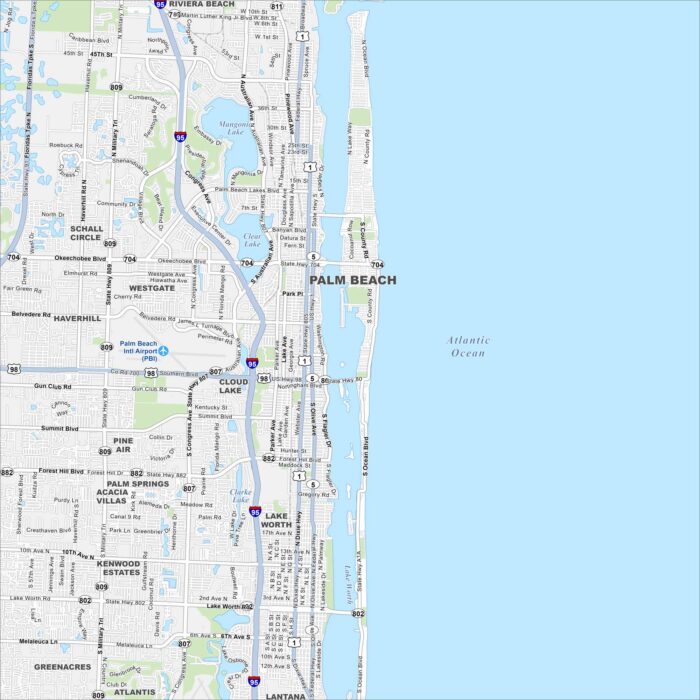
Palm Beach sits on a barrier island between the Intracoastal Waterway and the Atlantic. Use this map to see Worth Avenue and more.
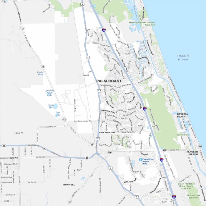
Palm Coast stretches between St. Augustine and Daytona Beach. Our map shows suburban neighborhoods set among canals and nature preserves.
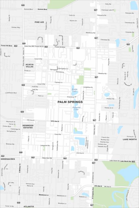
Palm Springs sits inland from West Palm Beach. Our map highlights suburban neighborhoods and nearby lakes.
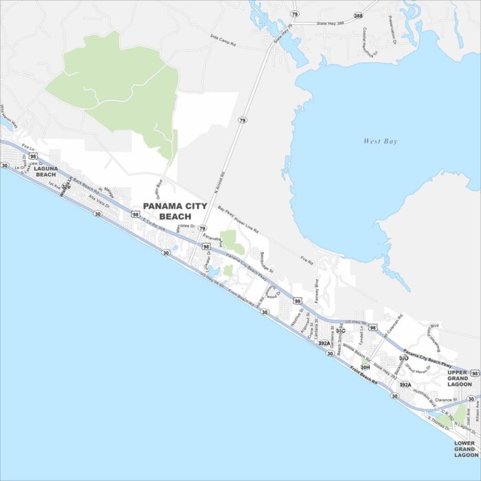
Panama City Beach runs along the Gulf Coast with miles of white sand. Our map outlines beachfront streets and piers.
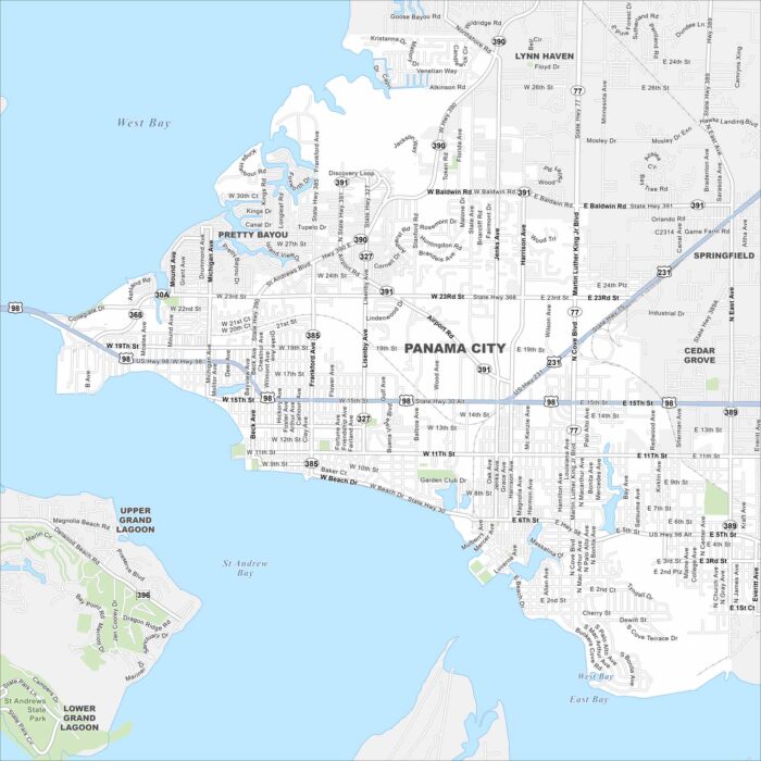
Take a look at Panama City on St. Andrews Bay. This map highlights its downtown, port areas, and residential neighborhoods.
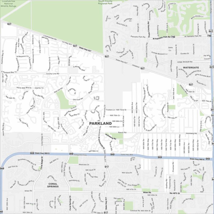
Take a look at Parkland, a suburban city north of Fort Lauderdale. Our map shows quiet neighborhoods, lakes, and parks.
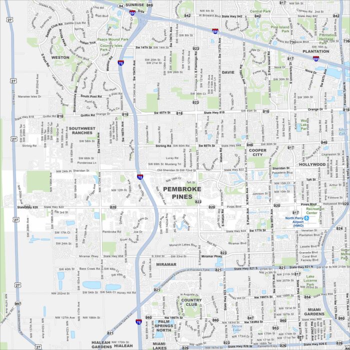
Our map of Pembroke Pines shows a city full of lakes and canals west of Hollywood. Suburban neighborhoods stretch across the grid.
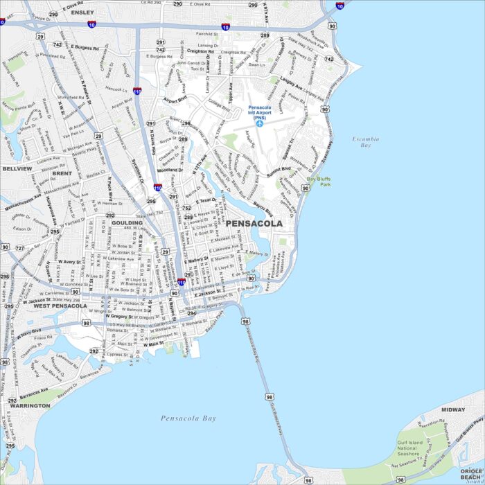
Pensacola lies on the Gulf Coast with white-sand beaches nearby. Our map highlights its downtown area and international airport.
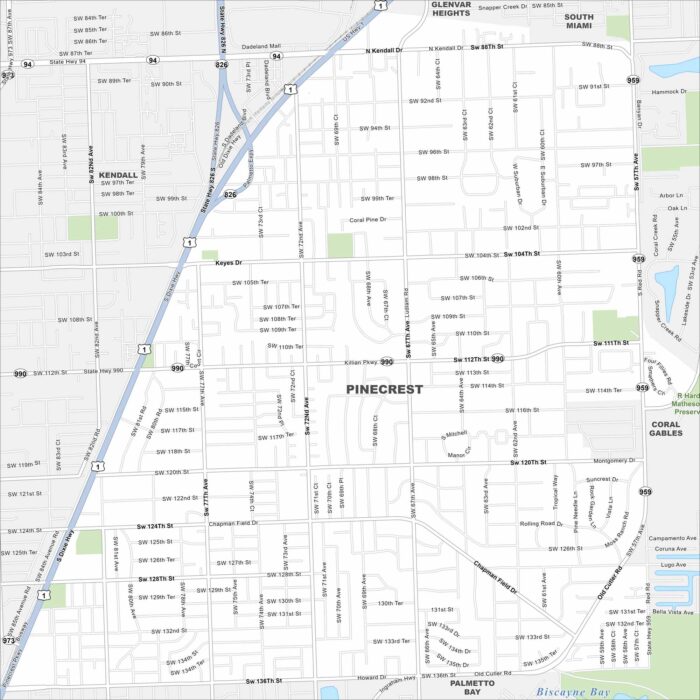
Pinecrest lies just south of Miami with leafy streets and large homes. Our map highlights its parks and easy access to major highways.
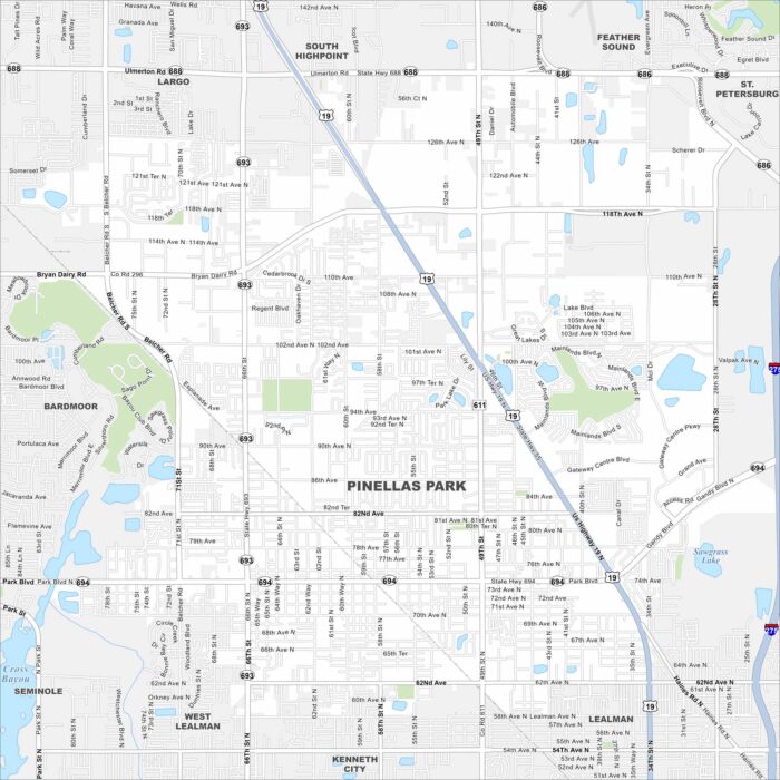
Our map of Pinellas Park shows a central location in Pinellas County. It’s a city with easy routes to Tampa Bay and the Gulf beaches.
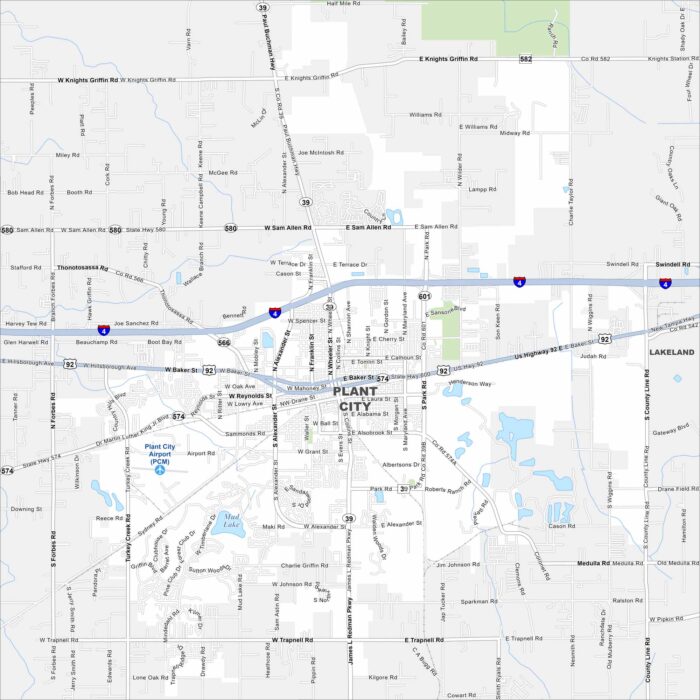
Plant City is famous for strawberries and farmland surrounding its core. Take a look at this map to see its roads spreading outward.