Florida Biomes Map
We’ve mapped grasslands, savannas, and mangroves across the peninsula. Water shapes almost everything you see on this map.
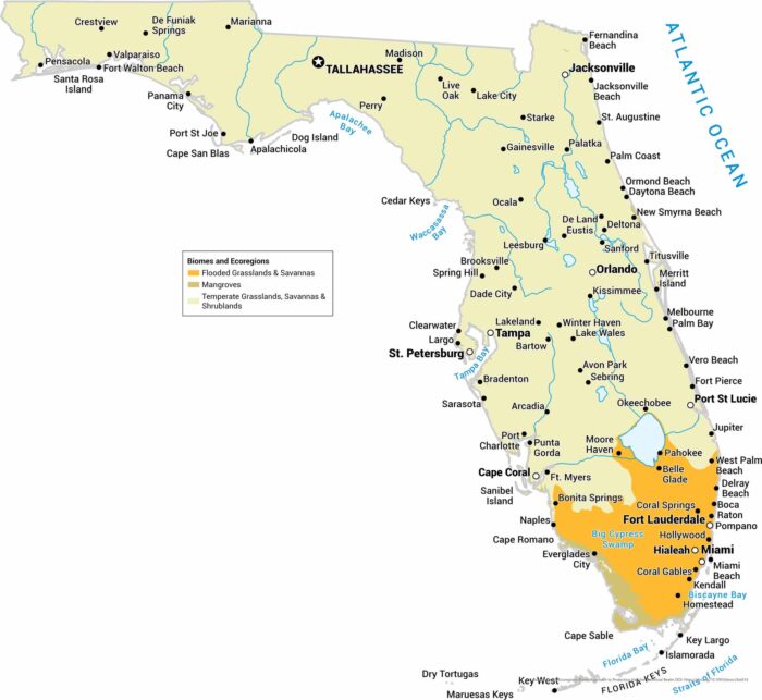
We’ve mapped grasslands, savannas, and mangroves across the peninsula. Water shapes almost everything you see on this map.
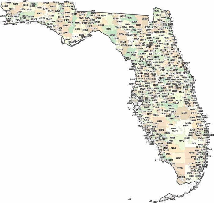
Hunt down any address in the Sunshine State with this Florida zip code map. Florida sprawls across 320XX to 349XX.
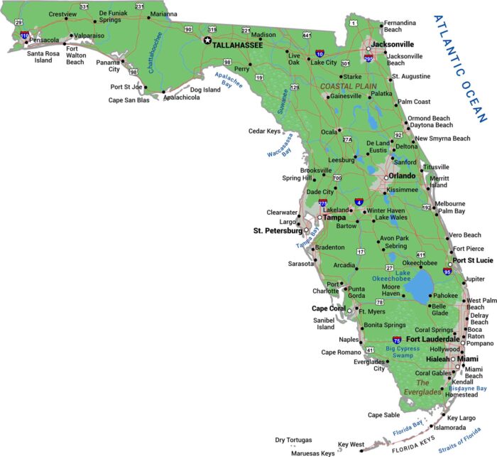
Our map shows Florida’s cities concentrate on the coasts. Miami, Fort Lauderdale, and West Palm Beach are all in the southeast.
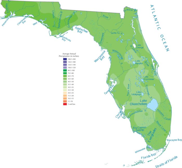
Florida’s shape guarantees tons of rain. With the Atlantic on one side and the Gulf Coast on the other, ocean moisture surrounds Florida.
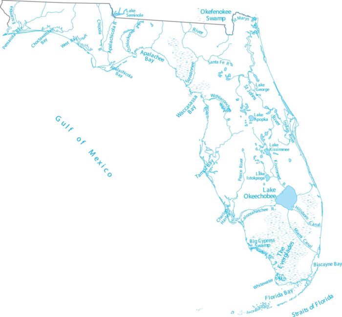
Step into Florida’s low-lying lakes and slow-moving rivers. Our map of Florida shows Lake Okeechobee and rivers draining to both coasts.
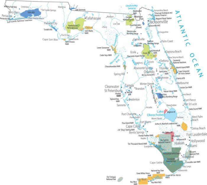
The coastal areas in Florida define where protected lands exists. Our map shows Everglades National Park covering the southern tip.
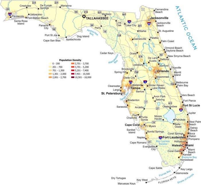
Florida’s population hugs the coast and major metros. But interior wetlands and the panhandle zone appear far less dense.
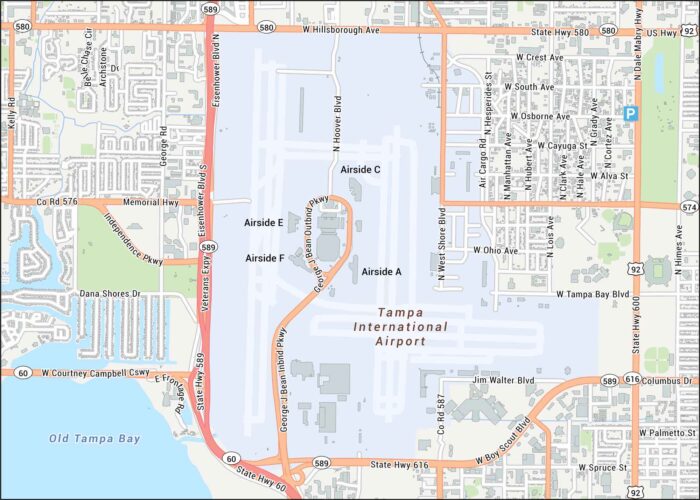
Our Tampa International Airport map highlights the main terminal, four airsides, and runways. Get oriented with its roads and highways.
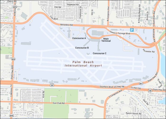
Palm Beach International Airport is laid out here with its runways, terminal loop, and nearby highways. Our road map keeps things simple.
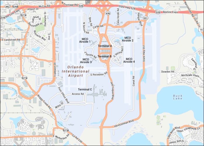
Our map of Orlando International Airport shows terminals, runways, and the main roads curling through the complex.
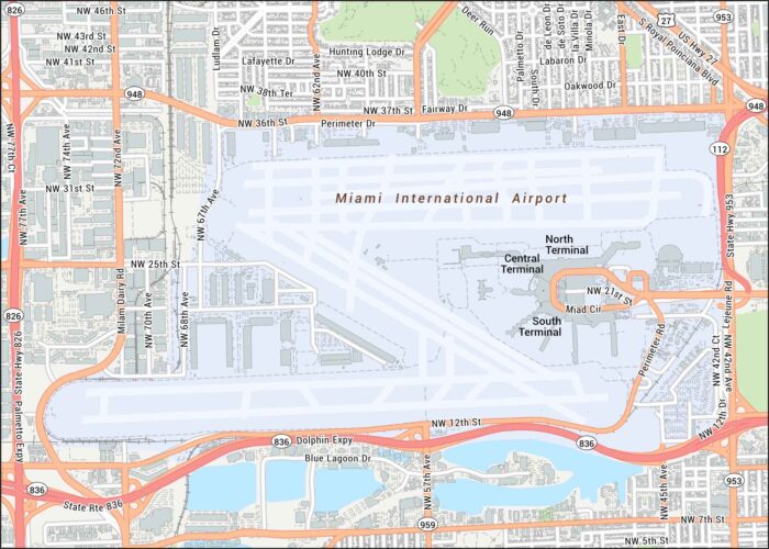
Get around Miami International Airport using our map that sits just west of Miami. It shows terminal wings and major access routes.
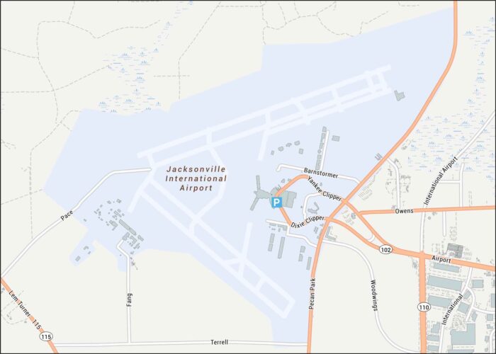
Our Jacksonville airport map allows you to fly into Jacksonville with ease. Our map highlights runways, highways, parking, and streets.
Our Florida physical map shows a state that’s basically flat. Swamps and wetlands fill the interior while beaches wrap its coastline.

The shape of Florida is almost entirely coastline between the Atlantic and the Gulf Coast. The northern borders Georgia and Alabama.
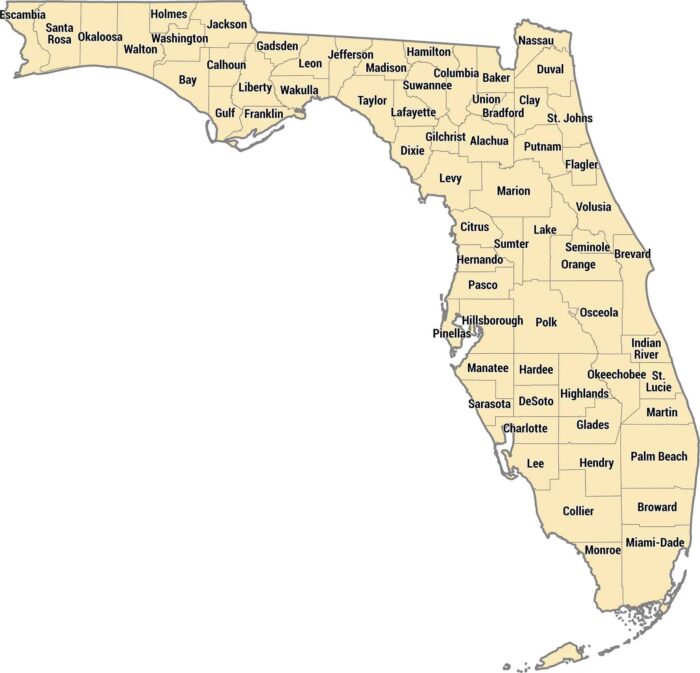
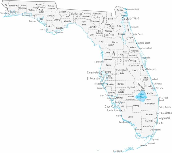
Our Florida county map shows 67 counties from the Panhandle to the Keys. The peninsula shape means you’ve got Gulf counties and more.