Florida Physical Map
Our Florida physical map shows a state that’s basically flat. Swamps and wetlands fill the interior while beaches wrap its coastline.
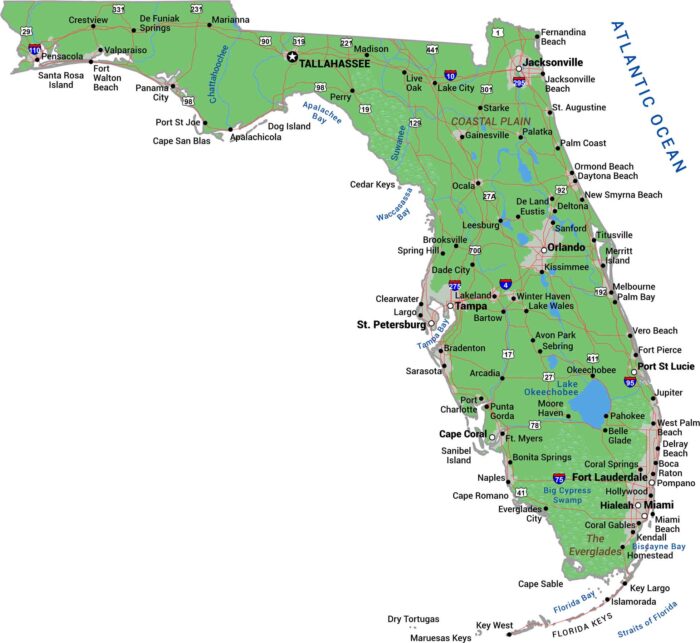
Our Florida physical map shows a state that’s basically flat. Swamps and wetlands fill the interior while beaches wrap its coastline.

The shape of Florida is almost entirely coastline between the Atlantic and the Gulf Coast. The northern borders Georgia and Alabama.
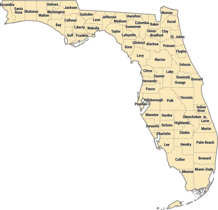
Our Florida county map shows 67 counties from the Panhandle to the Keys. The peninsula shape means you’ve got Gulf counties and more.
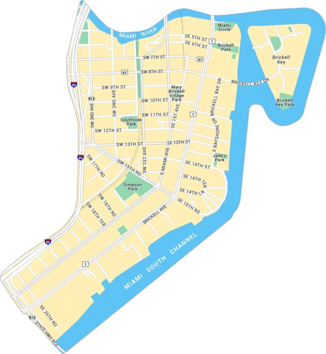
Take a look at our map of Brickell, Miami’s sleek financial hub along Biscayne Bay. You’ll find main roads, Brickell Key and local parks.
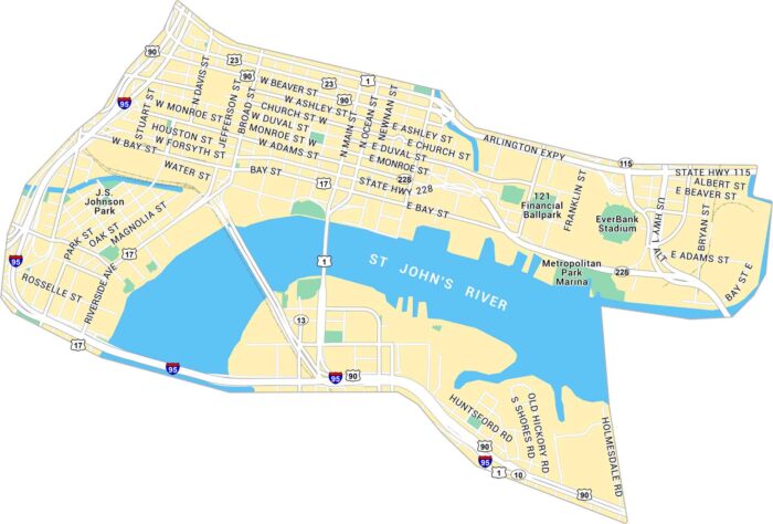
Here’s our map of Downtown Jacksonville running along the St. Johns River. It shows the bridges, parks, and downtown blocks.
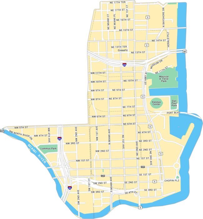
Our map of Downtown Miami shows the waterfront core along Biscayne Bay. It shows main streets, parks and the Miami River on the west side.
Explore Downtown Orlando with our map, showing the area around Lake Eola and Interstate 4. It lays out main streets, parks, and highways.
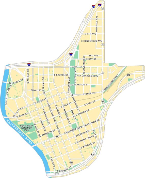
Our map of Downtown Tampa shows the city’s core along the Hillsborough River. It outlines main streets, the Riverwalk, and nearby parks.
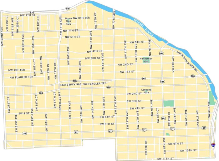
Our map of Little Havana shows the neighborhood just west of downtown Miami. Set along the Miami River, you’ll find major roads and highways.
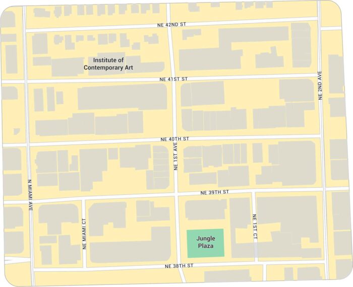
Our map of the Miami Design District shows the compact area just north of Wynwood. It highlights main streets and building footprints.
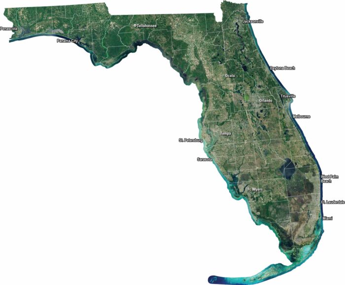
Florida shines bright from above with its coasts, wetlands, and cities. Our satellite map captures every from the Keys to the Panhandle.
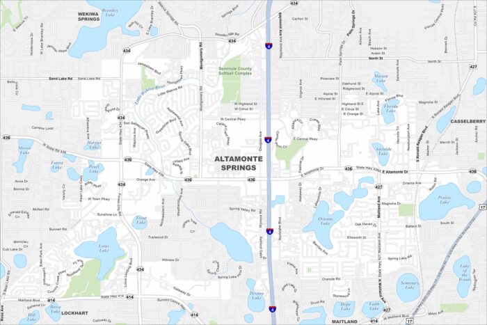
Altamonte Springs is a mix of busy highways, lakes, and well-kept parks. Cranes Roost Park is the local landmark everyone knows.
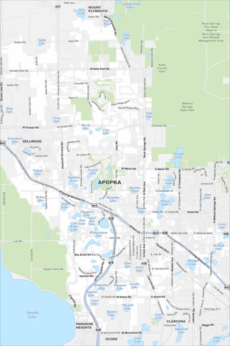
Here is a map of Apopka with its highways, state parks, and surrounding lakes. Apopka is called the “Indoor Foliage Capital of the World”.
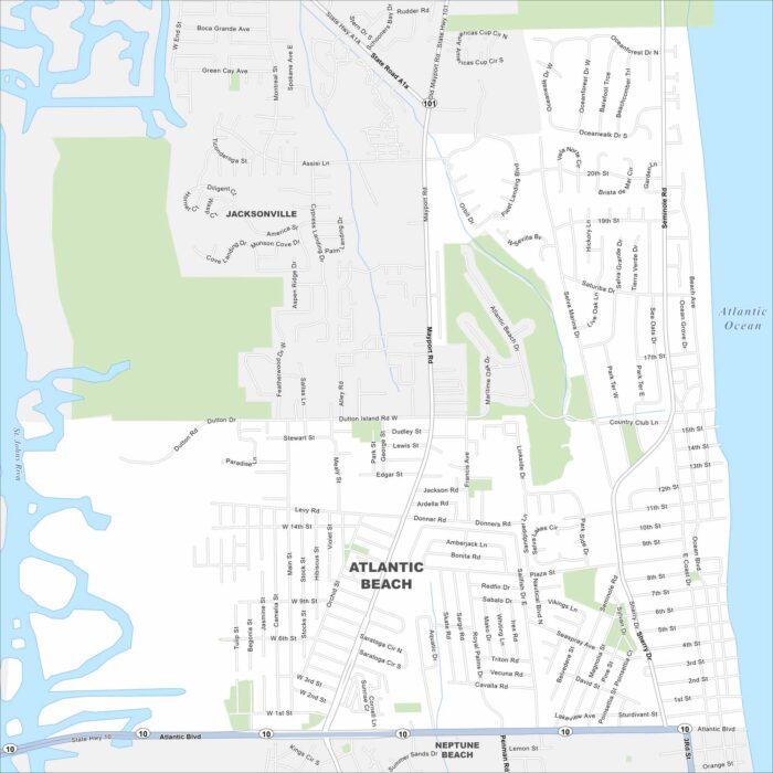
See the streets, highways, and coastal edges on this map. Our map of Atlantic Beach follows its long roads along the oceanfront.
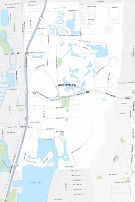
See the streets, highways, and waterways laid out here. Our map of Aventura highlights its coastal layout with canals.