Map of Altamonte Springs, Florida
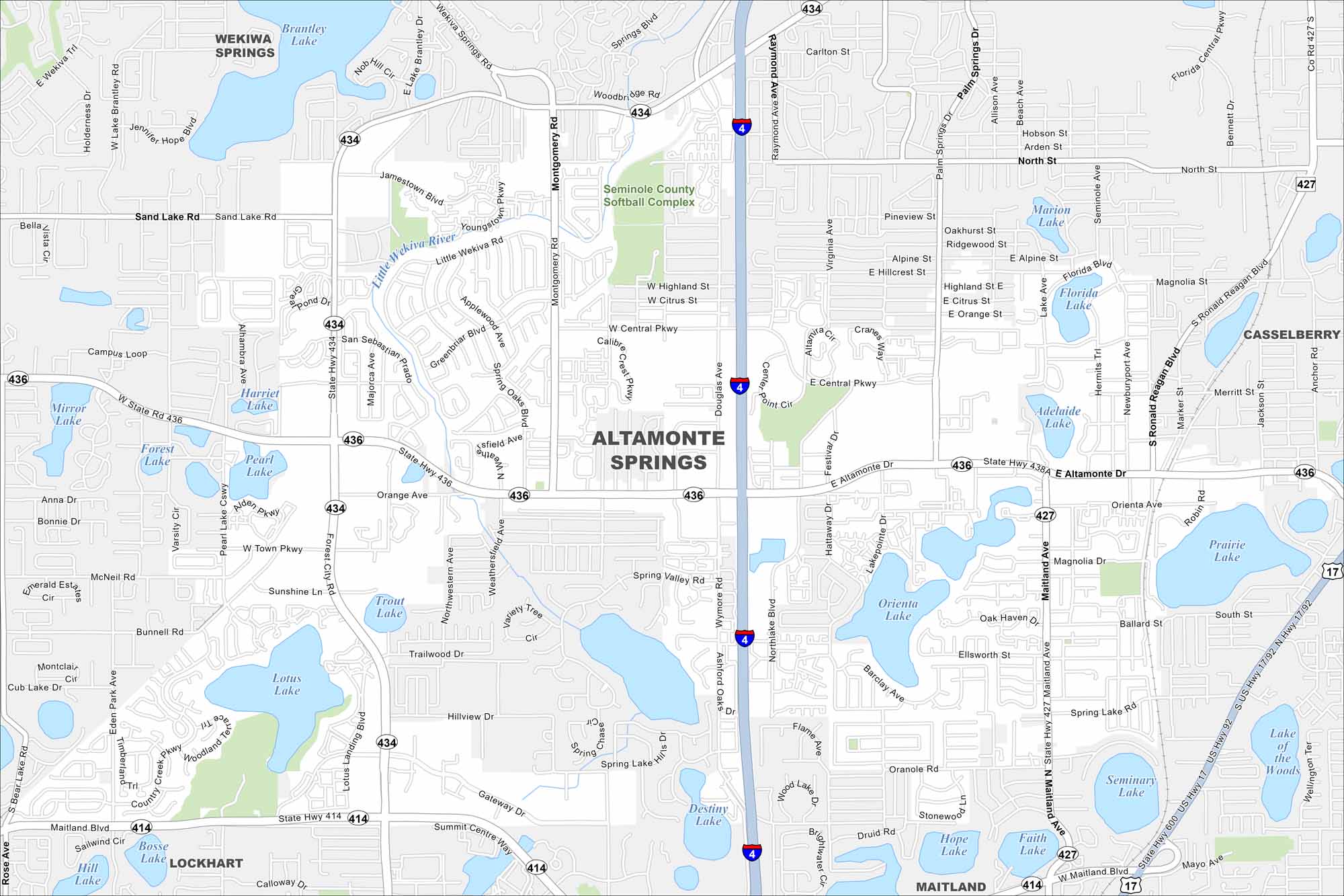
Just north of Orlando, Altamonte Springs is a mix of busy highways, lakes, and well-kept parks. Cranes Roost Park is the local landmark everyone knows. Our map shows I-4 and all major routes.
Florida State Maps
Discover Florida through our state maps


Map Information
On the Map
Interstates/Highways: I-4, State Hwy 436, State Hwy 414, State Hwy 434 Major Roads: Maitland Blvd, Montgomery Rd, Wekiva Springs Rd, Palm Springs Dr, S Ronald Reagan Blvd, Jamestown Blvd, Central Pkwy, Douglas Ave, Wymore Rd, Northlake Blvd, Orange Ave, Eden Park Ave, Sand Lake Rd, Gateway Dr, Ballard St Lakes and Reservoirs: Brantley Lake, Mirror Lake, Pearl Lake, Forest Lake, Lotus Lake, Trout Lake, Destiny Lake, Orienta Lake, Adelaide Lake, Marion Lake, Prairie Lake, Lake of the Woods, Seminary Lake, Hope Lake, Faith Lake, Bosse Lake, Hill Lake Major Rivers: Little Wekiva River Parks and Preserves: Seminole County Softball Complex Nearby Communities: Lockhart, Casselberry, MaitlandFlorida City Maps
Chart your course through Miami and Florida’s cities


