Map of Mountain View, California
Mountain View sits in the heart of Silicon Valley. Our map highlights its highways, roads, neighborhoods, and bayfront shoreline.
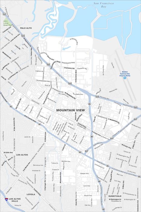
Mountain View sits in the heart of Silicon Valley. Our map highlights its highways, roads, neighborhoods, and bayfront shoreline.
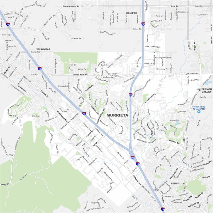
Explore Murrieta with our map to see everything it has. The city is connected by Interstate 15, linking it to Temecula and Riverside.
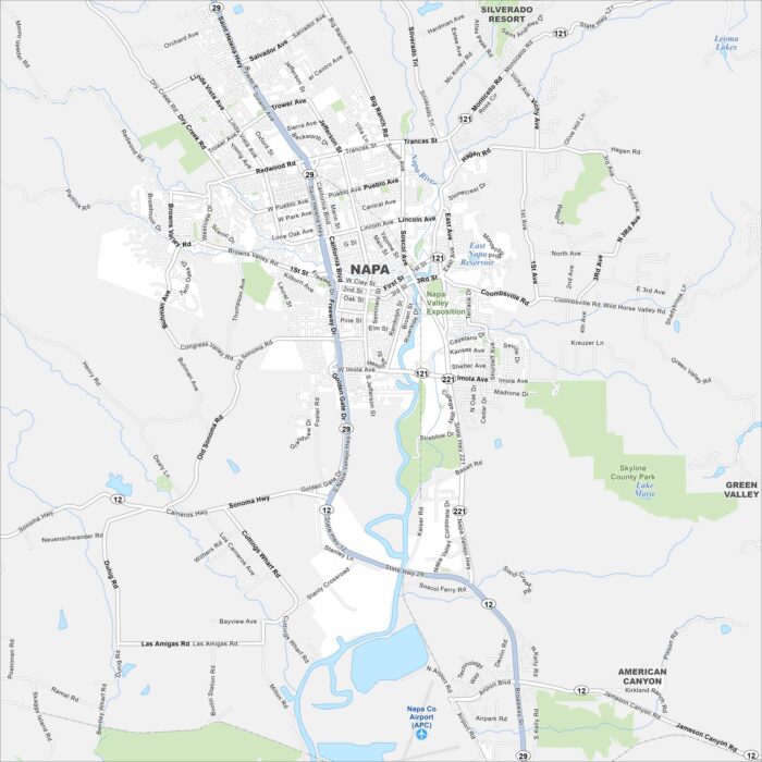
Explore Napa with our map, where vineyards line the valley floor. Downtown clusters along the Napa River with highways going to wine country.
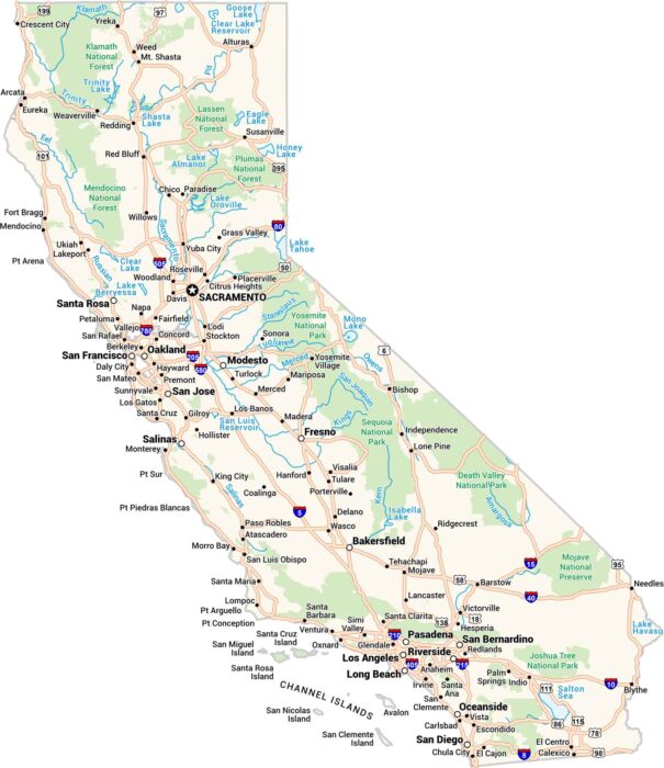
California is massive. It has cities, deserts, redwoods, and surf all in one place. Our map of California lays it out clean.
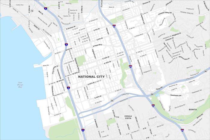
Our map of National City outlines a community just south of San Diego. Freeways cut through the city, connecting the whole city.
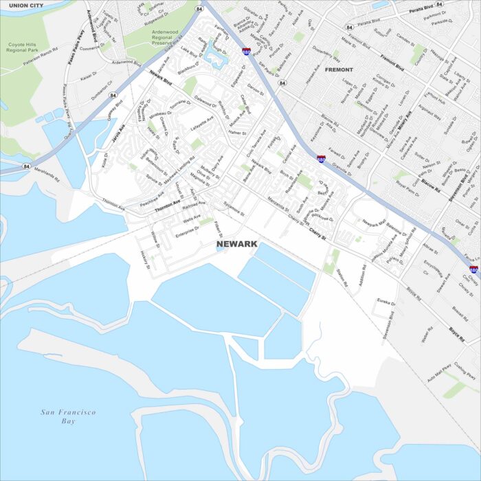
Newark sits in the East Bay near Fremont. Take a look at our map to see its road network, salt ponds, and highway connections.
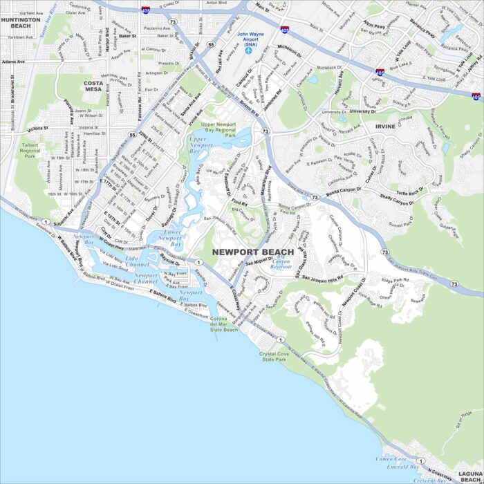
Newport Beach stretches along the Pacific coast in Orange County and is known for boating, surfing, and upscale neighborhoods.
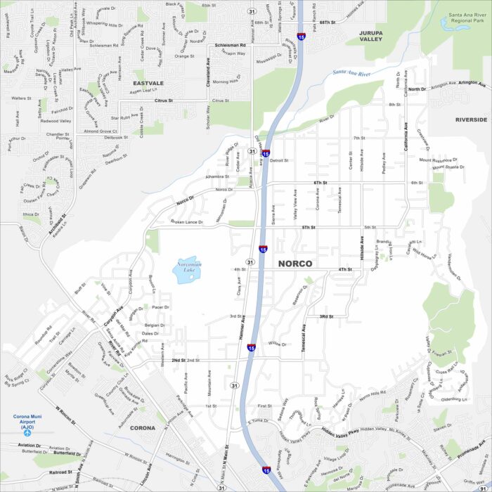
Our map of Norco highlights a community known for its rural, horse-friendly streets. The map shows large residential lots and streets.
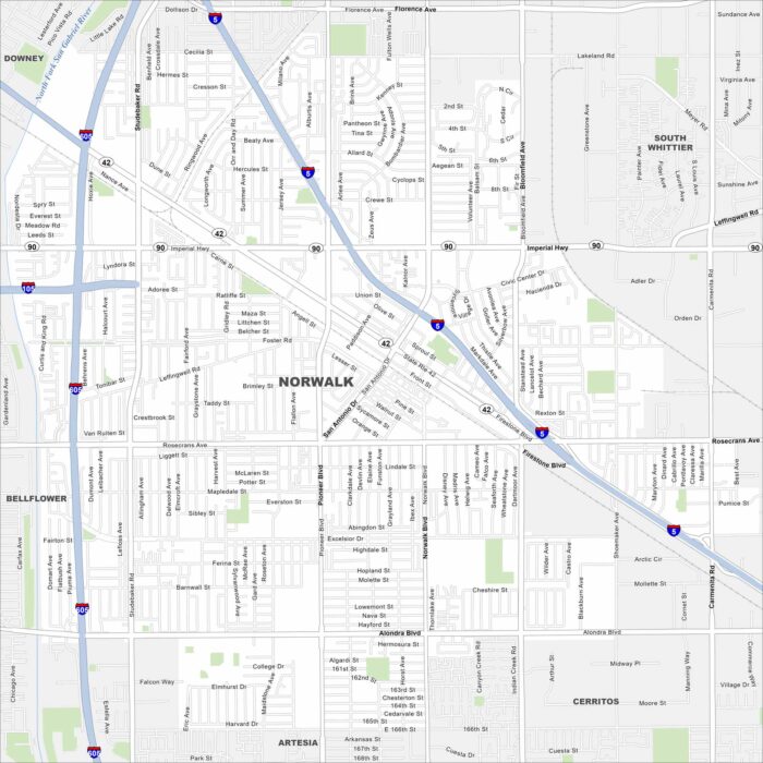
Norwalk sits in southeast Los Angeles County. Our map shows residential areas, major freeways, and local parks.
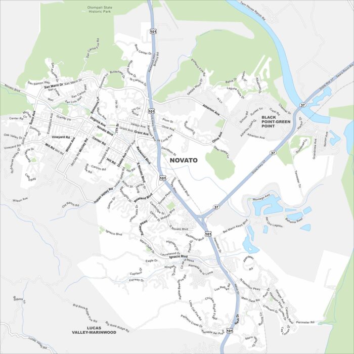
Novato sits at the northern edge of Marin County. Check out our map to see its residential areas bordered by hills and open space.
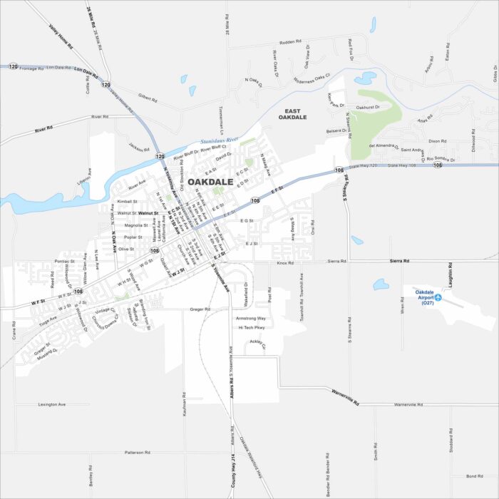
Oakdale sits on the Stanislaus River in the San Joaquin Valley. Our map highlights its grid-like streets surrounded by farmland.
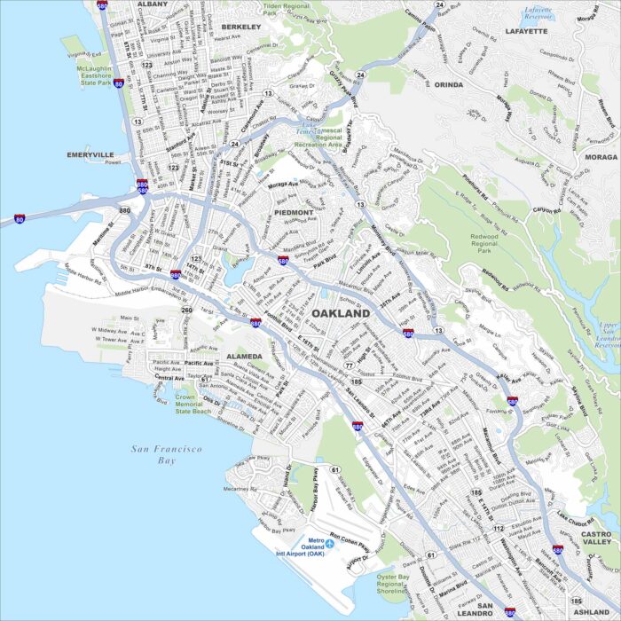
Our map of Oakland shows a city spread between the Bay shoreline and the East Bay Hills. The downtown core sits by Lake Merritt.
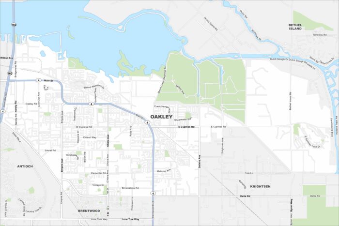
Oakley sits on the edge of the Sacramento–San Joaquin Delta. Our map highlights suburban neighborhoods surrounded by farmland and waterways.
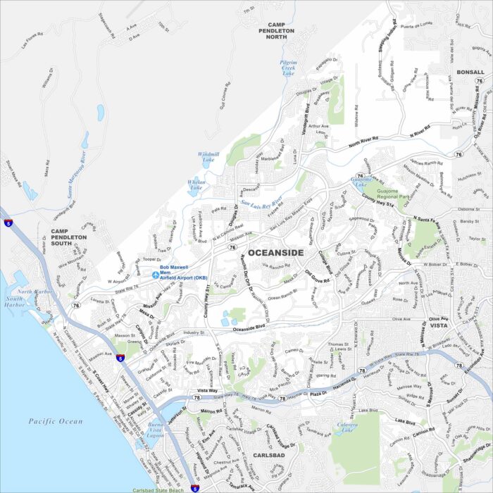
Oceanside sits on the Pacific coast of northern San Diego County. The map shows a long beachfront, a harbor, and a downtown grid.
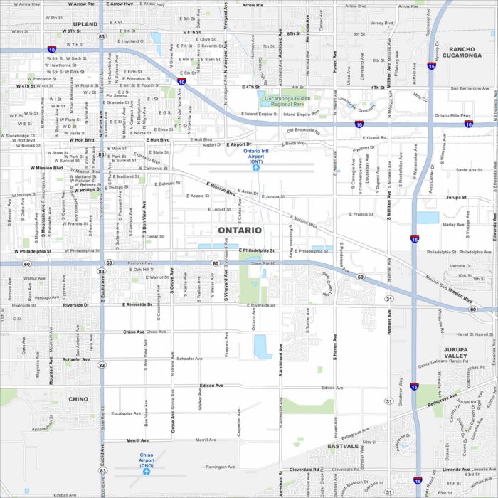
Take a look at Ontario, part of the Inland Empire. This map shows freeways, airports, streets and suburban neighborhoods.