Map of Newport Beach, California
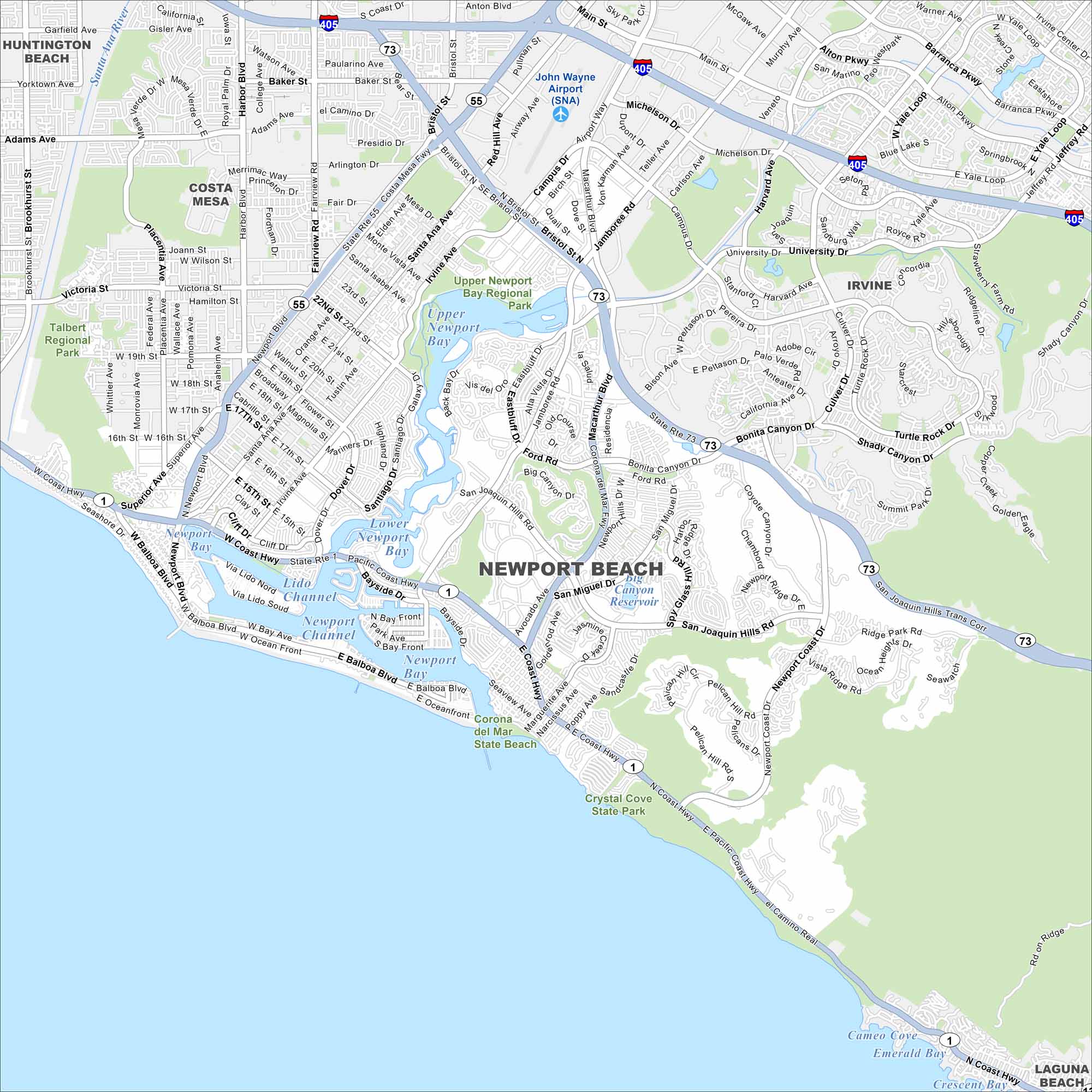
Newport Beach stretches along the Pacific coast in Orange County and is known for boating, surfing, and upscale neighborhoods. Check out our map to see its harbor, islands, and long beachfront.
California State Maps
Explore California with our state maps


Map Information
On the Map
Interstates/Highways: I-405, State Rte 1, State Rte 55, State Rte 73, Coast Hwy Major Roads: MacArthur Blvd, Jamboree Rd, Bristol St, Campus Dr, University Dr, Irvine Ave, Newport Blvd, Dover Dr, San Miguel Dr, Bonita Canyon Dr, Culver Dr, Shady Canyon Dr, Ridgeline Dr, Bison Ave, Avocado Ave, Marguerite Ave, Bayside Dr, Balboa Blvd, Oceanfront Airports: John Wayne Airport (SNA) Lakes and Reservoirs: Pacific Ocean, Newport Bay, Upper Newport Bay, Lower Newport Bay, Big Canyon Reservoir, Cameo Cove, Emerald Bay, Crescent Bay Parks and Preserves: Upper Newport Bay Regional Park, Talbert Regional Park, Corona del Mar State Beach, Crystal Cove State Park Nearby Communities: Huntington Beach, Costa Mesa, Irvine, Laguna BeachCalifornia City Maps
Here are detailed maps of California


