North Carolina Precipitation Map
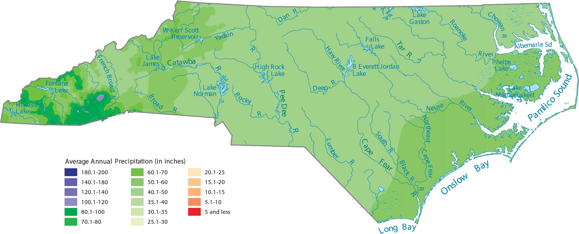
North Carolina gets a lot of rain because of its long coastline and high mountains in the west. Our precipitation map of North Carolina shows its mountains are the wettest spot. In fact, the Blue Ridge and Great Smoky Mountains are among the wettest places in the entire country.
Map Information
State Precipitation Maps
Select any state map below to view its precipitation map.


North Carolina State Maps
Get to know the mountains and coastlines of North Carolina.


