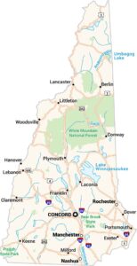
New Hampshire Lakes and Rivers Map
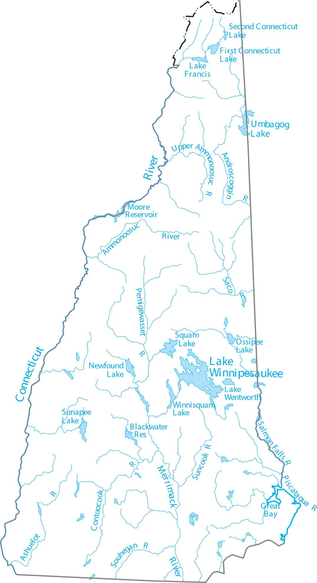
New Hampshire is in northern New England, with rivers flowing south to the Atlantic. Our map of New Hampshire highlights the Merrimack River and lakes. But this state is dominated by Lake Winnipesaukee, which sits at the foothills of the White Mountains.
Map Information
On the Map
Lakes and Rivers State Maps
Select any state map below to view its lakes and rivers map.


New Hampshire State Maps
Select one of our maps of the Granite State.