Pennsylvania Physical Map
Pennsylvania is Appalachian ridges and valleys from end to end. The mountains run diagonally across the state in our physical map.

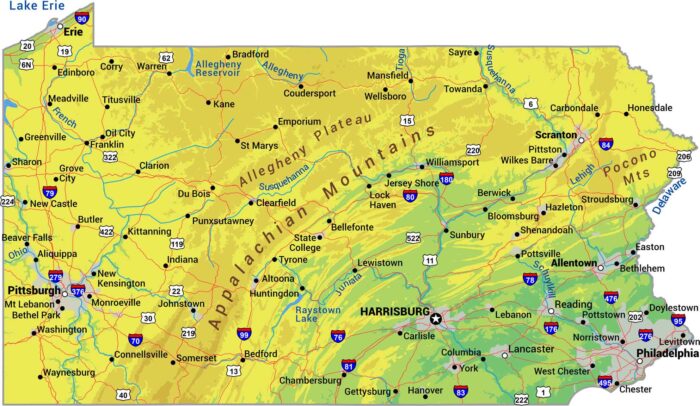
Pennsylvania is Appalachian ridges and valleys from end to end. The mountains run diagonally across the state in our physical map.
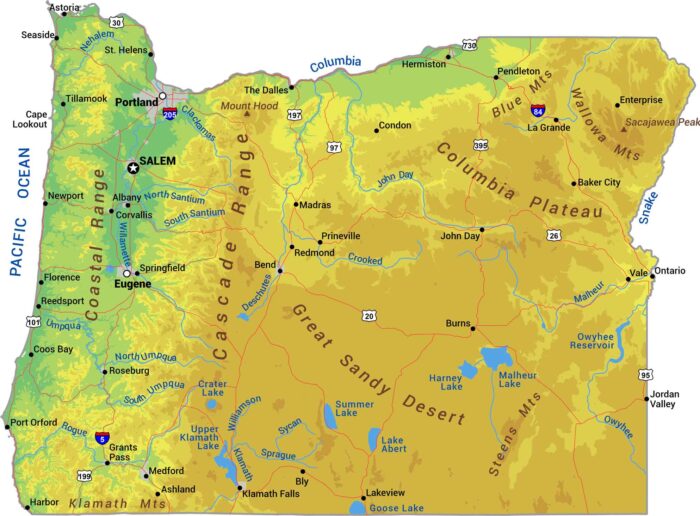
Our physical map of Oregon shows peaks like Mount Hood, the Willamette Valley, and mountain ranges. Oregon splits at the Cascades.

Our physical map of Oklahoma shows the Ozark/Ouachita Mountains, Great Plains and Panhandle all squeezed into one state.
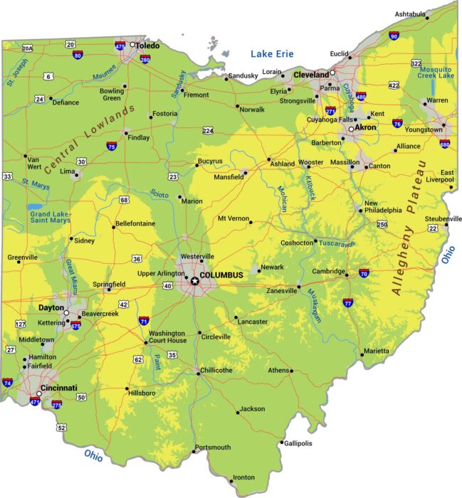
Ohio transitions from the Appalachian foothills and flattens out into farmland. The Lake Erie shoreline forms the northern border.

See flat prairie interrupted by the Badlands on our North Dakota physical map. It’s mostly Great Plains here with the Red River Valley.
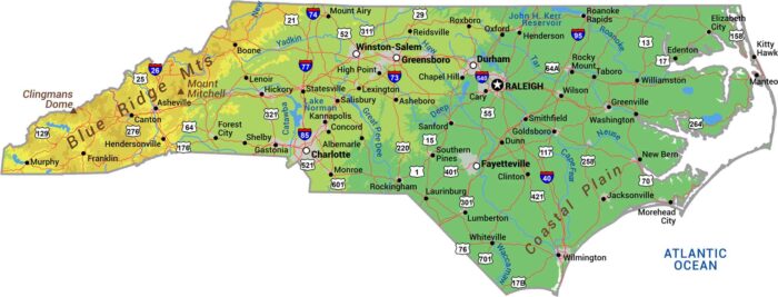
Our physical map of North Carolina shows three worlds stacked with the Blue Ridge Mountains all the way to the Atlantic coast.
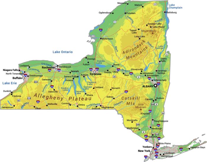
Our physical map of New York shows more than NYC. The Adirondack Mountains rise in the northeast, while the Catskills hold the southeast.

Explore high desert, mountains, and mesas with our physical map of New Mexico. The southern Rockies push through the north-central region.
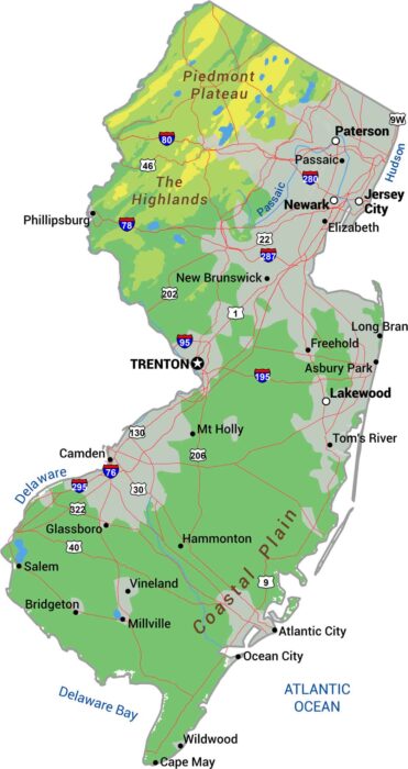
Our physical map of New Jersey shows the Appalachian ridges and valleys in the northwest. The southeast is the Atlantic Coastal Plain.
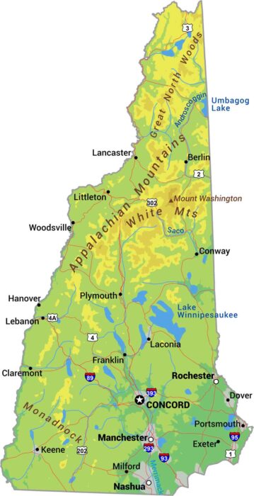
Our New Hampshire physical map shows its rugged terrain including the White Mountains and Mount Washington hitting 6,288 feet.
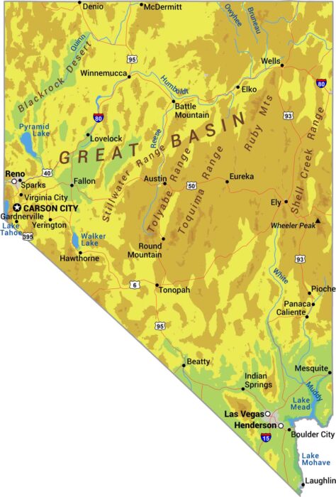
Our physical map of Nevada shows one of America’s driest, most mountainous states with elevations below sea level to over 13,000 feet.
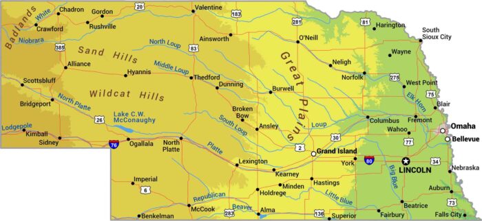
Our physical map of Nebraska shows geographic features and the gradual climb from eastern farmland to western ranching country.
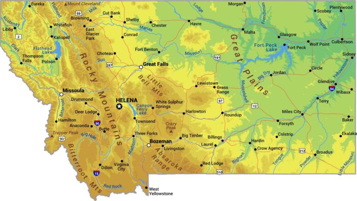
Our physical map of Montana shows a state split by the Rockies. The western third is pure mountain and the Great Plains in the east.
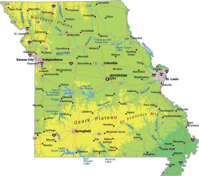
Missouri splits down the middle. There is the rugged Ozark highlands in the south. Then, everything flattens into farmland up north.
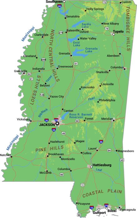
Our physical map of Mississippi displays rivers, lowlands, and coastline. Mississippi is delta and floodplain from top to bottom.