Outer Banks Map
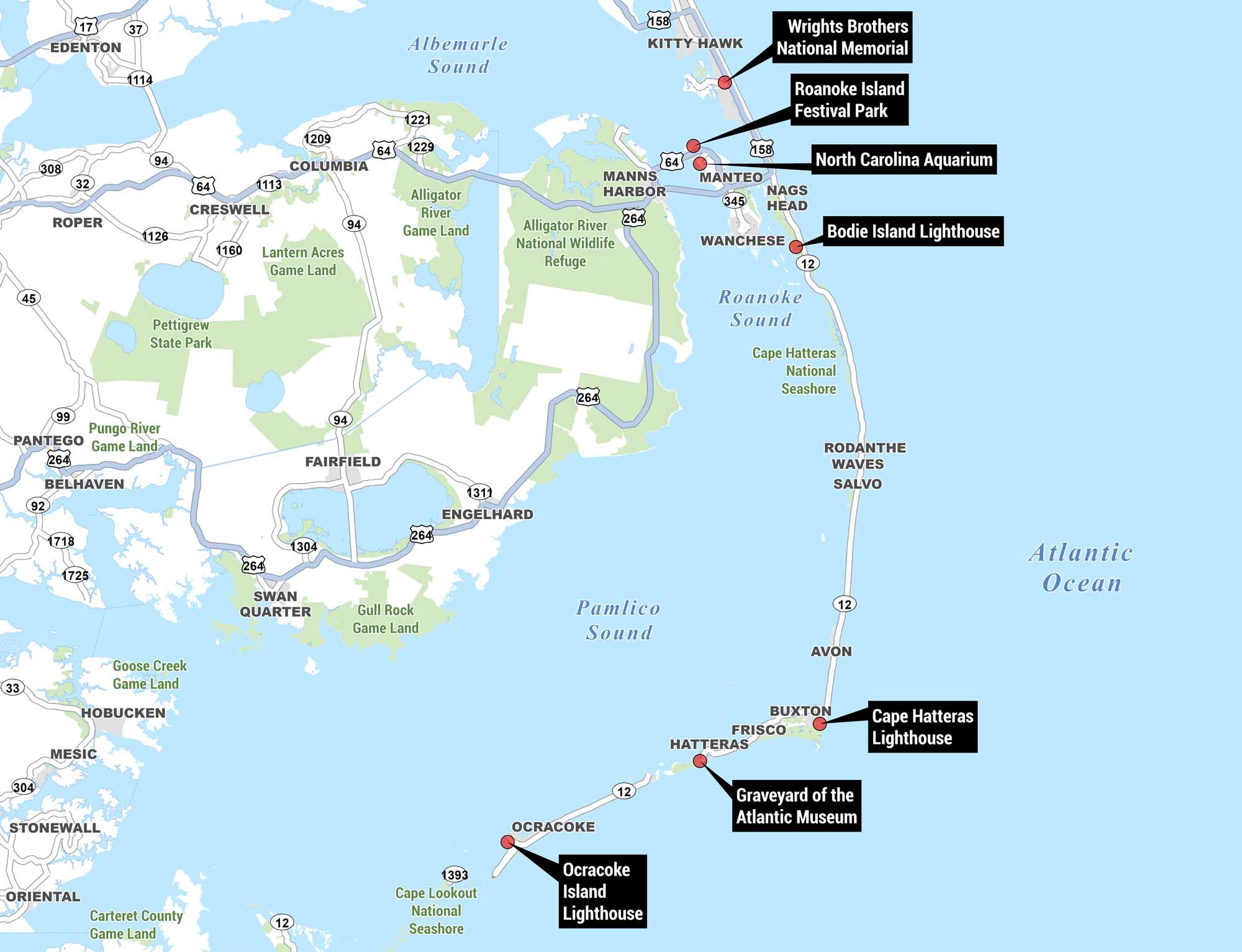
This is a reference map of the Outer Banks region of North Carolina, showing the narrow barrier island chain running along the Atlantic coast. Our map highlights key landmarks, waterways, highways, and natural areas, with labeled points of interest marked in black callout boxes.
Map Information
On the Map
Points of Interest: Wright Brothers National Memorial, Roanoke Island Festival Park, North Carolina Aquarium, Bodie Island Lighthouse, Cape Hatteras Lighthouse, Graveyard of the Atlantic Museum, Ocracoke Island Lighthouse Towns/Communities: Kitty Hawk, Manteo, Nags Head, Wanchese, Manns Harbor, Rodanthe, Waves, Salvo, Avon, Buxton, Frisco, Hatteras, Ocracoke Highways: US-64, US-158, NC-12, NC-264, NC-345, NC-94, NC-1304, NC-1311, NC-1393 Waterways: Albemarle Sound, Roanoke Sound, Pamlico Sound, Atlantic Ocean Protected and Natural Areas: Alligator River National Wildlife Refuge, Alligator River Game Land, Cape Hatteras National Seashore, Cape Lookout National Seashore, Pettigrew State Park, Lantern Acres Game Land, Pungo River Game Land, Gull Rock Game Land, Goose Creek Game Land, Carteret County Game LandReferences
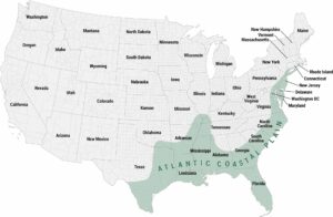
Coastal Region Maps
All coastal landscapes, maritime cultures, beaches, and islands.