Olympic Peninsula Map
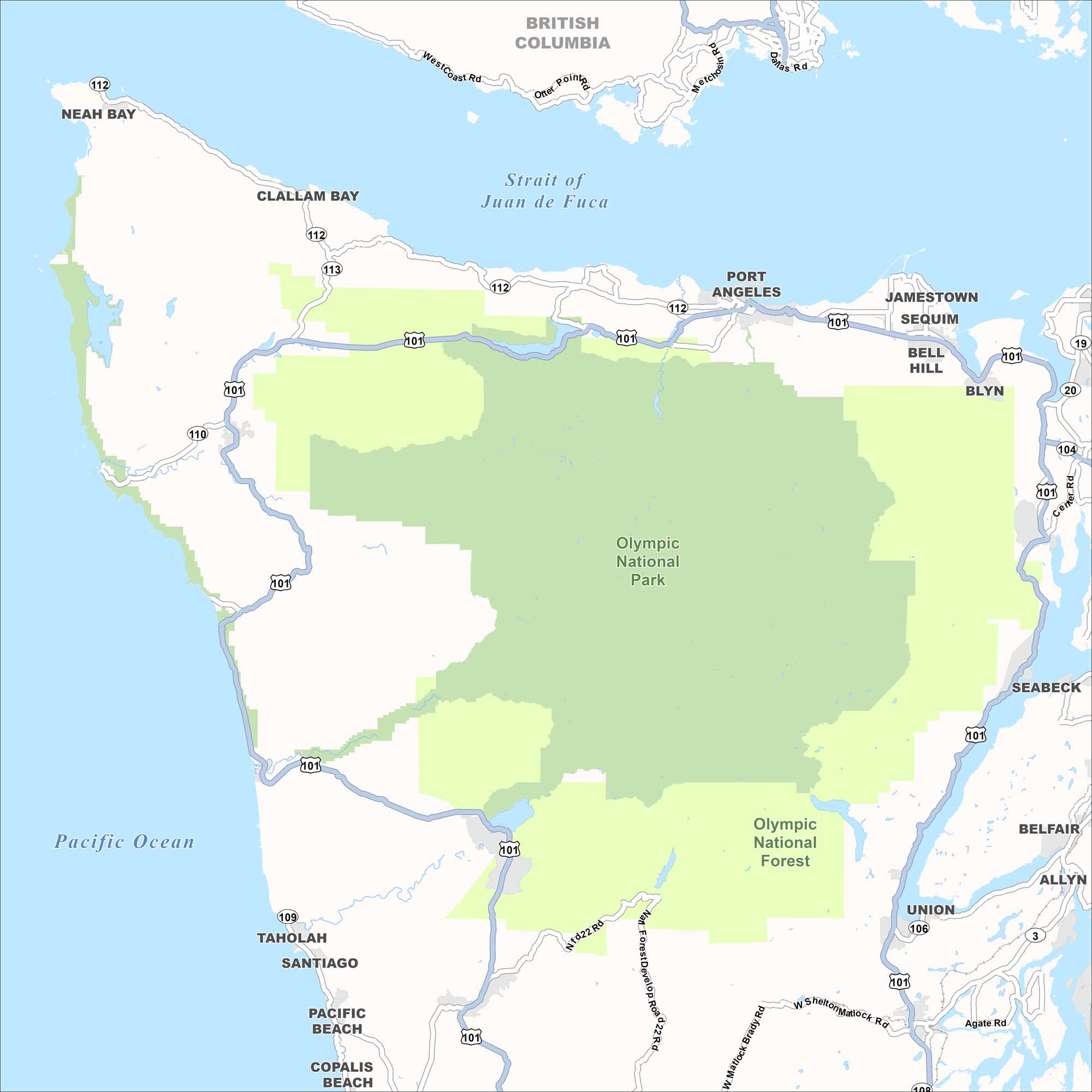
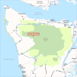
This map shows Washington State’s Olympic Peninsula. It’s dominated by two large protected land areas shaded in green. The region is bounded by the Strait of Juan de Fuca to the north, the Pacific Ocean to the west, and Puget Sound to the east. You’ll also notice that British Columbia, Canada is visible at the top.
Map Information
On the Map
Parks/Forests: Olympic National Park, Olympic National Forest Towns and Communities: Neah Bay, Clallam Bay, Port Angeles, Jamestown, Sequim, Bell Hill, Blyn, Seabeck, Belfair, Allyn, Union, Taholah, Santiago, Pacific Beach, Copalis Beach Waterways: Strait of Juan de Fuca, Pacific Ocean Highways/Roads: US-101, WA-112, WA-113, WA-110, WA-109, WA-106, WA-104, WA-19, WA-20, WA-3, West Coast Rd, Otter Point Rd, Matchno Rd, Dallas Rd, Center Rd, N Fd22 Rd, NW Forest Development Rd, W Matlock Brady Rd, W Shelton Matlock Rd, Agate Rd Bordering Region: British Columbia (Canada)Natural Region Maps
Geographic landforms, wilderness zones, deserts, mountain ranges, and terrain.