Leelanau Peninsula Map
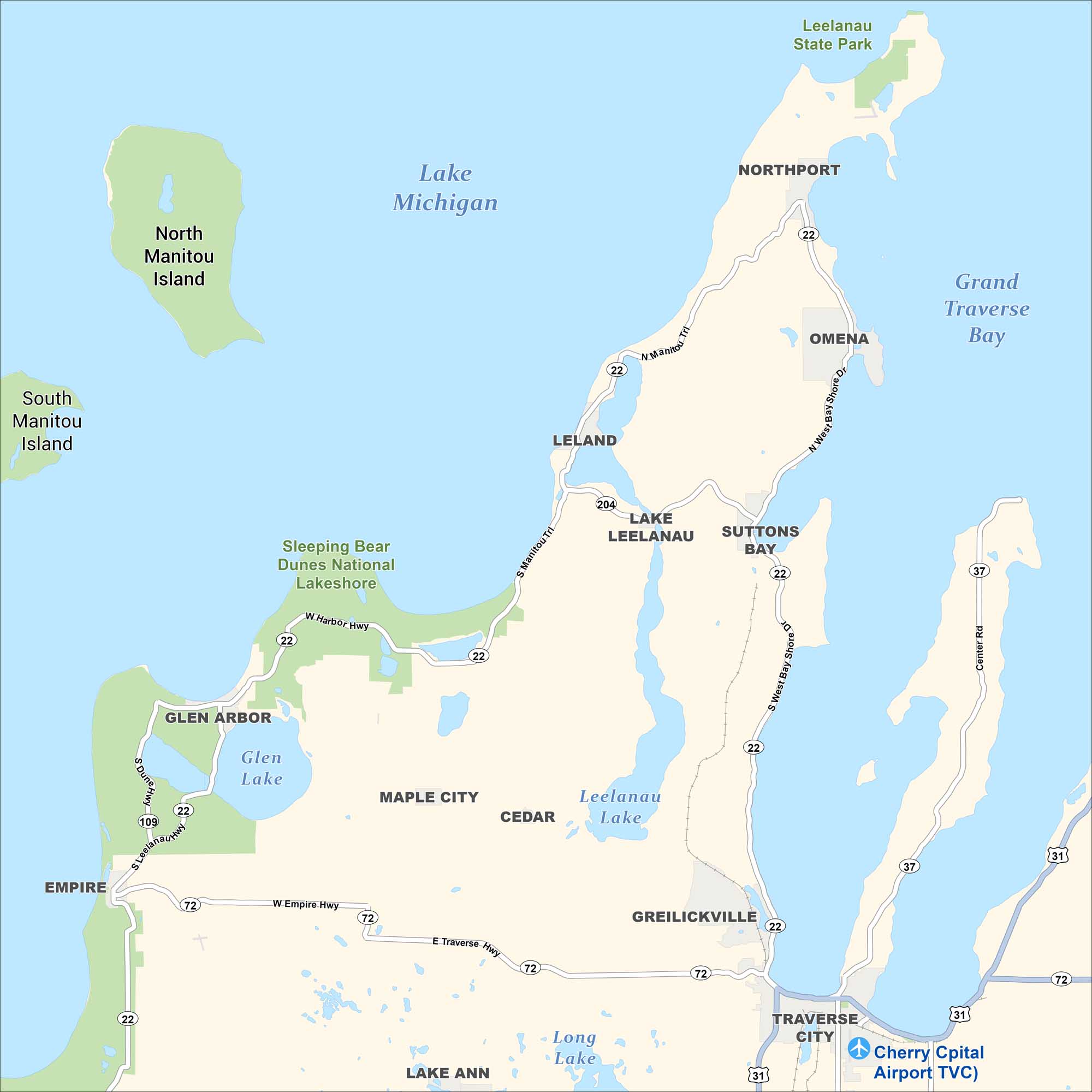
This is a detailed map of the Leelanau Peninsula in northwestern Michigan, showing towns, lakes, parks, islands, and roads. Green shading indicates protected natural areas, with Lake Michigan to the west and Grand Traverse Bay to the east.
Map Information
On the Map
Towns/Communities: Northport, Omena, Leland, Suttons Bay, Glen Arbor, Maple City, Cedar, Empire, Greilickville, Traverse City Parks & Protected Areas: Leelanau State Park, Sleeping Bear Dunes National Lakeshore Airports: Cherry Capital Airport (TVC) Islands: North Manitou Island, South Manitou Island Major Lakes: Lake Michigan, Grand Traverse Bay, Lake Leelanau, Glen Lake, Leelanau Lake, Long Lake, Lake Ann Highways and Roads: MI-22, MI-72, MI-204, MI-109, MI-31, MI-37, N Manitou Trl, S Manitou Trl, N West Bay Shore Dr, S West Bay Shore Rd, W Harbor Hwy, S Dunes Hwy, S Leelanau Hwy, W Empire Hwy, E Traverse Hwy, Center RdReferences
Coastal Region Maps
All coastal landscapes, maritime cultures, beaches, and islands.