Illinois National Parks and Forests Map
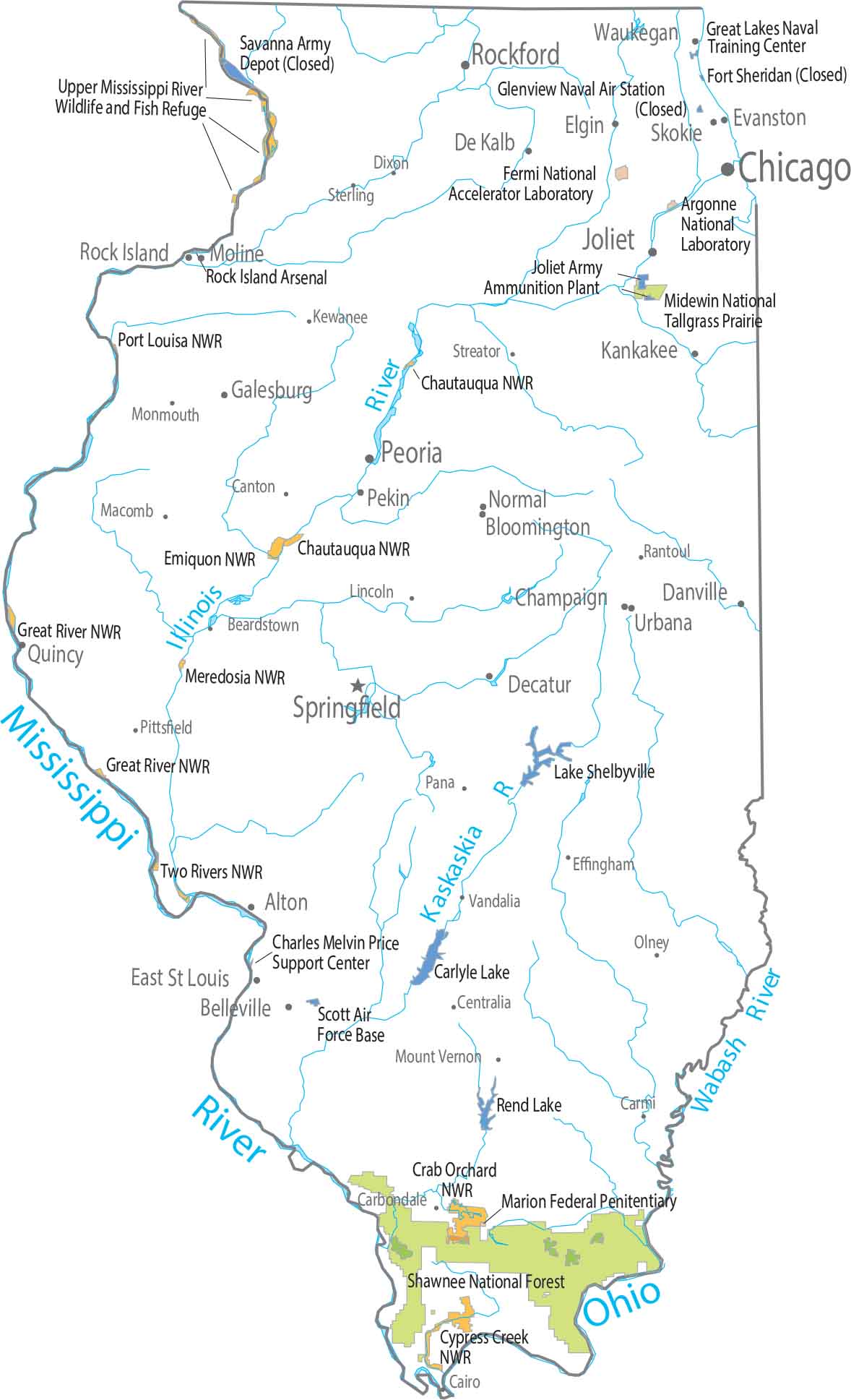
Our map shows limited national forests and parks in Illinois. Most protected land sticks close to rivers. Forests appear narrow and broken up. It’s mostly agriculture that fills everything else.
Map Information
On the Map
Parks, Forests and Federal Lands
National Forests (NF): Shawnee National Forest National Wildlife Refuges (NWR): Chautauqua NWR, Chautauqua NWR, Crab Orchard NWR, Cypress Creek NWR, Emiquon NWR, Great River NWR, Great River NWR, Meredosia NWR, Port Louisa NWR, Two Rivers NWR Other Landmarks: Argonne National Laboratory, Fermi National Accelerator Laboratory, Midewin National Tallgrass Prairie, Upper Mississippi River Wildlife and Fish RefugePopulated Places and Land Information
State Capital: Springfield Major Cities: Aurora, Chicago, Joliet, Rockford, Naperville Cities and Towns: Alton, Beardstown, Belleville, Bloomington, Cairo, Canton, Carbondale, Carmi, Centralia, Champaign, Charleston, Danville, Decatur, DeKalb, Dixon, East St Louis, Effingham, Elgin, Evanston, Galesburg, Joliet, Kankakee, Kewanee, Lincoln, Macomb, Moline, Monmouth, Mount Vernon, Normal, Olney, Pana, Pekin, Peoria, Pittsfield, Quincy, Rantoul, Rock Island, Skokie, Sterling, Streator, Urbana, Vandalia, Waukegan Lakes and Reservoirs: Carlyle Lake, Lake Shelbyville, Rend Lake Rivers and Streams: Illinois River, Kaskaskia River, Mississippi River, Ohio River, Wabash River Army and Military: Charles Melvin Price Support Center, Great Lakes Naval Training Center, Joliet Army Ammunition Plant, Rock Island Arsenal, Scott Air Force BaseIllinois State Maps
Get to know Illinois with our state maps


