Map of Huber Heights, Ohio
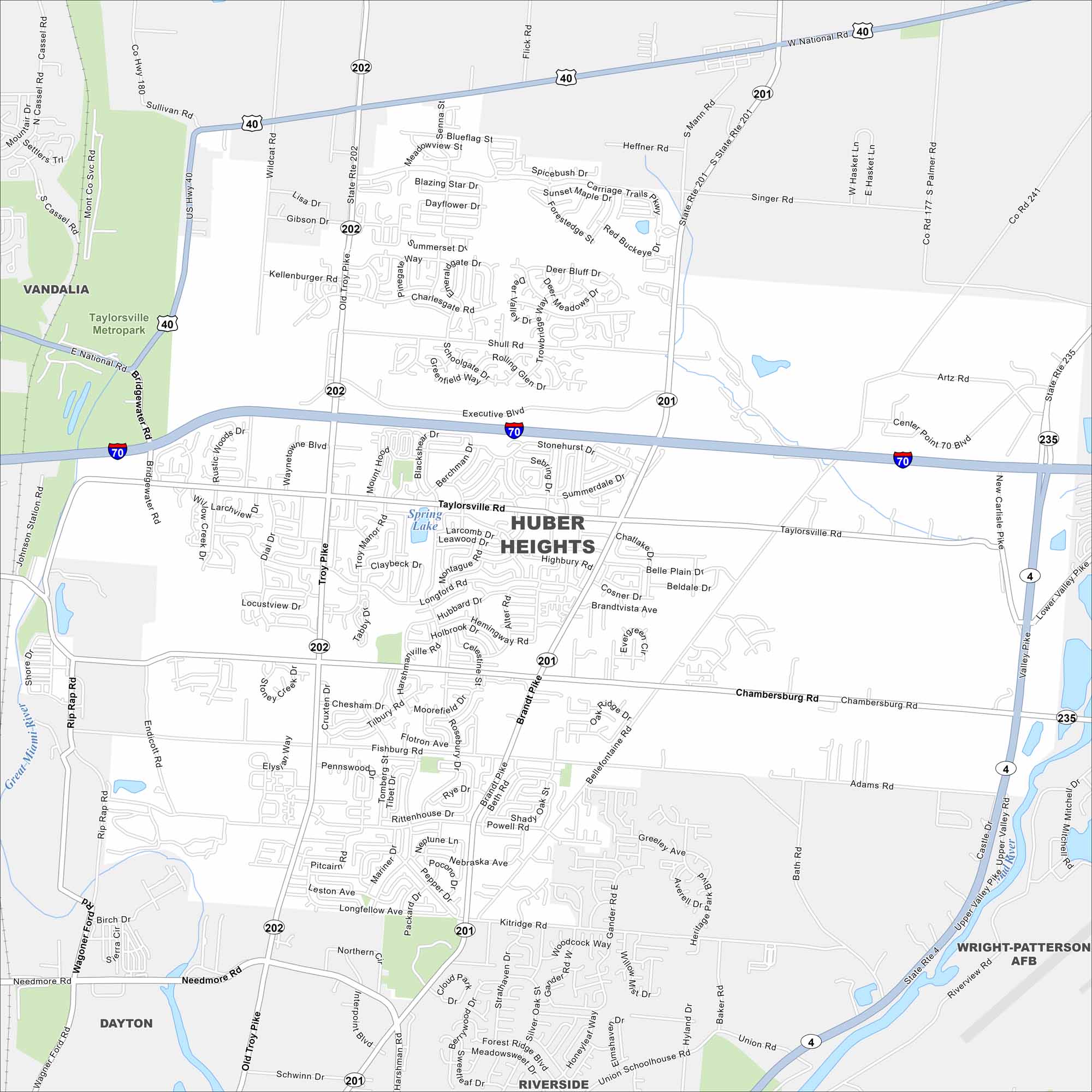
Check out our map of Huber Heights northeast of Dayton. The city spreads along I-70 with neighborhoods branching off. Parks and the Great Miami River lie close by.
Map Information
On the Map
Interstates/Highways: I-70, I-75, State Rte 202, State Rte 201, State Rte 4 Major Roads: Old Troy Pike, Brandt Pike, Chambersburg Rd, Fishburg Rd, Taylorsville Rd, Shull Rd, Executive Blvd, Center Point 70 Blvd, Bellefontaine Rd, Powell Rd, Rip Rap Rd, Wildcat Rd, Endicott Rd, Longford Rd, Harshmanville Rd, Kitridge Rd, Merilyne Ct, Longview Dr, Charlesgate Rd, Robinette Dr Major Rivers: Great Miami River Parks and Preserves: Taylorsville Metropark Nearby Communities: Dayton, Vandalia, Northridge, Park LayneOhio State Maps
Check out our maps covering farmland or any of Ohio’s major cities.


City Maps of Ohio
Here are maps of Columbus and Ohio’s major cities


