Map of Grove City, Ohio
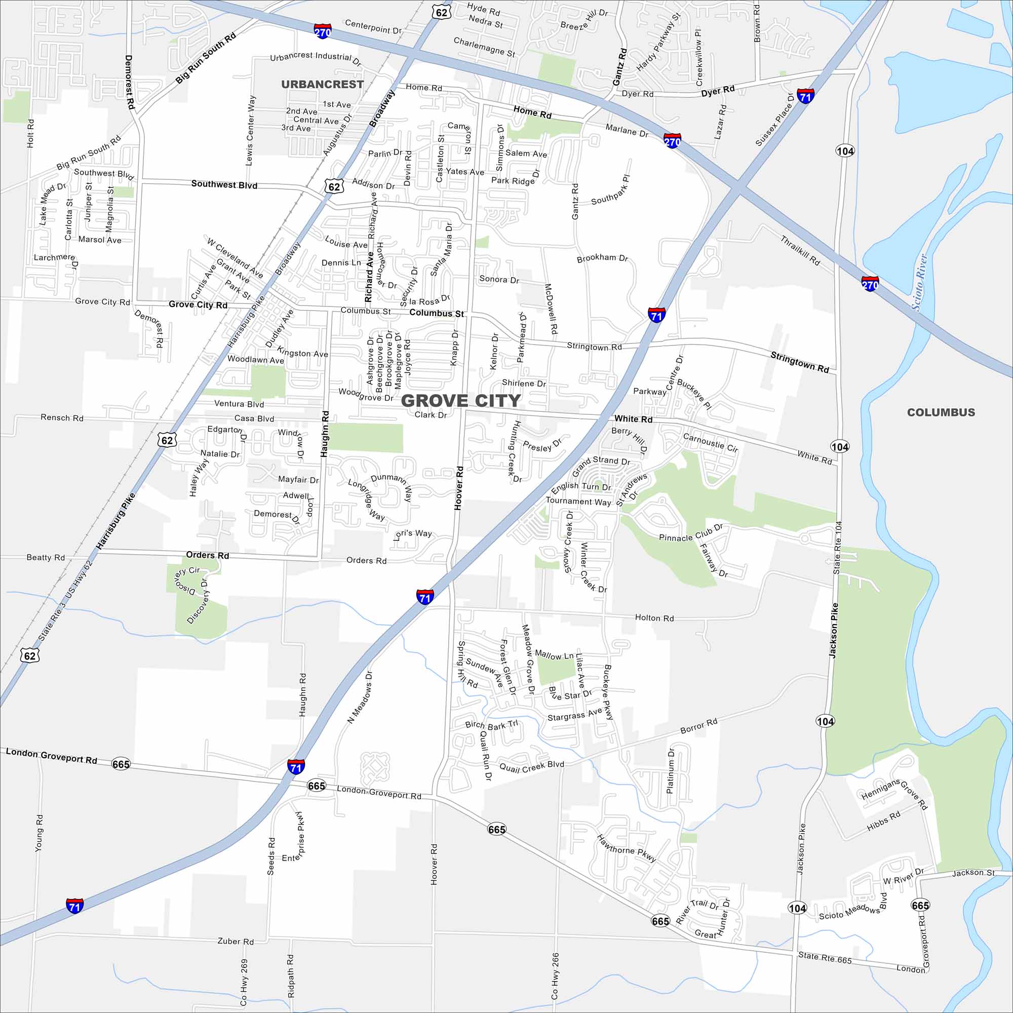
Grove City is in central Ohio, just south of Columbus. Interstates 71 and 270 connect it into the region. Our map shows highways, rivers, parks and open land.
Map Information
On the Map
Interstates/Highways: I-71, I-270, US Hwy 62, State Rte 665, State Rte 104 Major Roads: Broadway, Harrisburg Pike, Stringtown Rd, Grove City Rd, Orders Rd, London Groveport Rd, Jackson Pike, White Rd, Buckeye Pkwy, Gantz Rd, Hoover Rd, Haughn Rd, Demorest Rd, Southwest Blvd, Kingston Ave, Woodlawn Ave, Park Park Rd, Home Rd, Dyer Rd, Big Run South Rd Major Rivers: Scioto River Nearby Communities: Urbancrest, ColumbusOhio State Maps
Check out our maps covering farmland or any of Ohio’s major cities.


City Maps of Ohio
Here are maps of Columbus and Ohio’s major cities


