Florida Precipitation Map
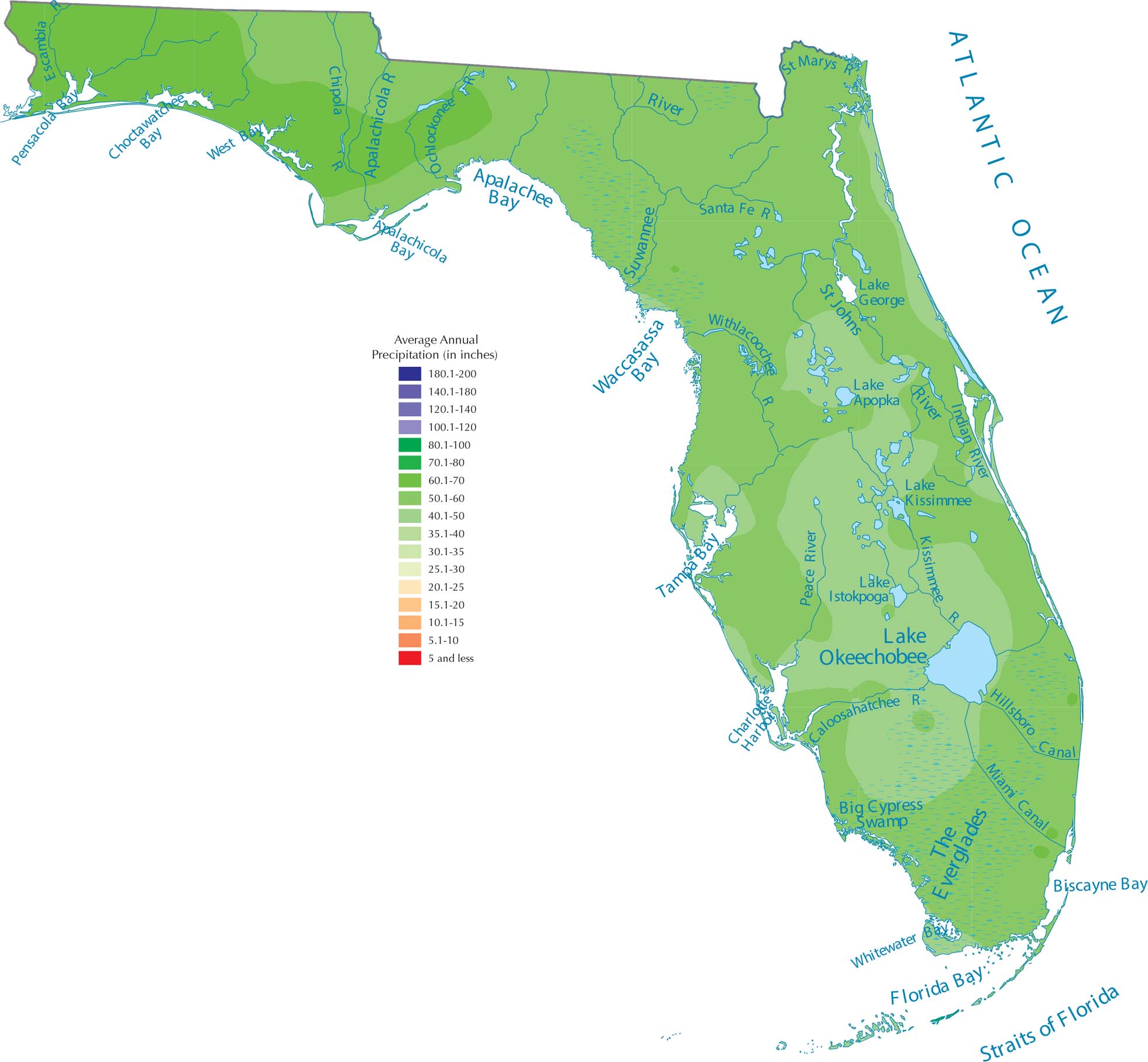
Florida’s shape basically guarantees tons of rain. With the Atlantic on one side and the Gulf Coast on the other, ocean moisture surrounds the state. This creates those intense summer thunderstorms that fuels the rainfall on our precipitation map of Florida.
Map Information
State Precipitation Maps
Select any state map below to view its precipitation map.


Florida State Maps
Discover Florida through our state maps


