Home » State Maps » Florida National Parks and Forests Map

Florida National Parks and Forests Map

Florida National Parks and Forests Map

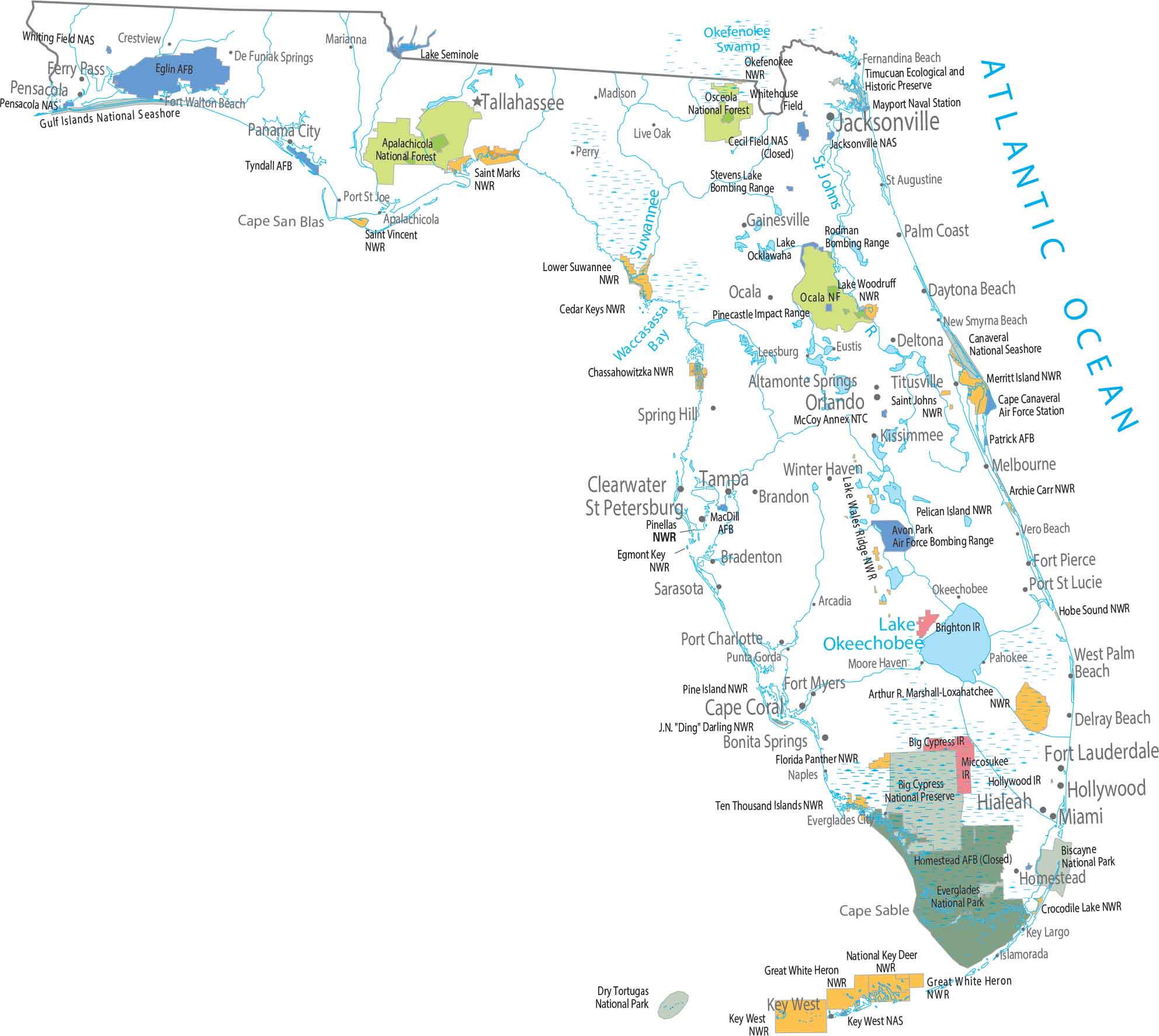
The coastal areas in Florida define where protected lands exists. Our map shows Everglades National Park covering the southern tip. Huge preserved areas sit inland across flat, wet terrain.

Map Information

  • National Parks and Forests Map of Florida
  • Original map provided by National Map. Map updated by our team.
  • Free for personal and commercial purpose. Attribution is required. How to attribute?

Leave a Reply

Your email address will not be published. Required fields are marked *