Home » State Maps » Florida Lakes and Rivers Map

Florida Lakes and Rivers Map

Florida Lakes and Rivers Map

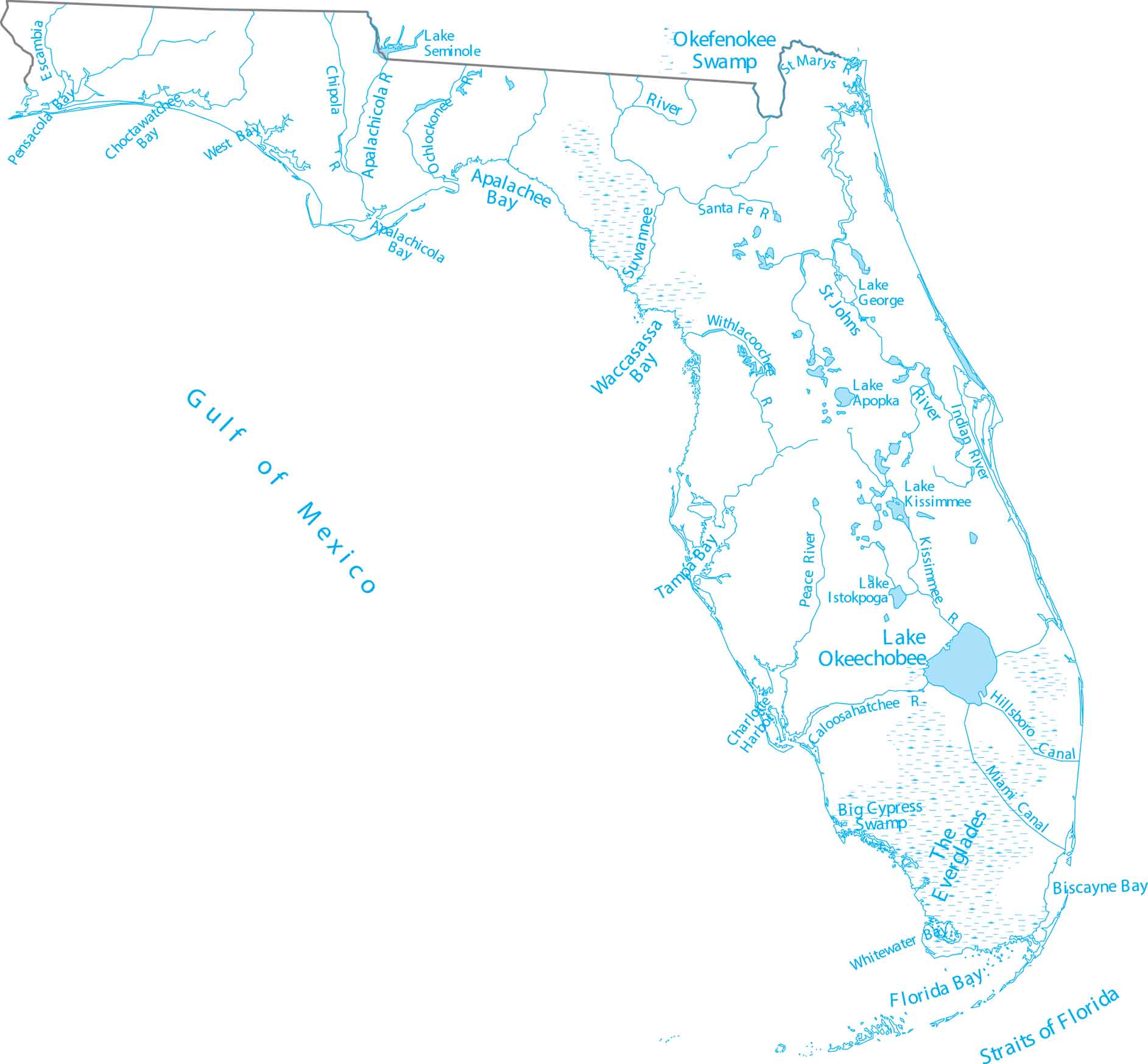
Step into Florida’s low-lying lakes and slow-moving rivers. Our map of Florida shows Lake Okeechobee and rivers draining to both coasts. Florida includes the extensive Everglades system and a ton of swamp regions.

Map Information

  • Lakes and Rivers Map of Florida
  • Original map provided by National Map. Map updated by our team.
  • Free for personal and commercial purpose. Attribution is required. How to attribute?

On the Map

Florida Location Map
Lakes and Reservoirs: Lake Apopka, Lake George, Lake Istokpoga, Lake Kissimmee, Lake Okeechobee, Lake Seminole Major Rivers: Apalachicola River, Caloosahatchee River, Chipola River, Escambia River, Indian River, Kissimmee River, Ochlockonee River, Peace River, Santa Fe River, St Johns River, St Marys River, Suwannee River, Withlacoochee River Bays: Apalachee Bay, Apalachicola Bay, Biscayne Bay, Choctawatchee Bay, Florida Bay, Pensacola Bay, Tampa Bay, Waccasassa Bay, West Bay, Whitewater Bay Swamps, Canals and Harbors: Big Cypress Swamp, Canals Miami Canal, Charlotte Harbor, Hillsboro Canal, Okefenokee Swamp, Straits of Florida, The Everglades

Leave a Reply

Your email address will not be published. Required fields are marked *