Map of Fairfield, Ohio
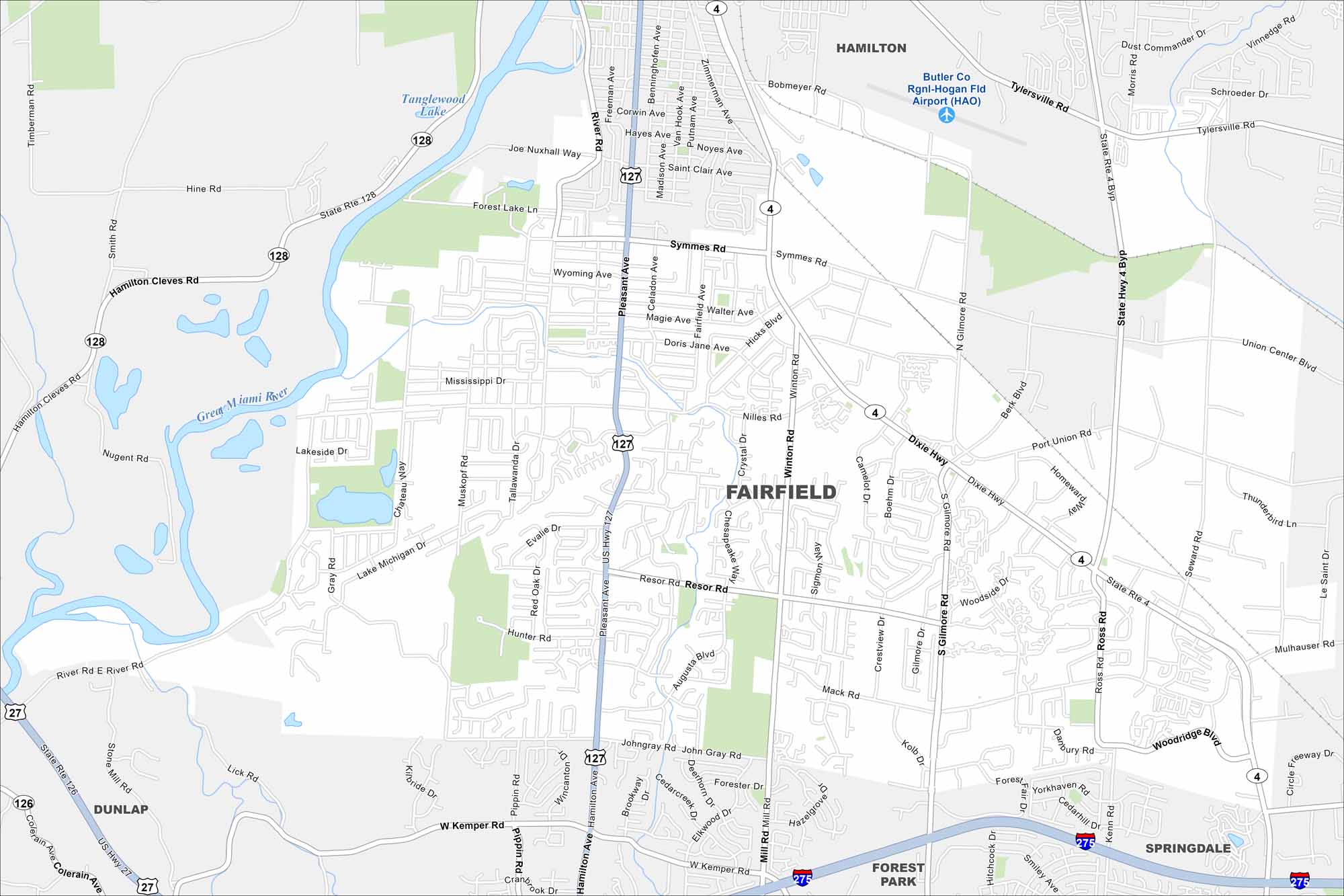
Fairfield is north of Cincinnati in southwest Ohio. The Great Miami River runs along its edge. That river corridor gives the city its natural boundary on the west side.
Map Information
On the Map
Interstates/Highways: I-275, US Hwy 127, US Hwy 27, State Rte 4, State Rte 128, State Rte 126 Major Roads: Dixie Hwy, Pleasant Ave, Nilles Rd, Winton Rd, Gilmore Rd, Symmes Rd, Mack Rd, Ross Rd, Seward Rd, Tylersville Rd, Port Union Rd, Hamilton Cleves Rd, River Rd, Hicks Blvd, Resor Rd, John Gray Rd, Mill Rd, Woodridge Blvd, Union Center Blvd, Mulhauser Rd Airports: Butler Co Rgnl-Hogan Fld Airport (HAO) Lakes and Reservoirs: Tanglewood Lake Major Rivers: Great Miami River Nearby Communities: Hamilton, Dunlap, Forest Park, SpringdaleOhio State Maps
Check out our maps covering farmland or any of Ohio’s major cities.


City Maps of Ohio
Here are maps of Columbus and Ohio’s major cities


