Map of Delaware, Ohio
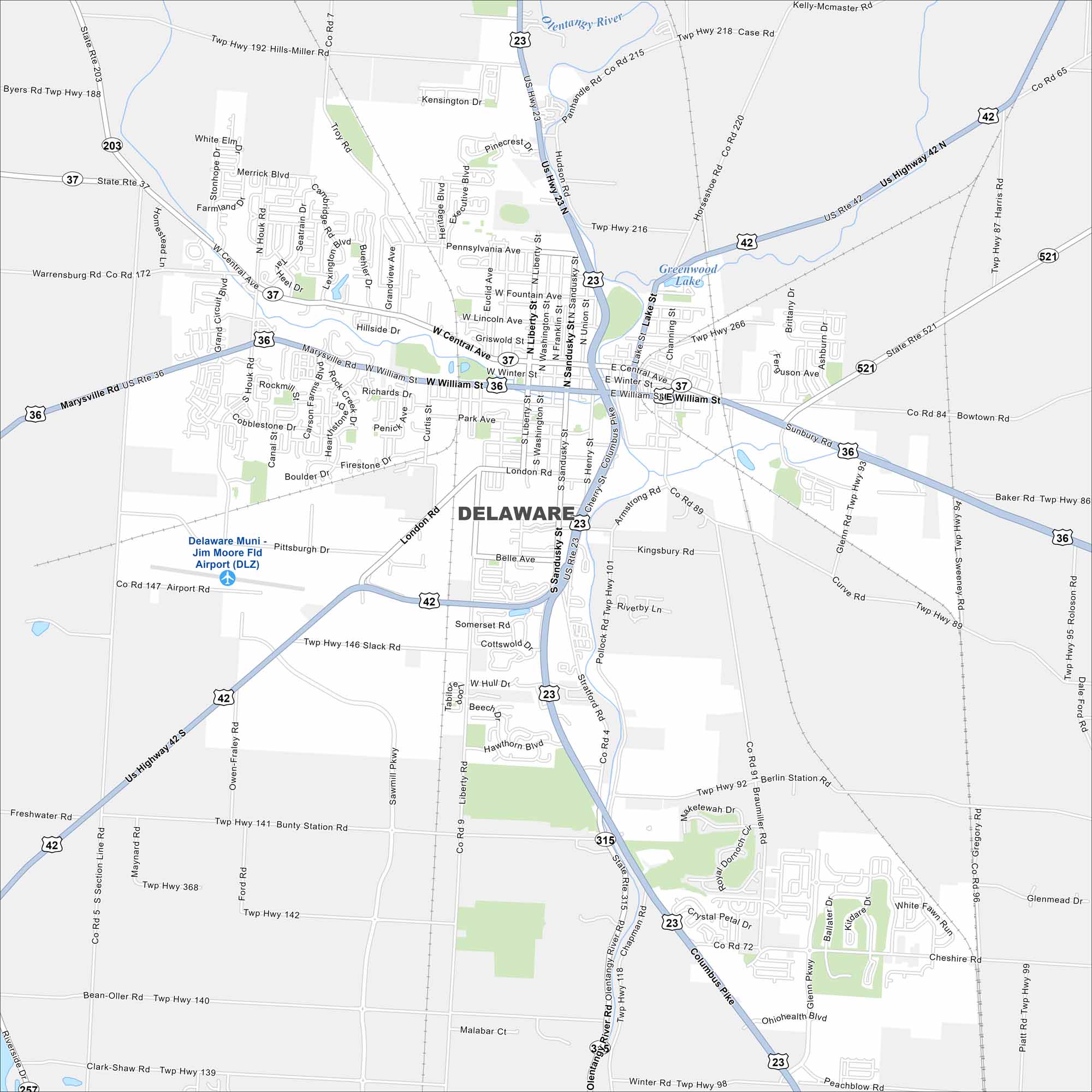
Our map of Delaware shows the Olentangy River as the main waterway. Streets travel out from a historic downtown square. It’s a growing city just north of Columbus.
Map Information
On the Map
Interstates/Highways: US Hwy 23, US Hwy 42, State Rte 37, State Rte 203, State Rte 521, State Rte 315 Major Roads: Sandusky St, William St, Central Ave, London Rd, Liberty St, Pennsylvania Ave, Houk Rd, Pollock Rd, Stratford Rd, Bowtown Rd, Sunbury Rd, Sawmill Pkwy, Glenn Pkwy, Section Line Rd, Bunty Station Rd, Hills-Miller Rd, Panhandle Rd, Columbus Pike, Winter Rd, Cheshire Rd Airports: Delaware Muni – Jim Moore Fld Airport (DLZ) Lakes and Reservoirs: Greenwood Lake Major Rivers: Olentangy RiverOhio State Maps
Check out our maps covering farmland or any of Ohio’s major cities.


City Maps of Ohio
Here are maps of Columbus and Ohio’s major cities


