Map of Cleveland, Ohio
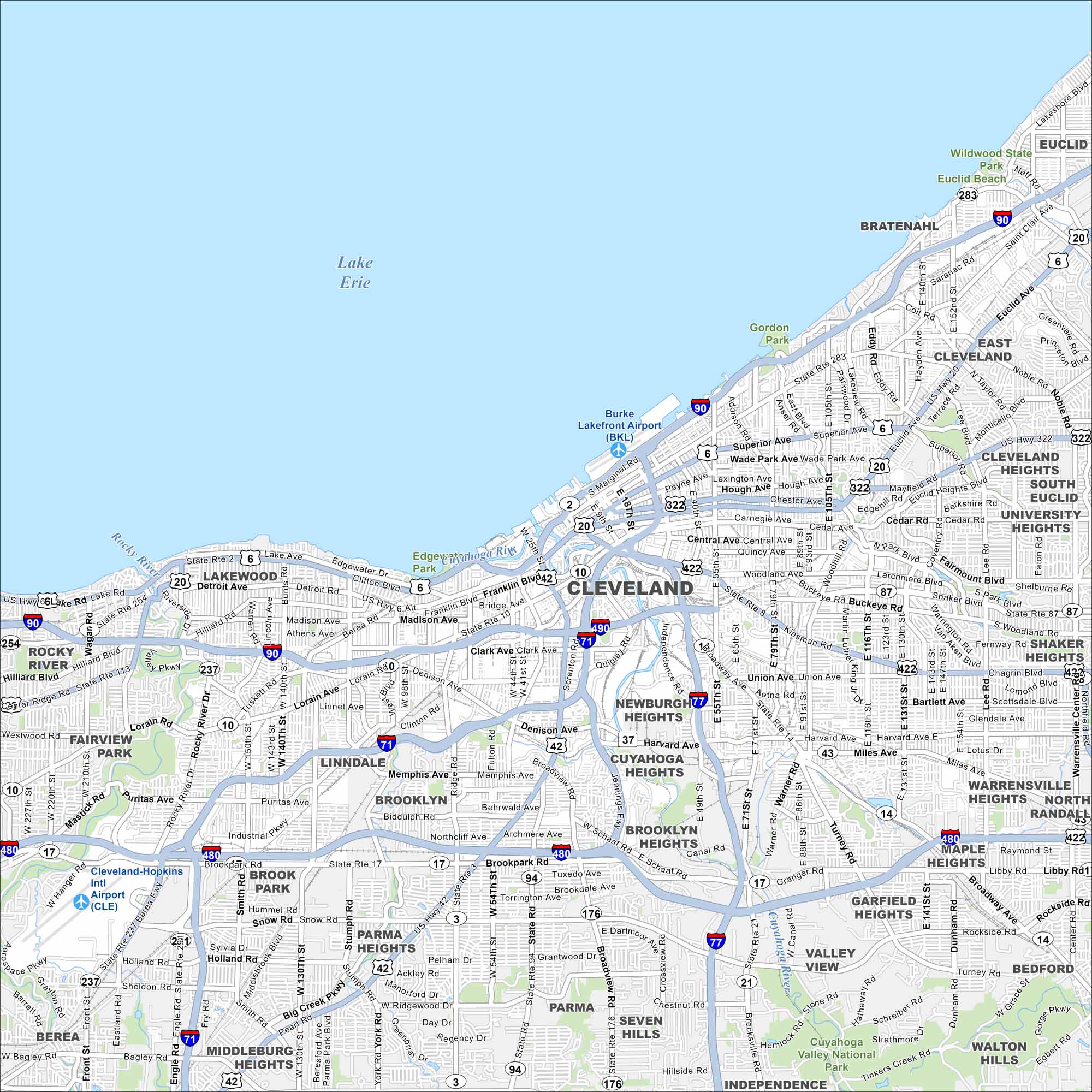
Our map of Cleveland follows the Cuyahoga River as it snakes into Lake Erie. Downtown streets cluster around the riverfront. On the south shore of Lake Erie, the city has a true waterfront setting.
Map Information
On the Map
Interstates/Highways: I-90, I-71, I-77, I-480, I-490, US Hwy 20, US Hwy 422, US Hwy 6, State Rte 2, State Rte 283, State Rte 176, State Rte 17, State Rte 8, State Rte 14, State Rte 87, State Rte 43 Major Roads: Euclid Ave, Carnegie Ave, Chester Ave, Woodland Ave, Lorain Ave, Detroit Ave, Broadway Ave, Harvard Ave, Miles Ave, Denison Ave, Memphis Ave, Pearl Rd, Ridge Rd, State Rd, Jennings Rd, Fulton Rd, West 25th St, East 55th St, East 105th St, Superior Ave Airports: Cleveland-Hopkins Intl Airport (CLE), Burke Lakefront Airport (BKL) Lakes and Reservoirs: Lake Erie Major Rivers: Cuyahoga River, Rocky River Parks and Preserves: Wildwood State Park, Euclid Beach, Gordon Park, Brookside Park, Valley National Park, Cuyahoga Valley National Park Nearby Communities: Lakewood, Rocky River, Fairview Park, Parma, Brooklyn, Garfield Heights, Maple Heights, Bedford, Shaker Heights, Cleveland Heights, East Cleveland, Euclid, Bratenahl, Linndale, Brook Park, Middleburg Heights, Seven Hills, Independence Neighborhoods: Downtown ClevelandOhio State Maps
Check out our maps covering farmland or any of Ohio’s major cities.


City Maps of Ohio
Here are maps of Columbus and Ohio’s major cities


