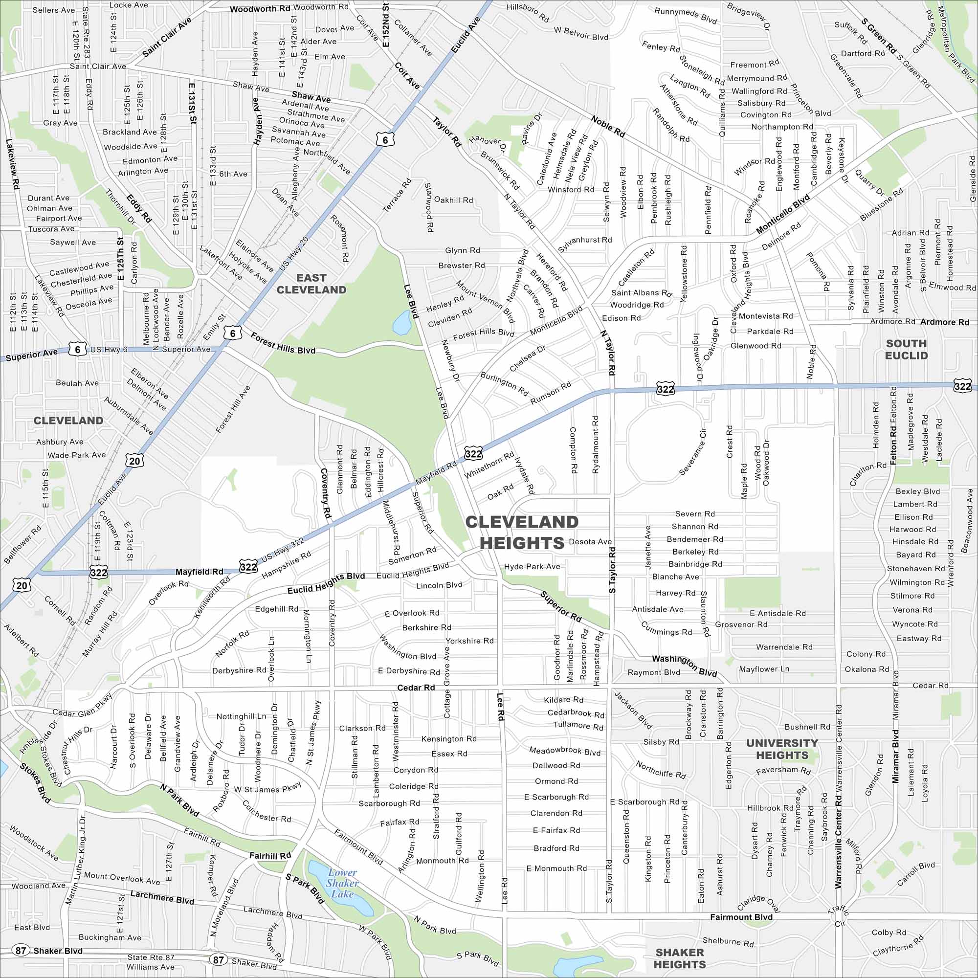
Map of Cleveland Heights, Ohio
Cleveland Heights spreads east of downtown. The community is known for tree-lined neighborhoods. Its elevation changes give the city its name.
Map Information
On the Map
Interstates/Highways: US Hwy 322, US Hwy 20, State Rte 87 Major Roads: Mayfield Rd, Cedar Rd, Coventry Rd, Lee Rd, Superior Rd, Taylor Rd, Noble Rd, Monticello Blvd, Euclid Heights Blvd, Fairmount Blvd, Washington Blvd, Silsby Rd, Warrensville Center Rd, South Taylor Rd, Belvoir Blvd, North Park Blvd, Edgehill Rd, Derbyshire Rd, Roxboro Rd, Harcourt Dr Lakes and Reservoirs: Lower Shaker Lake Nearby Communities: East Cleveland, South Euclid, University Heights, Shaker Heights, ClevelandOhio State Maps
Check out our maps covering farmland or any of Ohio’s major cities.


City Maps of Ohio
Here are maps of Columbus and Ohio’s major cities


