Permian Basin Map
Our map of the Permian Basin is shown as a blue-shaded region spanning western Texas and southeastern New Mexico with cities and towns.

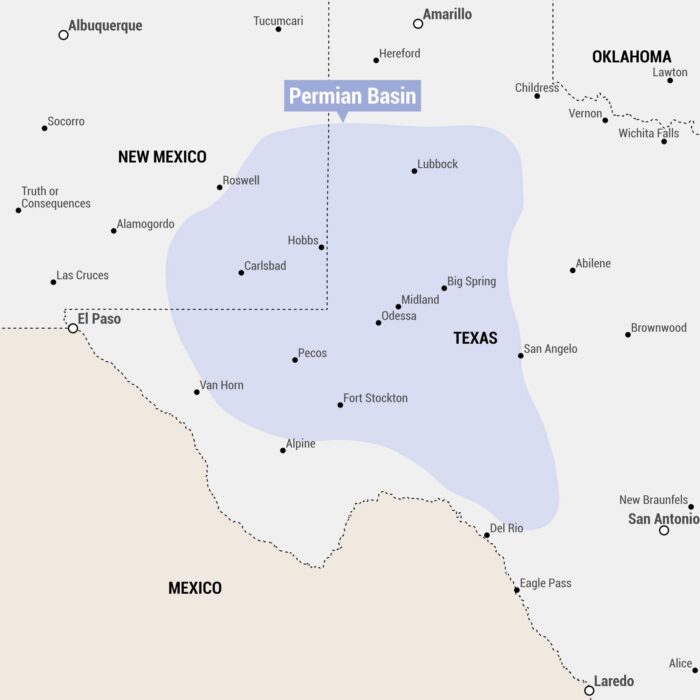
Our map of the Permian Basin is shown as a blue-shaded region spanning western Texas and southeastern New Mexico with cities and towns.
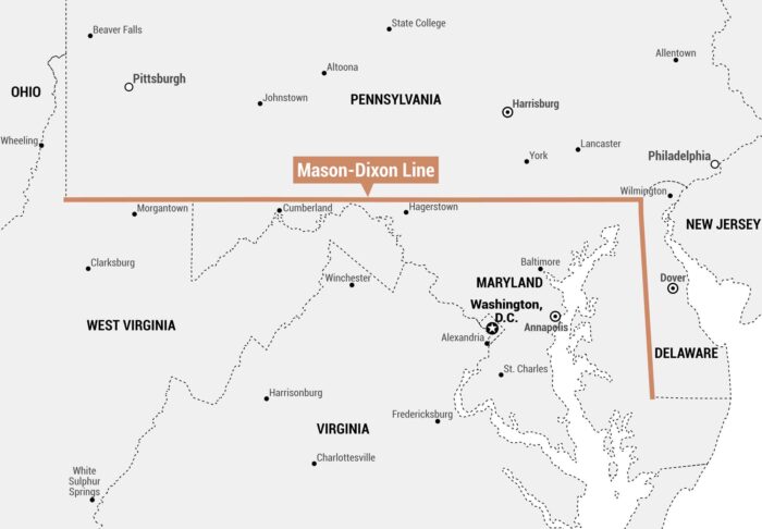
As shown on our Mason–Dixon Line map, it runs east-west along Pennsylvania’s southern border with Maryland and Delaware.
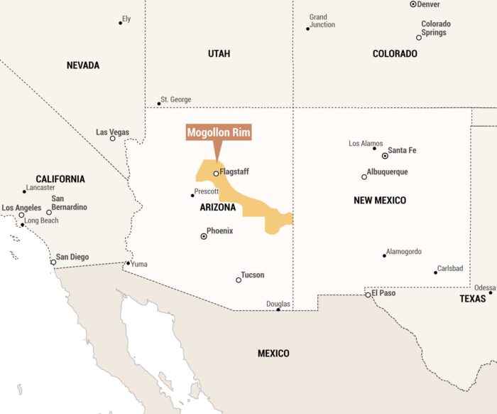
Our map highlights the Mogollon Rim in orange, an escarpment running through central Arizona. We included states and nearby cities.
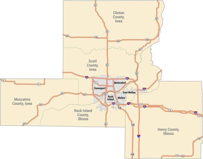
The Quad Cities sit along the Mississippi River along the Iowa-Illinois border. Our map shows Davenport, Bettendorf, Rock Island and Moline.
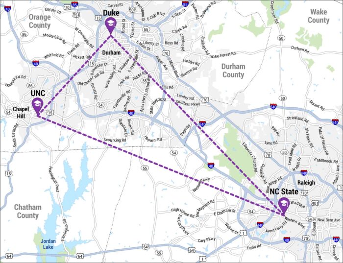
The Research Triangle is a region in North Carolina formed by Raleigh, Durham, and Chapel Hill. Our map shows the three cities in a triangle.
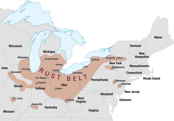
The Rust Belt was once an industrial heartland of the United States. Our map highlights the states and major cities that make up this region.
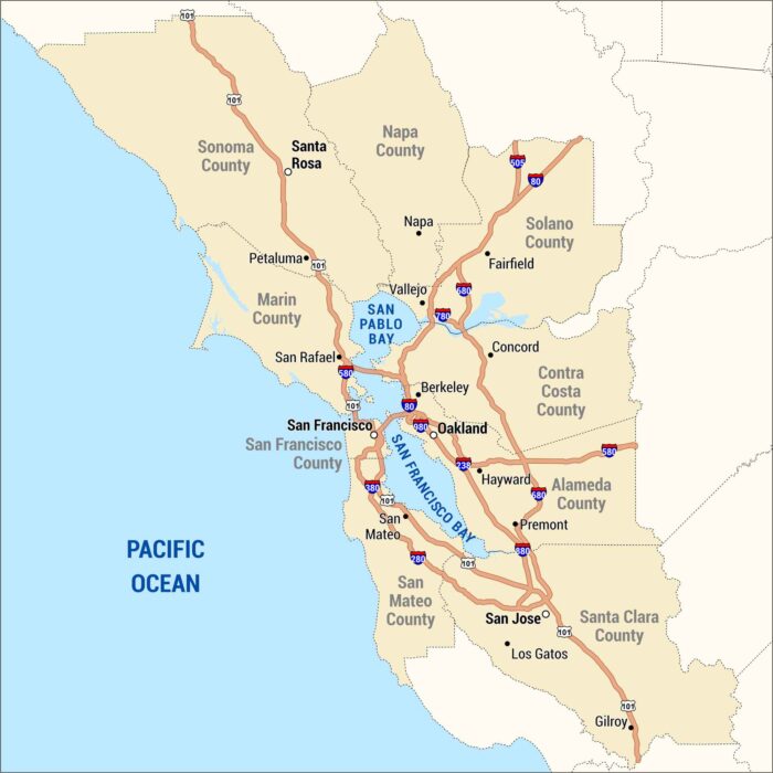
The Bay Area wraps around the water, from San Francisco to San Jose and across to Oakland. Our map shows the cities, bridges, and highways.
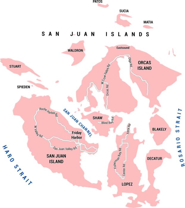
This map shows San Juan Island in Washington State with its roads, channels, and places. It’s a small place with big views of the ocean.
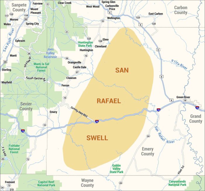
Our map of the San Rafael Swell highlights highways, rivers, and communities. Check out this geologic feature in central Utah.
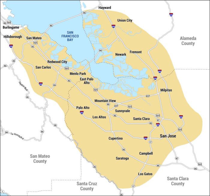
This map shows Silicon Valley along the southern end of San Francisco Bay. It includes San Jose, Mountain View, and other cities.
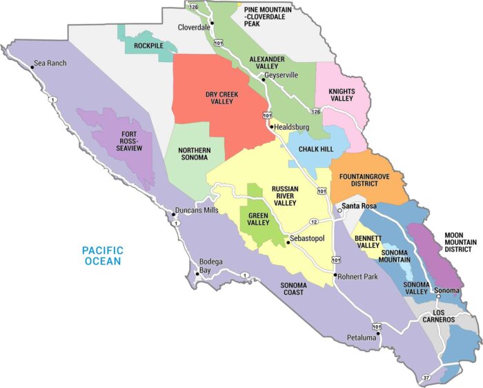
This map of Sonoma County highlights the region’s major cities, towns, and vineyard appellations in one of the country’s top wine regions.
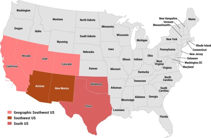
Our map of the US Southwest highlights how the region is often defined. Arizona and New Mexico form the core of the modern Southwest.
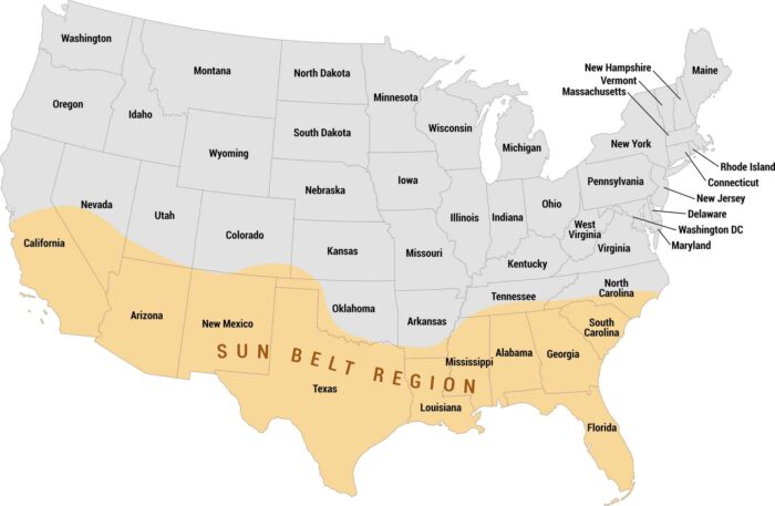
See how the Sun Belt stretches across the southern United States on our map. We show the Sun Belt highlighted in orange, coast-to-coast.
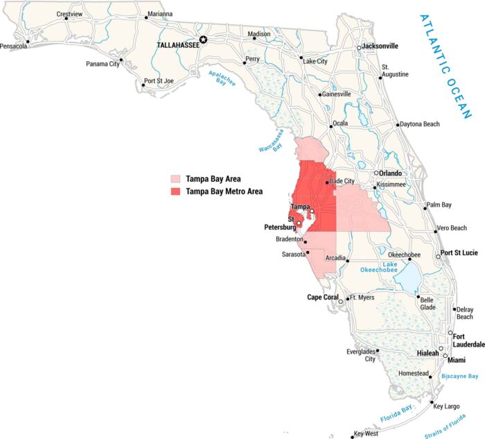
Our map shows all of Florida, with the Tampa Bay metro area marked in red and the broader Tampa Bay region in pink.
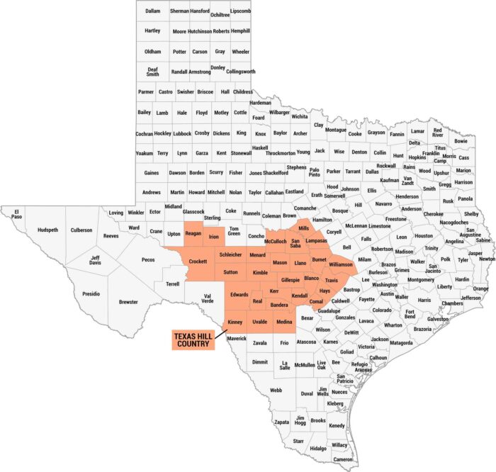
Texas Hill Country is all rolling hills. It feels rugged, calm, and unmistakably Texas. Get to know this region a bit better with our map.