Texas Panhandle Map
The Texas Panhandle is open land and flat as far as you can see. Our map lays out this region of Texas with major cities and small towns.

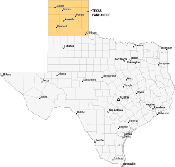
The Texas Panhandle is open land and flat as far as you can see. Our map lays out this region of Texas with major cities and small towns.
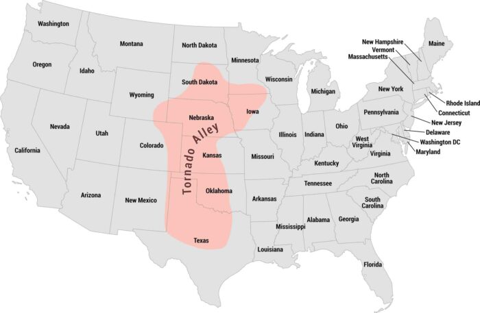
Tornado Alley cuts straight through the heart of the country. Our map shows this region from Texas up through Kansas, Oklahoma, and beyond.
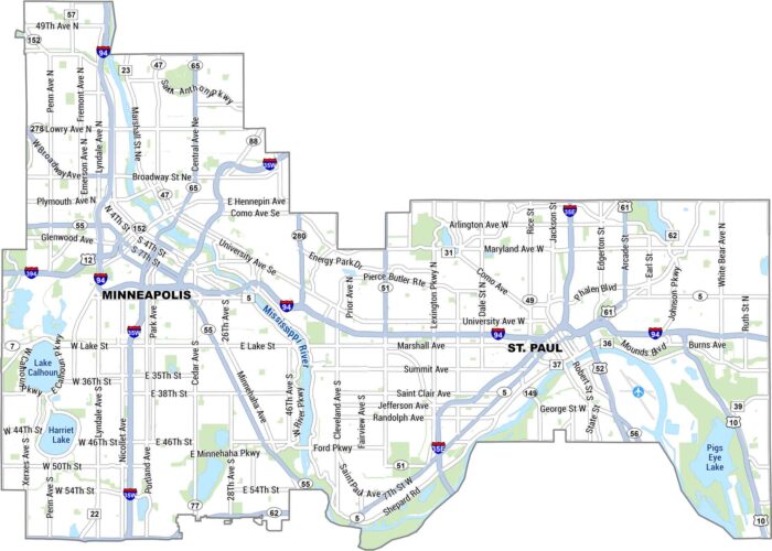
Our map of the Twin Cities lays out Minneapolis and St. Paul side by side, split by the Mississippi River. It shows main roads, lakes & parks.
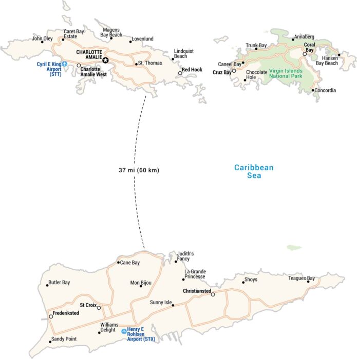
The U.S. Virgin Islands sit in the Caribbean. Our map shows highways, airports, national parks and settlements like St. Thomas and St. Croix.
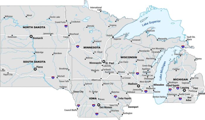
The Upper Midwest is big sky, big lakes, and long roads. Our map covers the stretch from Michigan to the Dakotas.
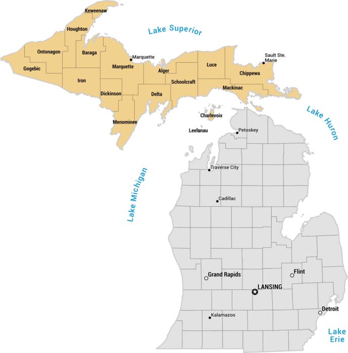
Michigan’s Upper Peninsula feels like its own world because it’s surrounded by water on three sides. Our map shows this region in yellow.
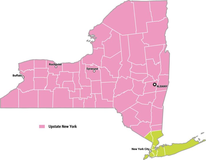
There’s no set boundary for Upstate New York. But most New Yorkers agree that it’s north of Westchester. Our map lays out these counties.
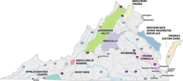
Virginia Wine Country rolls through the foothills of the Blue Ridge. Our map shows the 9 clusters of wineries in Virginia.
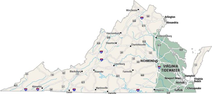
Virginia’s Tidewater region sits low and flat. Our map of the Virginia Tidewater shows where rivers meet the Chesapeake Bay on the east.
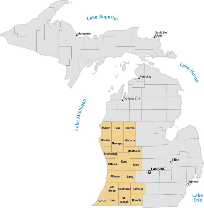
West Michigan is a region that stretch along Lake Michigan. Grand Rapids anchors the region, with Holland, Muskegon, and Saugatuck.
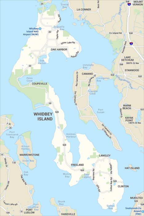
Our map of Whidbey Island shows its highways, parks and small towns. Shoreline roads run the length of the surrounding Puget Sound.