Fisherman’s Wharf Map, San Francisco
Our map of Fisherman’s Wharf shows the waterfront district on San Francisco’s northern edge with its roads, piers and sea lion viewing area.
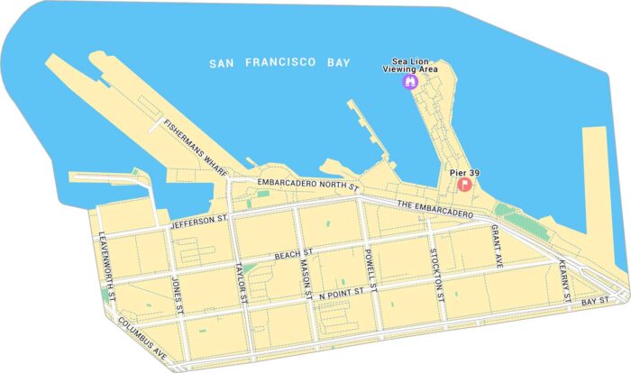
Our map of Fisherman’s Wharf shows the waterfront district on San Francisco’s northern edge with its roads, piers and sea lion viewing area.
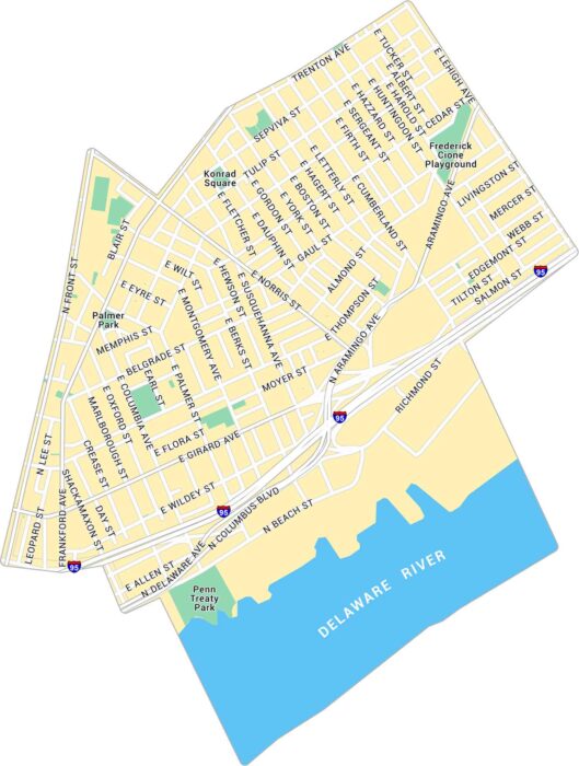
Our map of Fishtown shows the riverside neighborhood northeast of downtown Philadelphia. It lays out the streets, parks, and main routes.
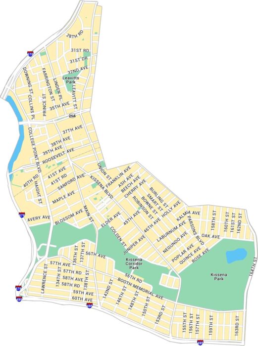
Our map of Flushing shows the busy Queens neighborhood centered around Main Street and Roosevelt Avenue. It outlines major roads and parks.
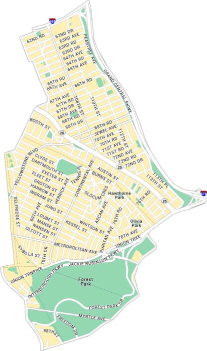
Our map of Forest Hills shows the Queens neighborhood just north of Forest Park. We show you the main streets, parks, and highways.
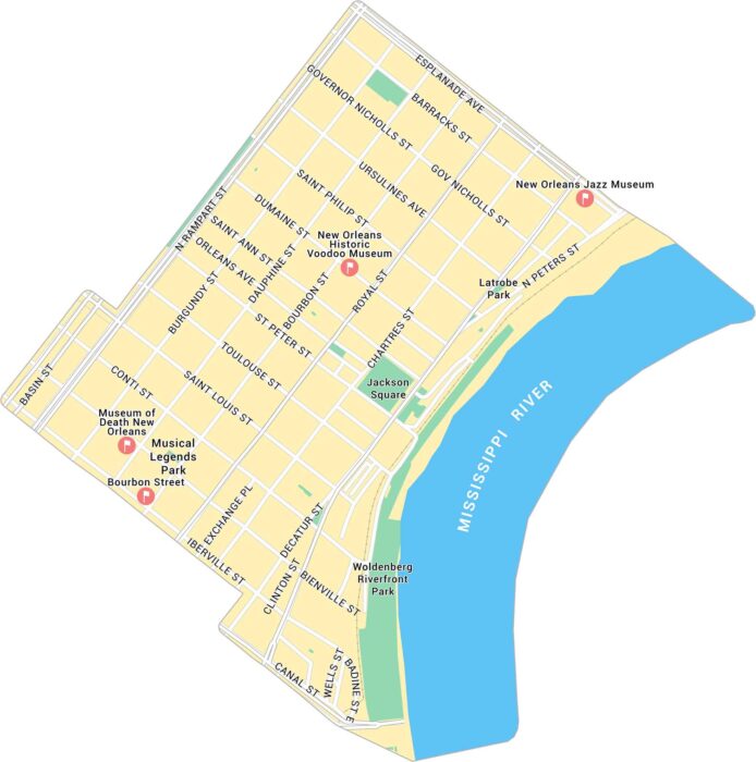
Our map of the French Quarter shows this neighborhood’s streets between the Mississippi River and Rampart Street.
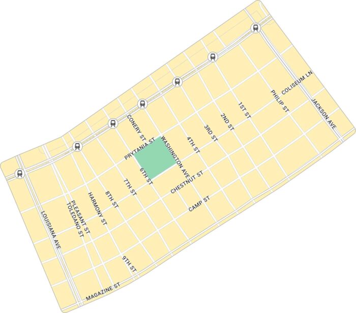
Our map of the Garden District shows the uptown New Orleans neighborhood. You’ll get to see St. Charles Avenue and its quiet blocks.
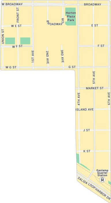
Our map of the Gaslamp Quarter shows the downtown San Diego district just north of the harbor. It’s a busy stretch packed with energy.
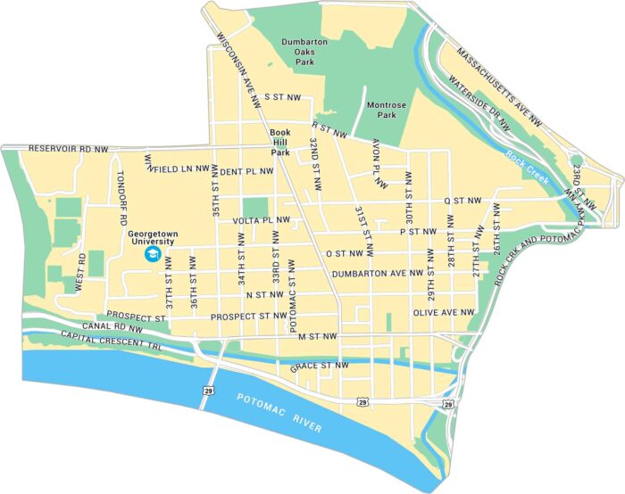
Our map of Georgetown shows the historic neighborhood along the Potomac on D.C.’s northwest edge. It’s a tight, scenic part of the city.
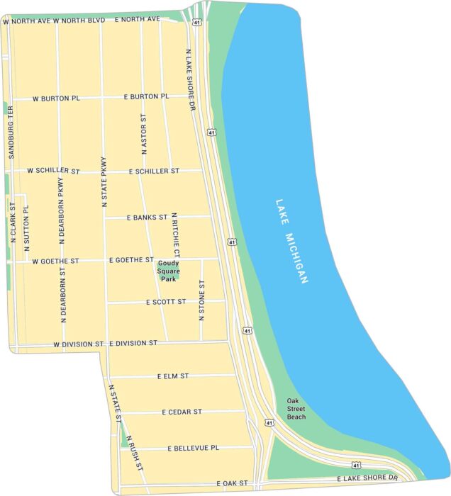
The Gold Coast runs along the lake just north of downtown Chicago. Our map of the Gold Coast lays out its streets, parks, and beaches.
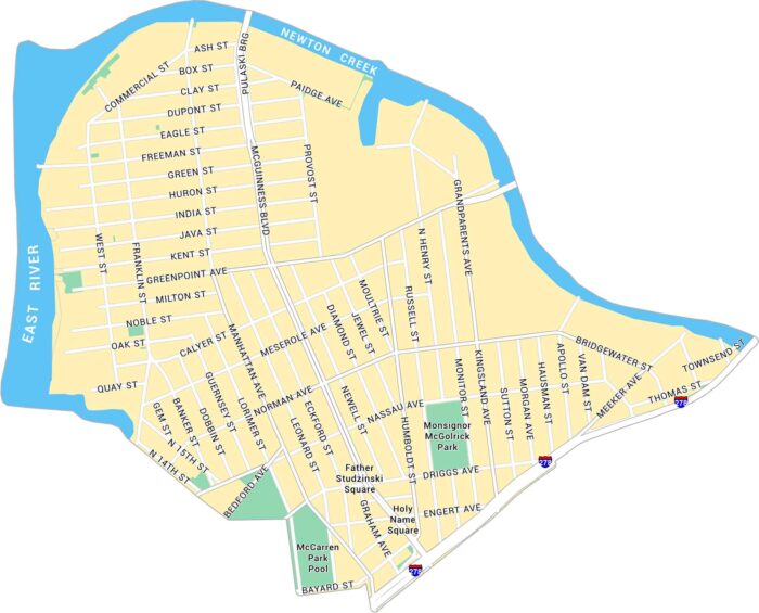
Greenpoint sits at the northern tip of Brooklyn, along the East River. This map shows its waterfront, main streets, and residential blocks.
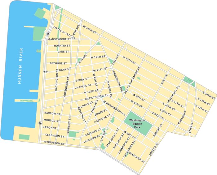
Greenwich Village sits below 14th Street in Lower Manhattan. Our map shows its narrow streets, the Hudson River and Washington Square Park.
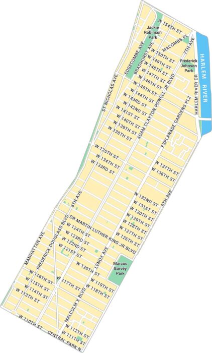
Harlem stretches across Upper Manhattan along the Harlem River. Our map shows its parks and network of busy streets.
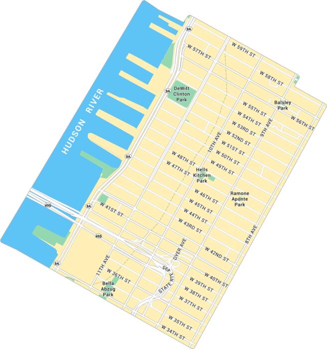
Find your way through Hell’s Kitchen with this map of Manhattan’s West Side. It shows the many avenues and parks.
Hillcrest sits just north of Balboa Park, close to the center of San Diego. Our map lays out its highways, parks, and tight grid of streets.
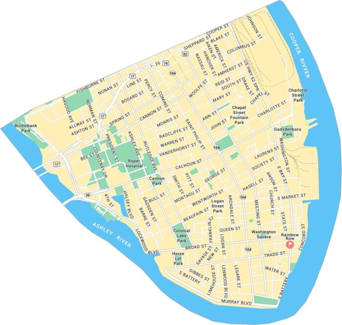
Charleston’s Historic District sits at the tip of the peninsula, where the Ashley and Cooper Rivers meet. Our map shows its streets and parks.