Historic District Map, Charleston
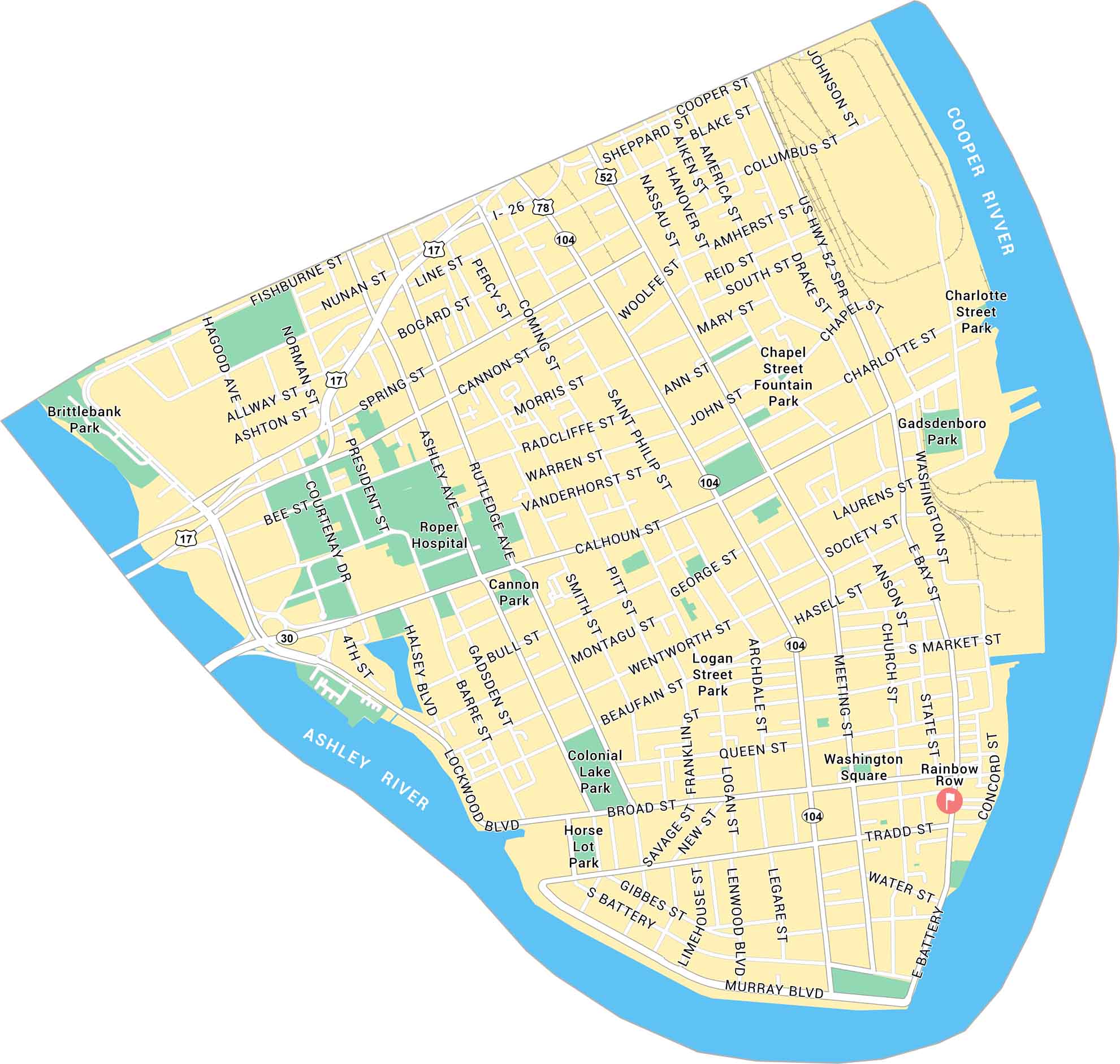
Charleston’s Historic District sits at the tip of the peninsula, where the Ashley and Cooper Rivers meet. This map shows its streets, waterfront, and parks.
Map Information
On the Map
Interstates/Highways: US Hwy 17, US Hwy 52, State Rte 30, State Rte 78, State Rte 104 Major Roads: Calhoun St, Broad St, Meeting St, King St, East Bay St, Market St, Lockwood Blvd, Ashley Ave, Rutledge Ave, Coming St, Saint Philip St, Wentworth St, Beaufain St, Tradd St, Murray Blvd, George St, Cannon St, Spring St, Line St, President St Major Rivers: Ashley River, Cooper River Parks: Washington Square, Colonial Lake Park, Brittlebank Park, Cannon Park, Horse Lot Park, Logan Street Park, Chapel Street Fountain Park, Gadsdenboro Park, Charlotte Street Park Landmarks: Roper Hospital, Rainbow RowCity Maps of South Carolina
Find our maps of Charleston and South Carolina cities here


