Park Slope Map, New York
Our map of Park Slope shows this NYC neighborhood that stretches along Prospect Park. It includes main roads and green spaces.
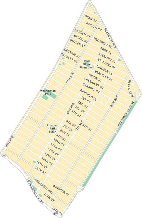
Our map of Park Slope shows this NYC neighborhood that stretches along Prospect Park. It includes main roads and green spaces.
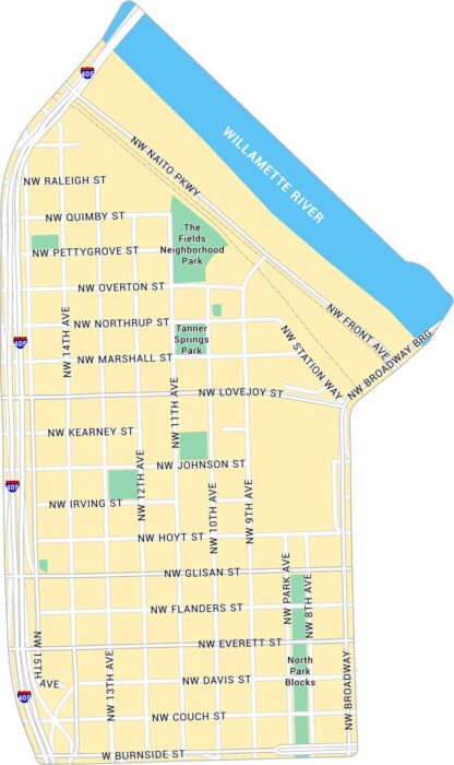
Our map of the Pearl District highlights one of Portland’s most walkable neighborhoods. It shows its streets, parks, and its rail lines.
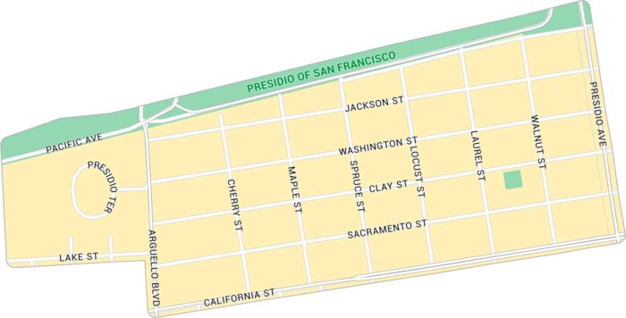
Our map of Presidio Heights shows a peaceful neighborhood bordering the Presidio. It includes major streets and nearby green spaces.
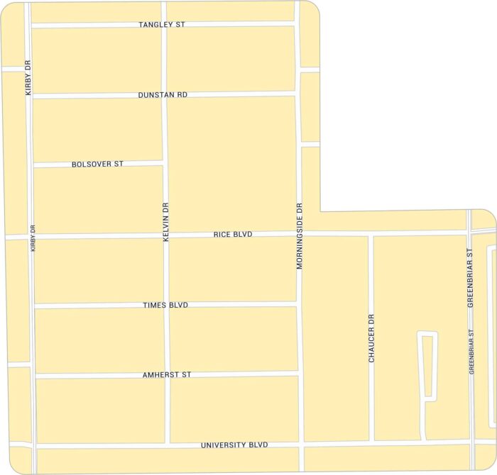
Rice Village sits west of Rice University. Our map highlights its network of roads. You can find it between Kirby Drive and University Blvd.
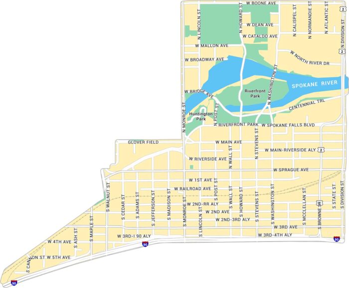
Downtown Spokane’s Riverside district sits along the Spokane River. Our map shows the river’s path, nearby streets, and its green spaces.
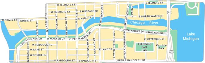
The Chicago Riverwalk stretches along the Main Branch of the Chicago River. Our map highlights its path and streets at the city’s core.
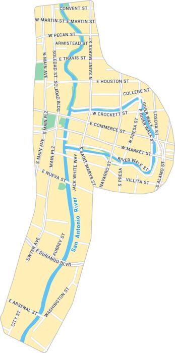
The San Antonio River Walk winds through the heart of downtown. Our map follows the curves of the San Antonio River as it flows here.
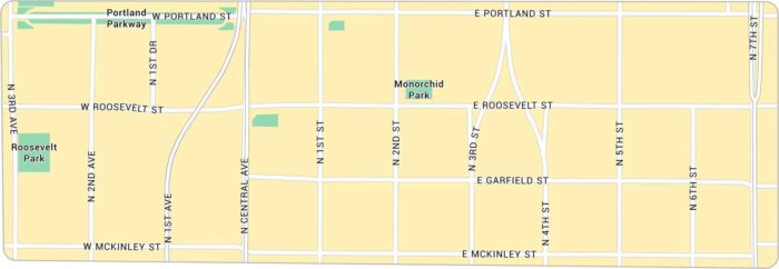
Roosevelt Row sits in the heart of downtown Phoenix. Our map highlights its roads including Roosevelt Street and Central Avenue.
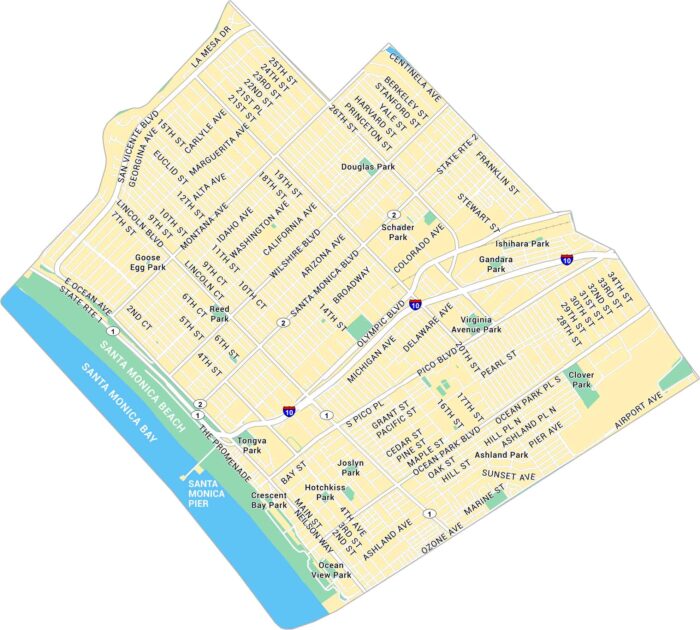
Santa Monica stretches along the Pacific Ocean. Our map shows its downtown roads, the famous pier, and Ocean Avenue running beside the coast.
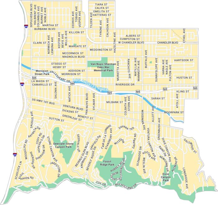
Sherman Oaks sits in the heart of the San Fernando Valley. Our Sherman Oaks map highlights its streets, Ventura Boulevard, and nearby parks.
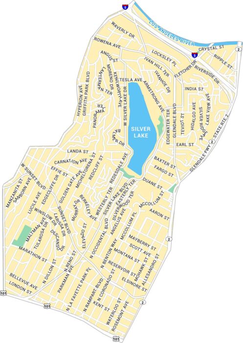
Silver Lake is one of Los Angeles’ most defining neighborhoods. Our map shows the parks, highways and lively stretches of Sunset Boulevard.
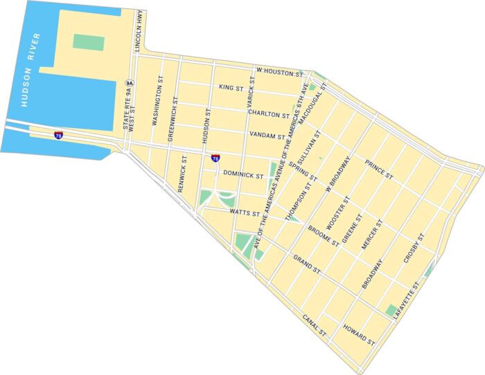
SoHo is stylish, busy, and always changing. Our SoHo map highlights shows its parks and roads from Houston and Canal Streets.
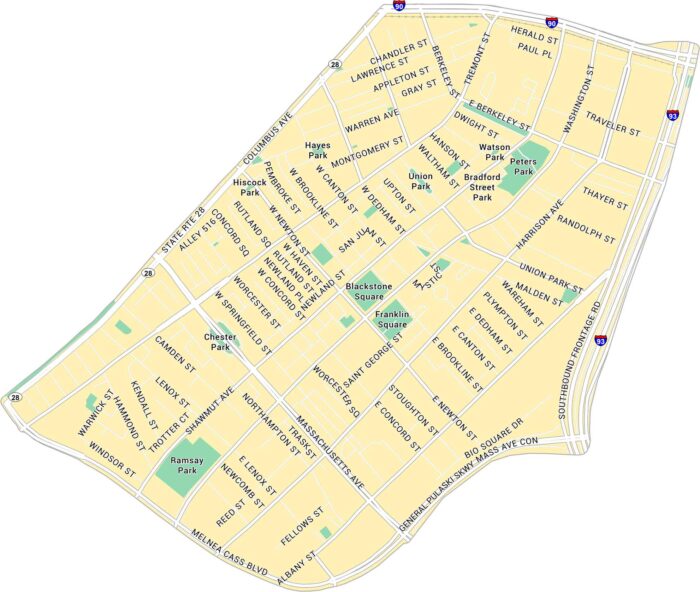
Our map of South End, Boston shows its parks, highways and streets stretching between Tremont Street and Massachusetts Avenue.
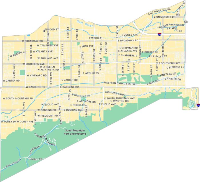
South Mountain is where Phoenix meets the edge of the Sonoran Desert. Our map of South Mountain shows its desert roads, rivers and parks.
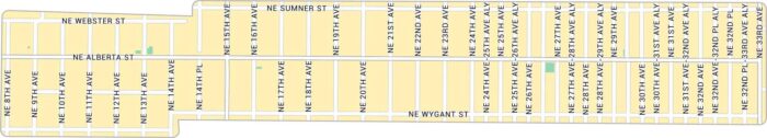
Our Alberta Arts map lays out the heart of northeast Portland. The neighborhood has a laid-back, creative energy that feels purely Portland.