Roosevelt Row Map, Phoenix
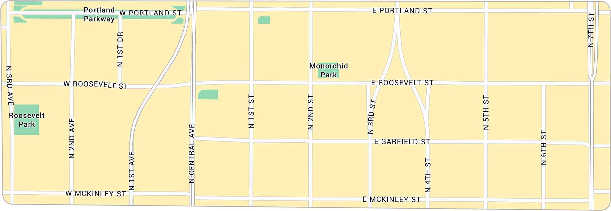
Roosevelt Row sits in the heart of downtown Phoenix, filled with murals, galleries, and colorful streets. Our map highlights its roads including Roosevelt Street and Central Avenue. It’s the city’s creative core.
Map Information
On the Map
Major Roads: Central Ave, Roosevelt St, Portland St, McKinley St, Garfield St, 7th St, 3rd Ave, 2nd Ave, 1st Ave, 1st St, 2nd St, 3rd St, 4th St, 5th St, 6th St, 1st Dr Parks: Roosevelt Park, Monorchid Park Parkways: Portland ParkwayPhoenix Neighborhood Maps
See our neighborhood maps of Phoenix, Arizona.
Arizona City Maps
Here’s our full batch of Arizona city maps


