Map of Akron, Ohio
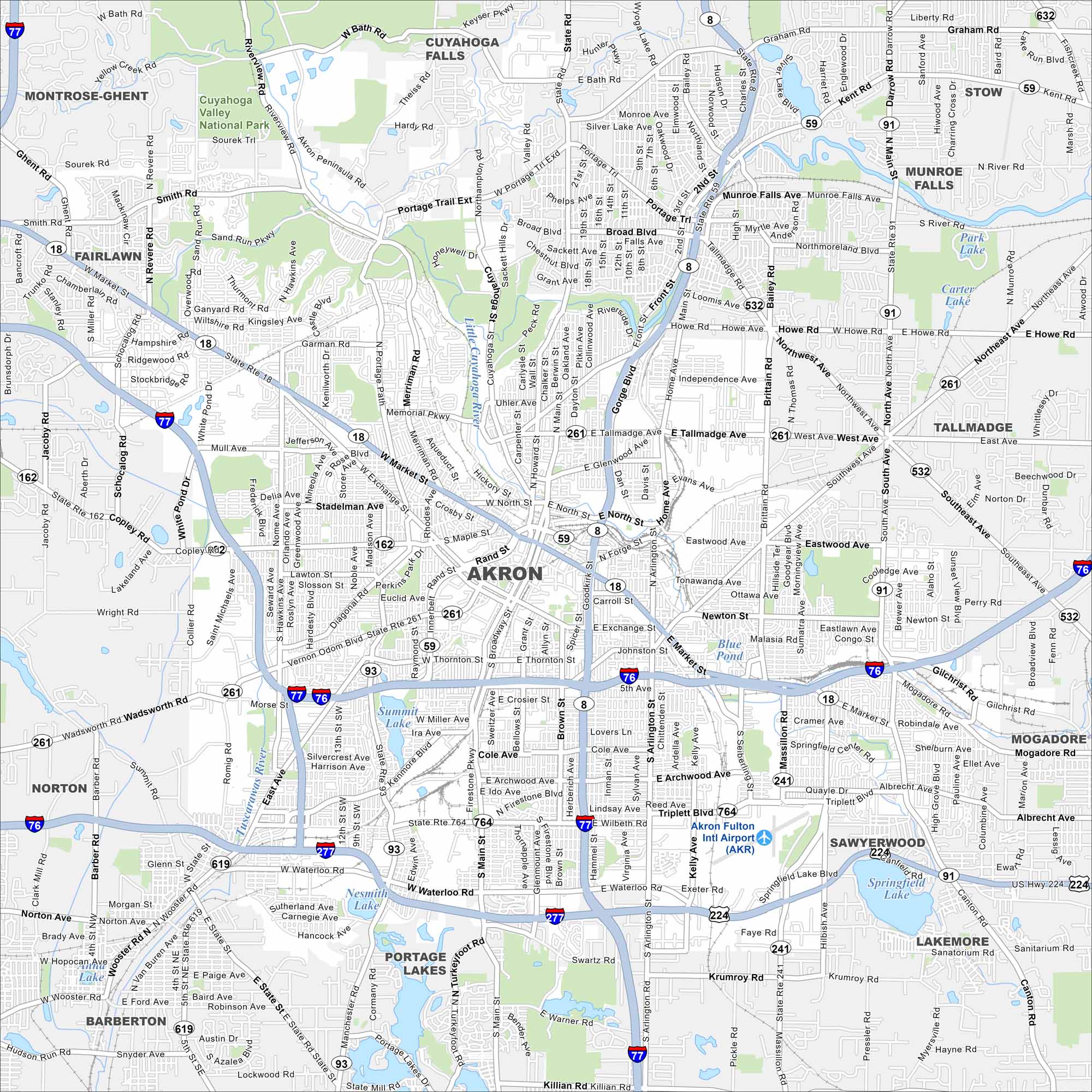
Akron is laid out with its roads traveling from its downtown. Our map shows its highways, lakes, parks and railways. The city has an industrial heritage with the the Cuyahoga Valley nearby.
Map Information
On the Map
Interstates/Highways: I-77, I-76, I-277, I-80, US Hwy 224, State Rte 8, State Rte 18, State Rte 59, State Rte 91, State Rte 93, State Rte 162, State Rte 172, State Rte 261, State Rte 303, State Rte 532, State Rte 619, State Rte 764 Major Roads: Market St, Main St, Broadway St, Exchange St, Waterloo Rd, Arlington Rd, Manchester Rd, Dart Ave, Rand Ave, Rhodes Ave, Howard St, Tallmadge Ave, Gorge Blvd, Brittain Rd, Darrow Rd, Hawkins Ave, Copley Rd, Wooster Rd, Canton Rd, Albrecht Ave Airports: Akron Fulton Intl Airport (AKR) Lakes and Reservoirs: Park Lake, Carter Lake, Blue Pond, Summit Lake, Nesmith Lake, Springfield Lake, Portage Lakes, Sleepy Hollow Lake, Silver Lake Major Rivers: Cuyahoga River, Tuscarawas River, Little Cuyahoga River Parks and Preserves: Cuyahoga Valley National Park Nearby Communities: Montrose-Ghent, Fairlawn, Cuyahoga Falls, Munroe Falls, Stow, Tallmadge, Mogadore, Sawyerwood, Lakemore, Barberton, NortonOhio State Maps
Check out our maps covering farmland or any of Ohio’s major cities.


City Maps of Ohio
Here are maps of Columbus and Ohio’s major cities


