Map of Brunswick, Ohio
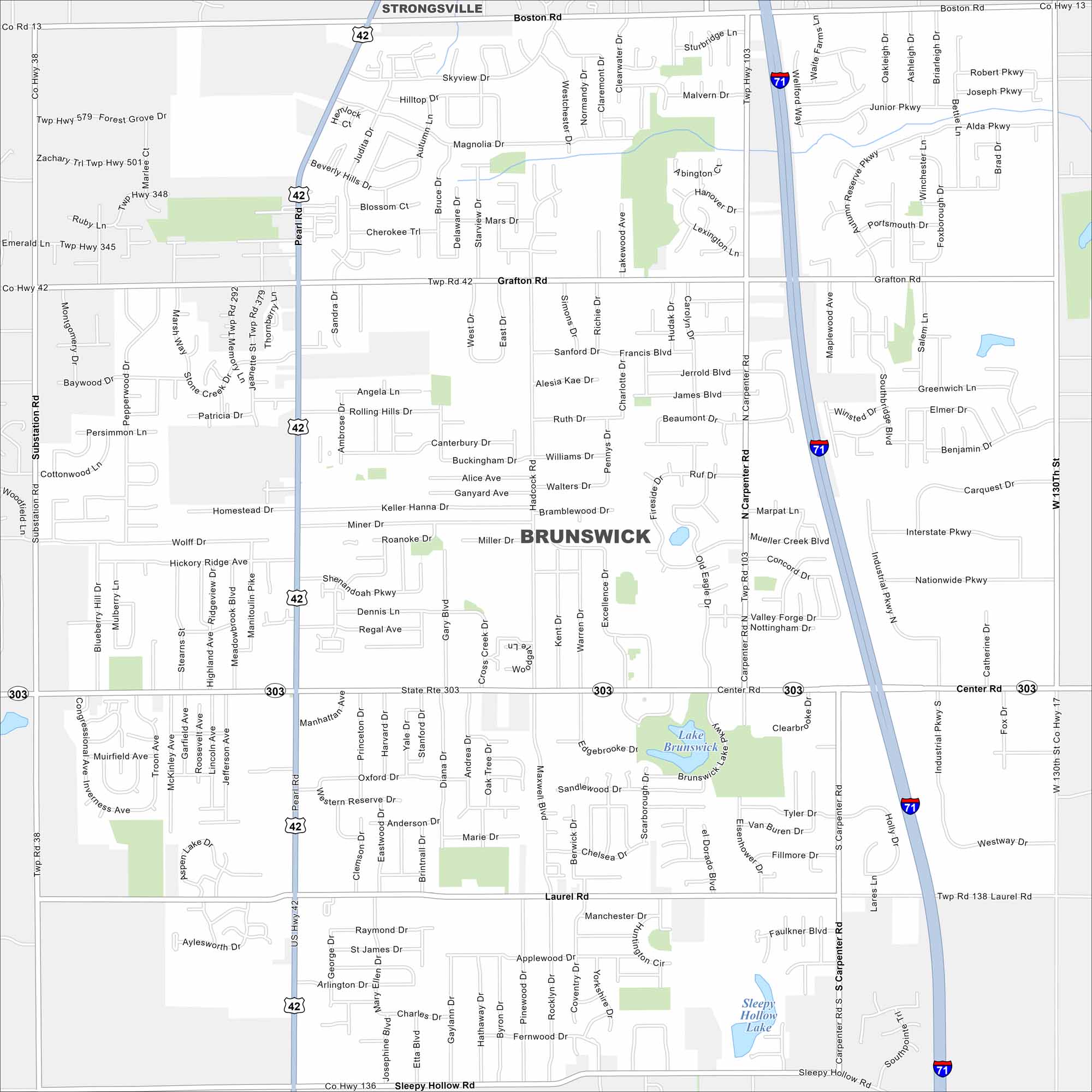
Our map of Brunswick highlights its roads, parks and lakes. It’s located south of Cleveland. Parks and quiet neighborhoods fill much of the city. It’s one of the largest cities in Medina County but still feels small-town.
Map Information
On the Map
Interstates/Highways: I-71, US Hwy 42, State Rte 303 Major Roads: Center Rd, Pearl Rd, Carpenter Rd, Grafton Rd, Boston Rd, Sleepy Hollow Rd, Laurel Rd, West Point Dr, Marks Rd, Substation Rd, W 130th St, Hadcock Rd, Bennett Rd, Clearbrooke Dr, Skyview Dr, Manhattan Ave, Applewood Dr, Beverly Hills Dr, Hadcock Rd, Excellence Dr Lakes and Reservoirs: Lake Brunswick, Sleepy Hollow Lake Nearby Communities: StrongsvilleOhio State Maps
Check out our maps covering farmland or any of Ohio’s major cities.


City Maps of Ohio
Here are maps of Columbus and Ohio’s major cities


