Map of Cincinnati, Ohio
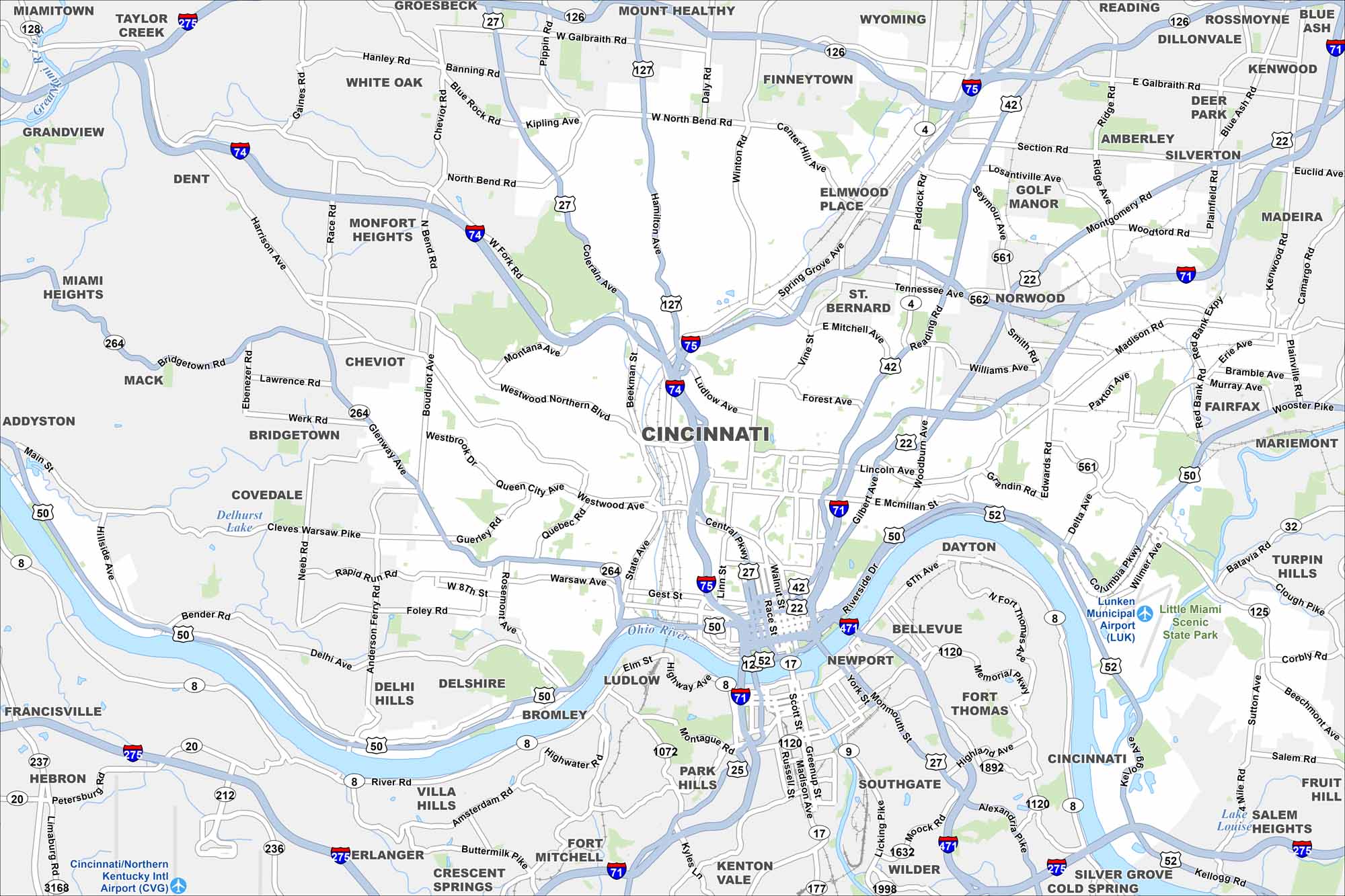
Our map of Cincinnati shows highways, city streets, and the Ohio River curving along downtown. Nicknamed the “Queen City”, it rises from the riverfront into surrounding hills. Bridges link it directly to Kentucky.
Map Information
On the Map
Interstates/Highways: I-71, I-75, I-74, I-275, I-471, US Hwy 50, US Hwy 42, State Rte 562, State Rte 126, State Rte 561, State Rte 125, State Rte 32 Major Roads: Reading Rd, Central Pkwy, Gilbert Ave, Victory Pkwy, Montgomery Rd, Columbia Pkwy, Madison Rd, Hamilton Ave, Winton Rd, Colerain Ave, Harrison Ave, Glenway Ave, River Rd, Warsaw Ave, Gest St, 6th Ave, Riverside Dr, Kellog Ave, Beechmont Ave, Burnet Ave Airports: Cincinnati/Northern Kentucky Intl Airport (CVG), Lunken Municipal Airport (LUK) Lakes and Reservoirs: Lake Salem Major Rivers: Ohio River, Licking River, Great Miami River, Little Miami River Nearby Communities: Covington, Newport, Norwood, St. Bernard, Cheviot, Silverton, Deer Park, Madeira, Mariemont, Fairfax, Fort Thomas, Bellevue, Dayton, Southgate, Wilder, Fort Mitchell, Erlanger, Florence, Hebron Neighborhoods: Downtown CincinnatiOhio State Maps
Check out our maps covering farmland or any of Ohio’s major cities.


City Maps of Ohio
Here are maps of Columbus and Ohio’s major cities


