Map of Cuyahoga Falls, Ohio
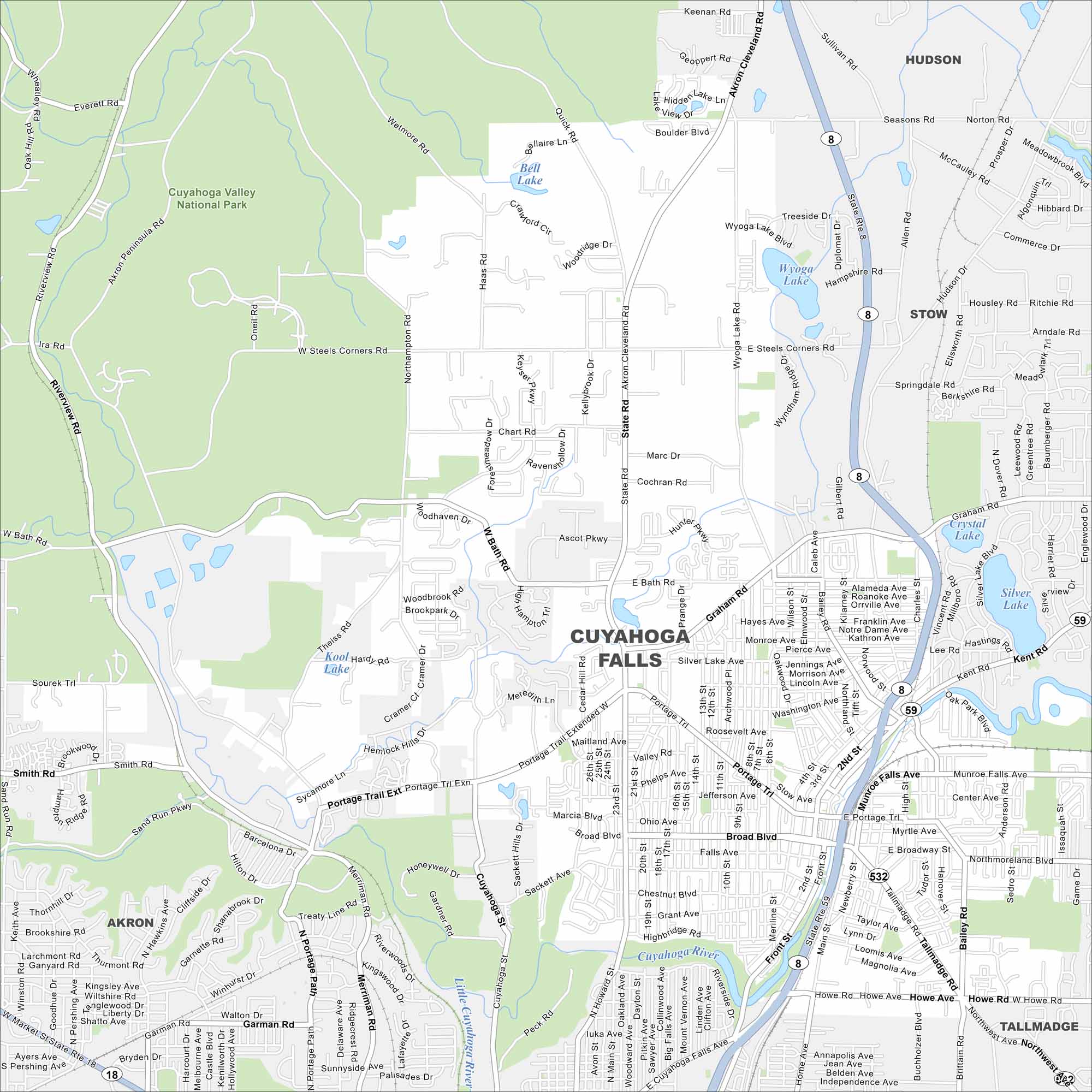
See the mapped streets, highways, and river crossings in Cuyahoga Falls. This city grew around the Cuyahoga River, where rapids once powered industry. Today, the riverfront remains its centerpiece.
Map Information
On the Map
Interstates/Highways: State Rte 8, State Rte 59, State Rte 532 Major Roads: State Rd, Main St, Portage Trl, Graham Rd, Howe Rd, Front St, Wyoga Lake Rd, Steels Corners Rd, Bath Rd, Northampton Rd, Akron Cleveland Rd, Munroe Falls Ave, Bailey Rd, Hudson Dr, Oak Park Blvd, Second St, Fourth St, Broad Blvd, Silver Lake Ave, Valley Rd Lakes and Reservoirs: Wyoga Lake, Crystal Lake, Silver Lake, Bell Lake, Kool Lake Major Rivers: Cuyahoga River, Little Cuyahoga River Parks and Preserves: Cuyahoga Valley National Park Nearby Communities: Akron, Stow, Hudson, Munroe Falls, Silver Lake, TallmadgeOhio State Maps
Check out our maps covering farmland or any of Ohio’s major cities.


City Maps of Ohio
Here are maps of Columbus and Ohio’s major cities


