Map of Dayton, Ohio
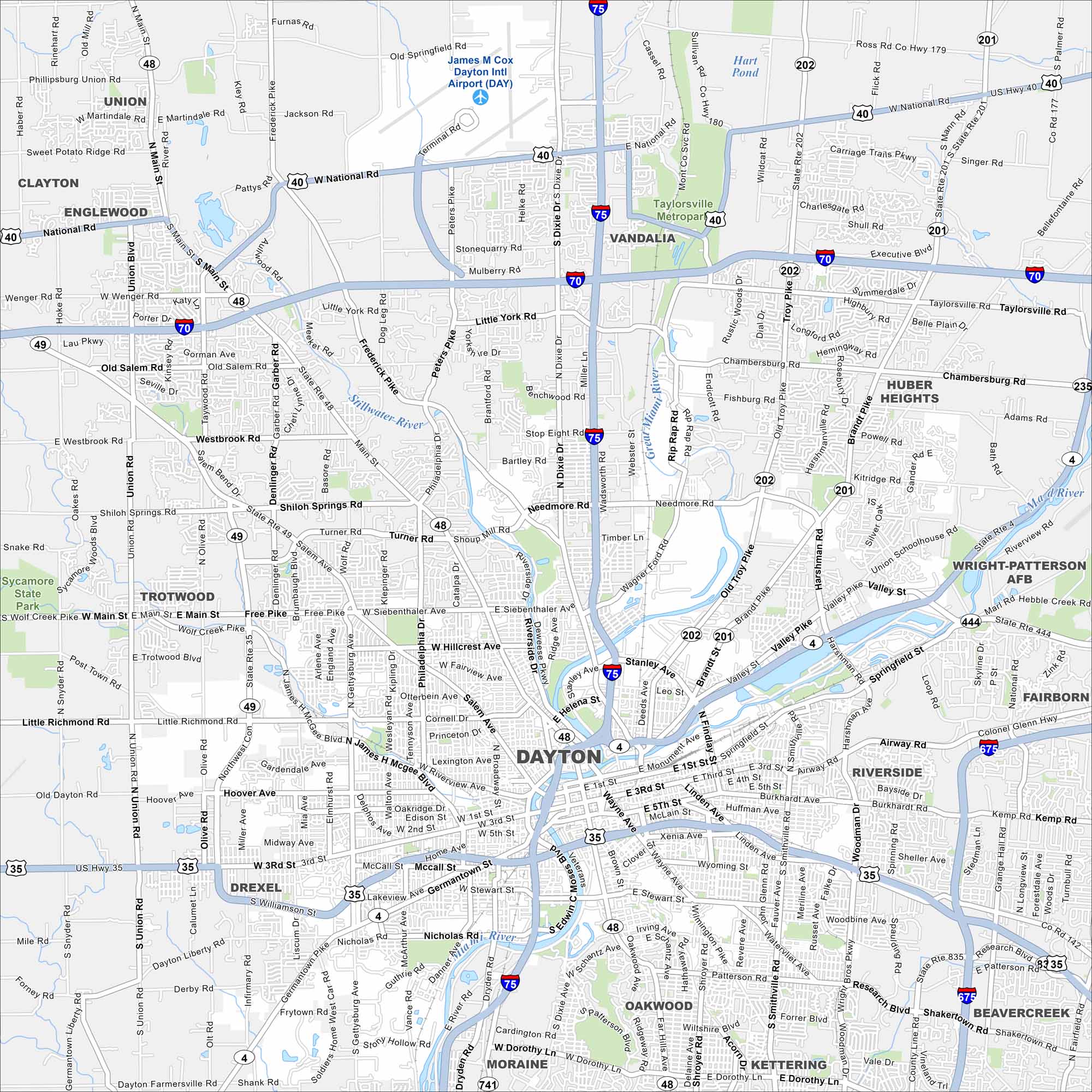
Take a look at Dayton with its mapped roads, highways, and the Great Miami River. The city is known for aviation history and innovation. Several rivers come together across the metro area.
Map Information
On the Map
Interstates/Highways: I-75, I-70, I-675, US Hwy 35, US Hwy 40, State Rte 4, State Rte 48, State Rte 49, State Rte 202, State Rte 201, State Rte 235, State Rte 444, State Rte 741, State Rte 835 Major Roads: Main St, Wayne Ave, Salem Ave, Keowee St, Monument Ave, Third St, Fifth St, Patterson Rd, Smithville Rd, Woodman Dr, Linden Ave, Germantown St, Gettysburg Ave, Nicholas Rd, Needmore Rd, Shoup Mill Rd, Siebenthaler Ave, Free Pike, Riverside Dr, Airway Rd Airports: James M Cox Dayton Intl Airport (DAY) Lakes and Reservoirs: Hart Pond Major Rivers: Great Miami River, Stillwater River, Mad River Parks and Preserves: Taylorsville Metropark, Sycamore State Park Nearby Communities: Oakwood, Kettering, Moraine, Riverside, Beavercreek, Fairborn, Huber Heights, Vandalia, Englewood, Trotwood, Drexel, Union, ClaytonOhio State Maps
Check out our maps covering farmland or any of Ohio’s major cities.


City Maps of Ohio
Here are maps of Columbus and Ohio’s major cities


