Map of Elyria, Ohio
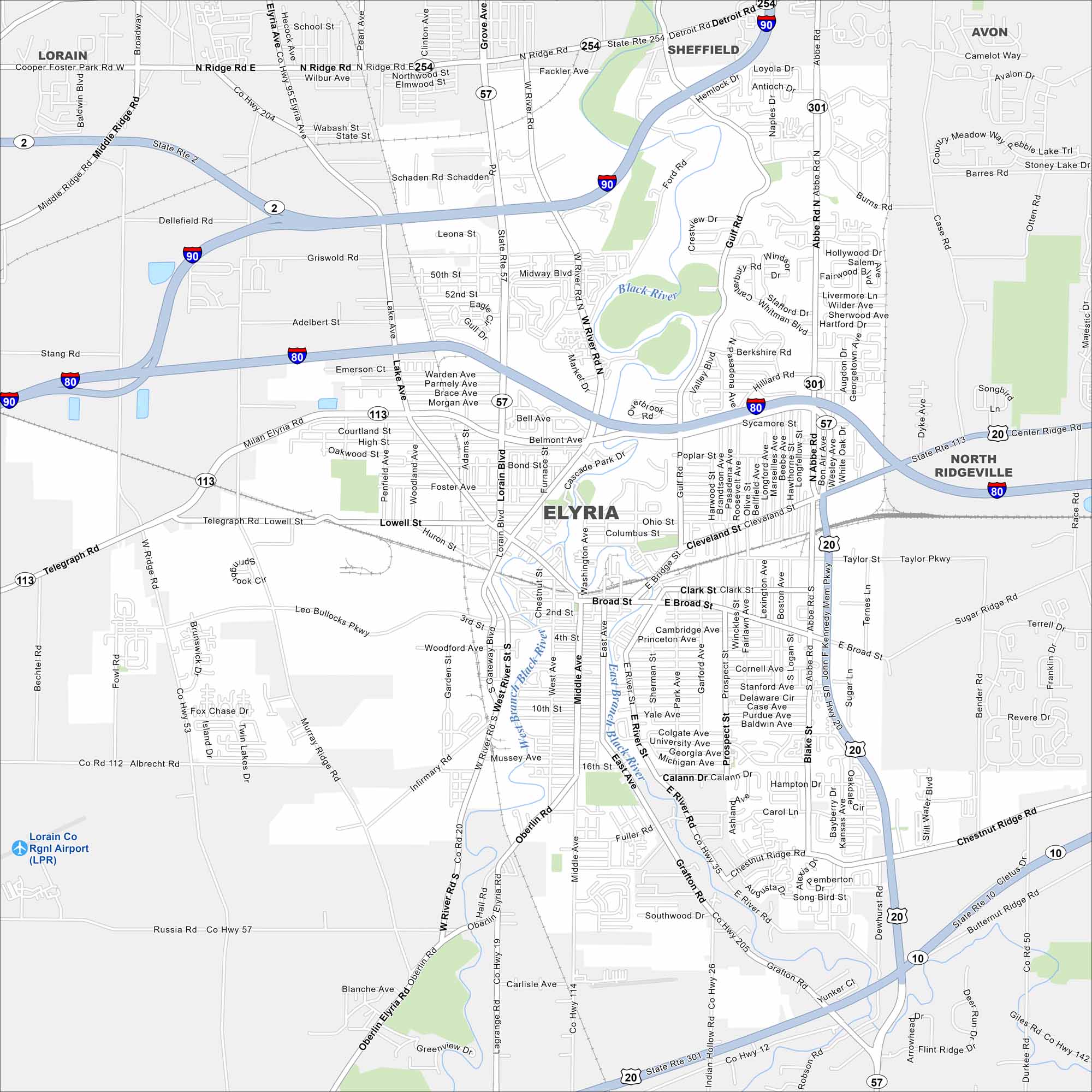
Our map of Elyria shows I-80 and I-90 running just north of the city. The Black River cuts through its center in two branches. Elyria lies west of Cleveland and has a history tied to early industry.
Map Information
On the Map
Interstates/Highways: I-90, I-80, US Hwy 20, State Rte 2, State Rte 57, State Rte 113, State Rte 301, State Rte 254, State Rte 10, State Rte 303 Major Roads: Broad St, Cleveland St, Gulf Rd, Abbe Rd, Middle Ridge Rd, Lake Ave, Lorain Blvd, West River Rd, East River Rd, Grafton Rd, Oberlin Rd, Chestnut Ridge Rd, North Ridge Rd, Detroit Rd, Lake Ave, Fuller Rd, 16th St, 10th St, 4th St, 2nd St Airports: Lorain Co Rgnl Airport (LPR) Major Rivers: Black River, West Branch Black River, East Branch Black River Nearby Communities: Lorain, Sheffield, Avon, North RidgevilleOhio State Maps
Check out our maps covering farmland or any of Ohio’s major cities.


City Maps of Ohio
Here are maps of Columbus and Ohio’s major cities


