Map of Hamilton, Ohio
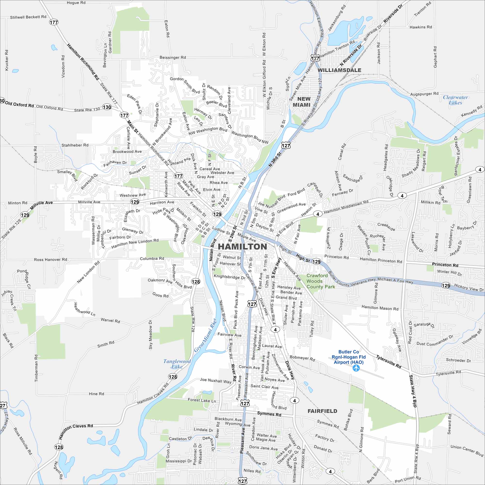
Hamilton sits along the Great Miami River in southwestern Ohio. Our map shows the river bending right through downtown. It also shows major roads, lakes and parks.
Map Information
On the Map
Interstates/Highways: US Hwy 127, State Rte 129, State Rte 177, State Rte 130, State Rte 4, State Rte 128, State Rte 177 Major Roads: High St, Main St, Dixie Hwy, Pleasant Ave, Erie Blvd, Neilan Blvd, B St, Martin Luther King Jr Blvd, Riverside Dr, Hamilton Richmond Rd, Millville Ave, New London Rd, Eaton Rd, Central Ave, Ludlow St, Pershing Ave, Knightsbridge Dr, Grand Blvd, Hancock Ave, Tylersville Rd Airports: Butler Co Rgnl-Hogan Fld Airport (HAO) Lakes and Reservoirs: Clearwater Lakes, Tanglewood Lake Major Rivers: Great Miami River Parks and Preserves: Crawford Woods County Park Nearby Communities: New Miami, Williamsdale, FairfieldOhio State Maps
Check out our maps covering farmland or any of Ohio’s major cities.


City Maps of Ohio
Here are maps of Columbus and Ohio’s major cities


