Map of Kettering, Ohio
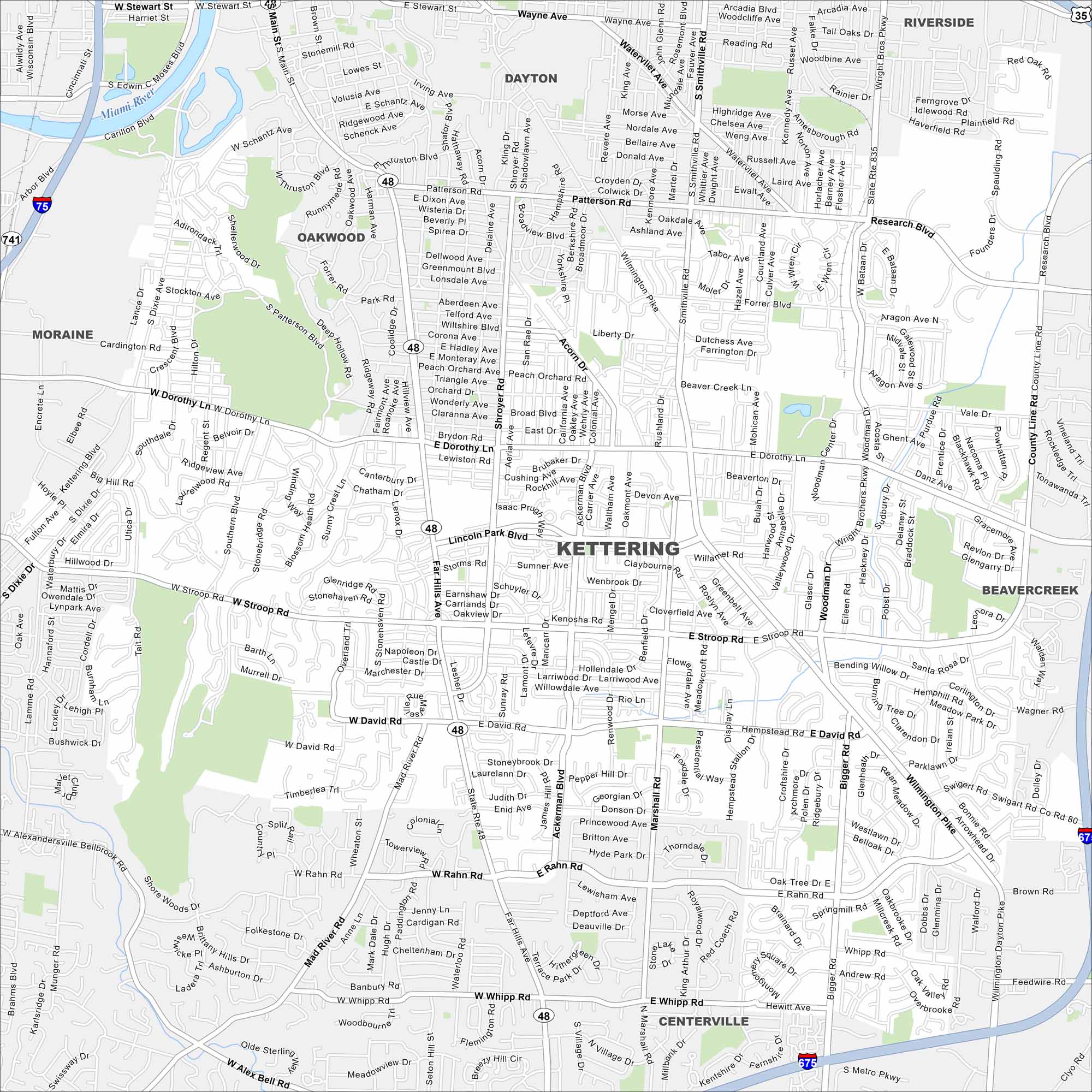
Our map of Kettering shows it blending into greater Dayton. Parks and residential areas cover much of the area. Interstates 75 and 675 swoop around the city.
Map Information
On the Map
Interstates/Highways: I-675, US Hwy 35, State Rte 48, State Rte 835 Major Roads: Wilmington Pike, Far Hills Ave, Stroop Rd, Dorothy Ln, Shroyer Rd, Marshall Rd, Hewitt Ave, Woodman Dr, Stockhalm Rd, Southern Blvd, West David Rd, East David Rd, Ackerman Blvd, Bigger Rd, Smithville Rd, Patterson Rd, Spaulding Rd, County Line Rd, Forrer Blvd, Beaverwyck Rd Nearby Communities: Oakwood, Dayton, Moraine, Centerville, BeavercreekOhio State Maps
Check out our maps covering farmland or any of Ohio’s major cities.


City Maps of Ohio
Here are maps of Columbus and Ohio’s major cities


