Map of Mansfield, Ohio
Mansfield sits between Cleveland and Columbus. Our map shows its highway network and the rail lines cutting through. Rolling hills and wooded areas spread out nearby.
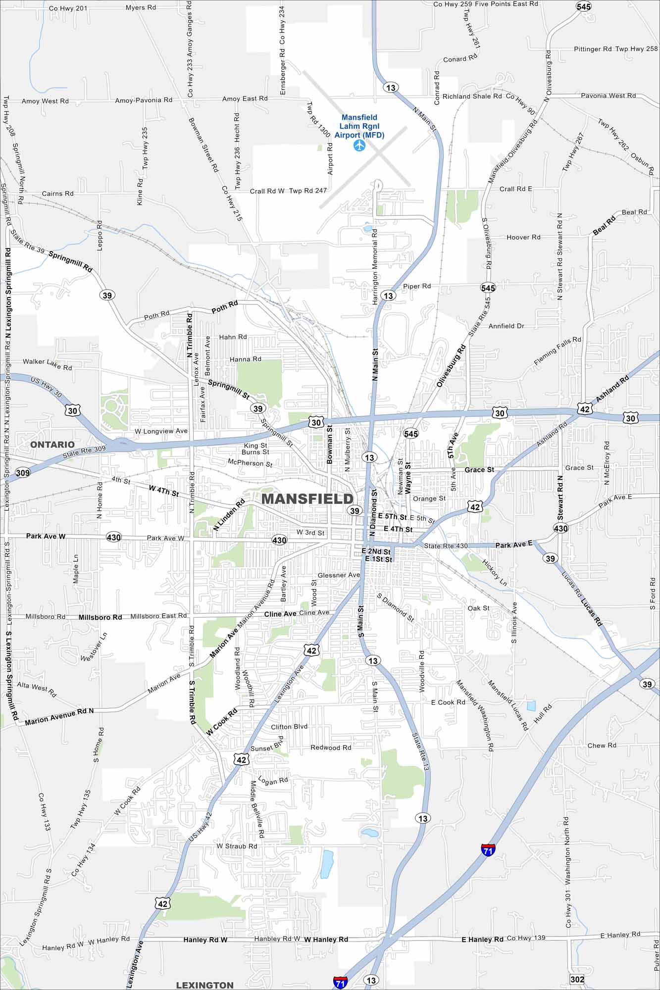
Map Information
On the Map
Interstates/Highways: I-71, US Hwy 30, US Hwy 42 Major Roads: Main St, Park Ave, Trimble Rd, Cook Rd, Lexington Ave, Diamond St, Springmill St, Fourth St, Hanley Rd, Longview Ave, Marion Ave, Glessner Ave, Cline Ave, Ashland Rd, Stewart Rd, Olivesburg Rd, Crall Rd, Home Rd, Walker Lake Rd, Straub Rd Airports: Mansfield Lahm Rgnl Airport (MFD) Nearby Communities: Ontario, LexingtonOhio State Maps
Check out our maps covering farmland or any of Ohio’s major cities.


City Maps of Ohio
Here are maps of Columbus and Ohio’s major cities


