Map of Reynoldsburg, Ohio
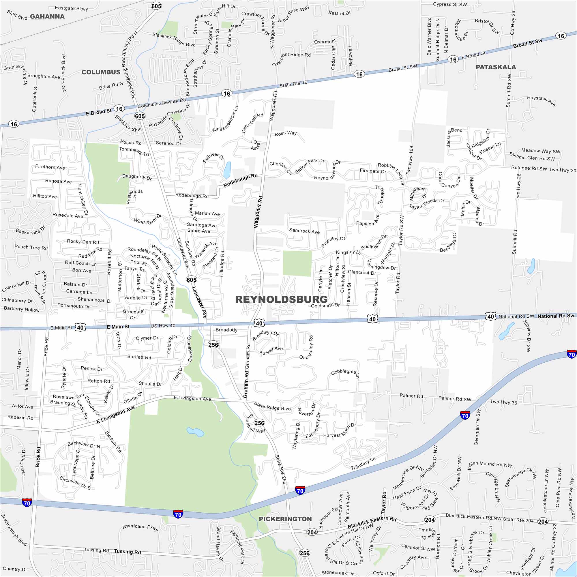
Our map lays out Reynoldsburg, Ohio. Known as the “Birthplace of the Tomato”, the annual Tomato Festival brings in crowds from across Ohio.
Map Information
On the Map
Interstates/Highways: I-70, US Hwy 40, State Rte 16, State Rte 256, State Rte 204 Major Roads: Main St, Broad St, Livingston Ave, Waggoner Rd, Tussing Rd, Graham Rd, Taylor Rd, Brice Rd, Lancaster Ave, Rosehill Rd, Summit Ridge Dr, Reynoldsburg New Albany Rd, Blacklick Eastern Rd, Palmer Rd, Brice Rd, Chantry Dr, Taylor Rd, Slate Ridge Blvd, Davidson Dr, Hill Rd Nearby Communities: Columbus, Gahanna, Pickerington, PataskalaOhio State Maps
Check out our maps covering farmland or any of Ohio’s major cities.


City Maps of Ohio
Here are maps of Columbus and Ohio’s major cities


