Delmarva Peninsula Map
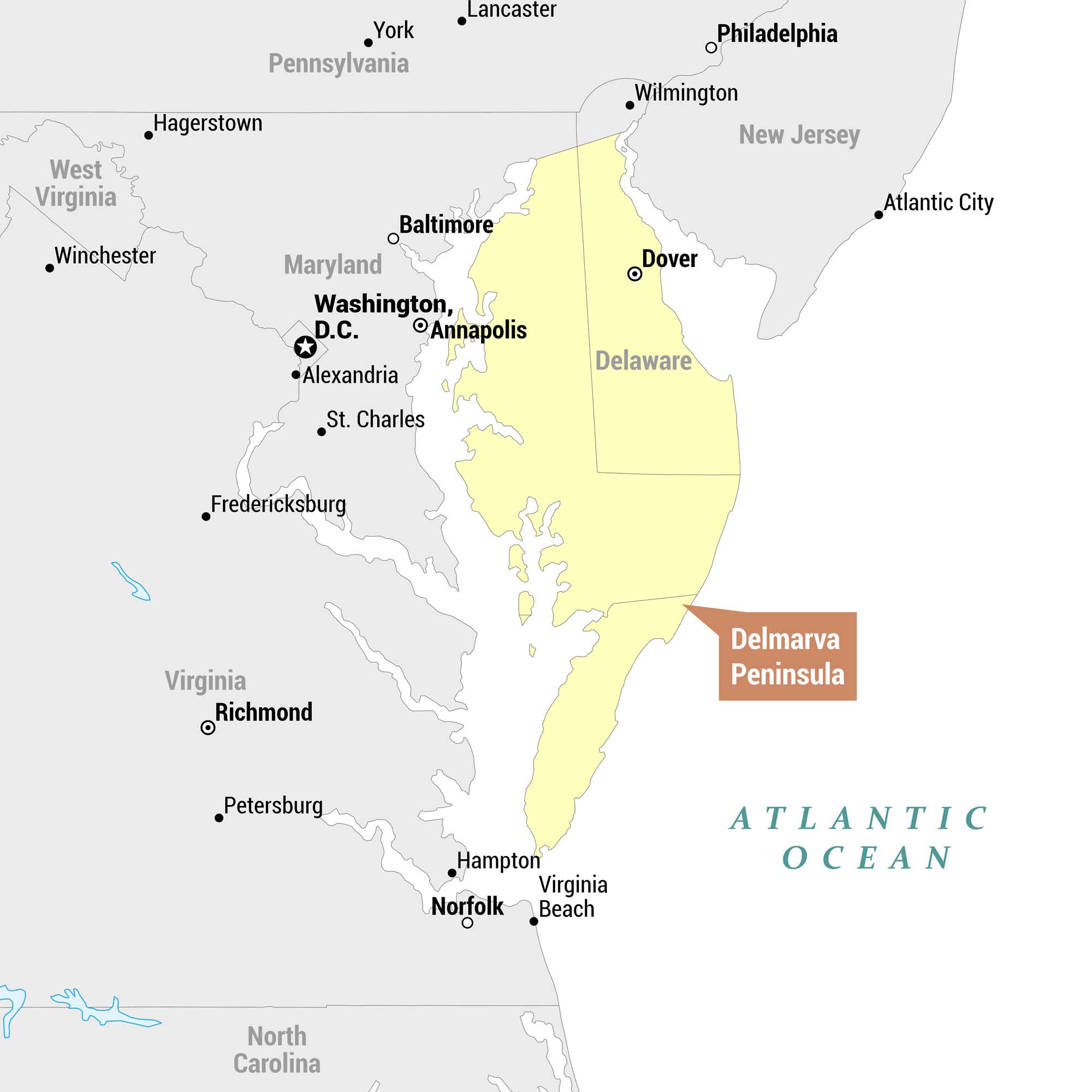
See the Delmarva Peninsula with our map, highlighted it in yellow. This landmass is bordered by Chesapeake Bay to the west and the Atlantic Ocean to the east. The peninsula gets its name from the three states that share it – Delaware, Maryland, and Varginia. Close enough for Virginia!
Map Information
On the Map
States on the Peninsula (highlighted in yellow): Delaware, Maryland (Eastern Shore), Virginia (Eastern Shore) Surrounding States: Maryland, Virginia, Pennsylvania, West Virginia, New Jersey, North Carolina Cities: Dover, Philadelphia, Wilmington, Atlantic City, Baltimore, Annapolis, Washington D.C., Alexandria, St. Charles, Hagerstown, Winchester, Fredericksburg, Richmond, Petersburg, Hampton, Norfolk, Virginia Beach, York, Lancaster Bodies of Water: Atlantic Ocean, Chesapeake BayReferences
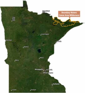
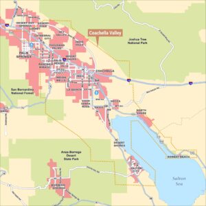
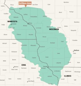
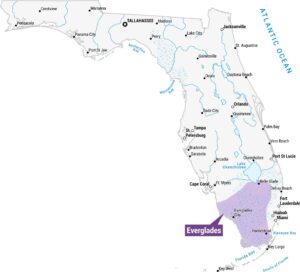
Natural Region Maps
Geographic landforms, wilderness zones, deserts, mountain ranges, and terrain.